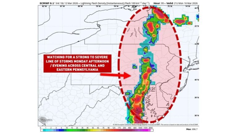
Big Country Texas and Concho Valley Face Multi-Day Winter Storm as Rain Turns to Freezing Rain, Then Snow by Saturday Night
TEXAS — A complex and high-impact winter weather event is setting up across Big Country Texas and the Concho Valley, with forecast data showing a multi-phase storm that will evolve rapidly from cold rain Friday afternoon into freezing rain Friday night through Saturday morning, before changing over to snow Saturday night. Forecasters warn that the prolonged nature of the storm, combined with ice accumulation and later snowfall, could create dangerous travel conditions, power outages, and infrastructure stress across the region.
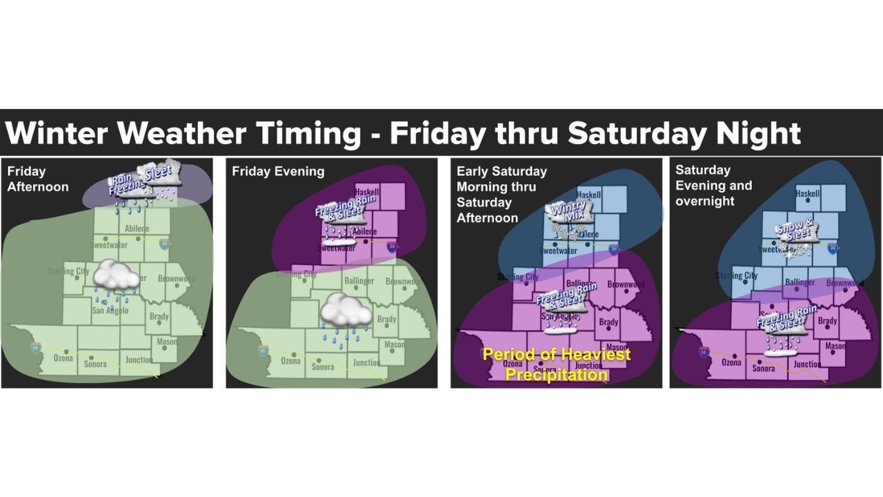
Friday Afternoon: Cold Rain Begins Across the Region
The first phase of the storm arrives Friday afternoon, with widespread cold rain overspreading much of Big Country and surrounding counties. While temperatures will initially remain just above freezing, the rain will saturate roadways, soil, and infrastructure — setting the stage for more dangerous conditions once temperatures drop later in the day.
This initial rain may appear manageable, but it plays a critical role by preconditioning surfaces for ice formation once freezing air moves in.
Friday Night Through Saturday Morning: Freezing Rain and Sleet Take Over
As temperatures fall Friday evening, precipitation is expected to transition to freezing rain, with sleet mixing in at times, especially across northern portions of the Big Country. This period represents the most hazardous phase for icing, as liquid precipitation freezes on contact with roads, bridges, power lines, and trees.
Forecasters highlight Friday night into Saturday morning as a window when travel could quickly become treacherous or impossible, particularly on elevated roadways and untreated surfaces.
Saturday: Heaviest Precipitation and Widespread Impacts
By early Saturday morning through Saturday afternoon, much of the region is expected to remain locked in a wintry mix of freezing rain and sleet, marking the period of heaviest precipitation. Ice accretion during this window could strain power infrastructure, increase the risk of tree damage, and lead to scattered power outages.
Emergency planners caution that conditions may deteriorate faster than they can be mitigated, especially in rural areas.
Saturday Night: Transition to Snow Ends the Event
As colder air deepens Saturday night, precipitation should gradually transition from freezing rain and sleet to snow. While ice accumulation is expected to decrease during this phase, snowfall on top of existing ice will further complicate road conditions and slow recovery efforts.
Even light to moderate snow on icy surfaces can significantly increase accident risk and delay power restoration.
Why This Storm Is Especially Concerning
This event stands out due to its long duration and multiple precipitation types, which increase cumulative impacts. The combination of:
- Cold rain → freezing rain → sleet → snow
- Extended icing window
- Overnight timing
creates a scenario where impacts can compound over time, rather than improve quickly.
Safety Emphasis: Remember the 4 P’s
Officials are urging residents to keep the 4 P’s in mind throughout the storm:
- People: Limit travel, check on elderly and vulnerable neighbors, and prepare for possible outages
- Pets: Keep animals indoors, ensure food and water do not freeze
- Pipes: Insulate exposed pipes, open sink cabinets, disconnect hoses
- Plants: Cover or move sensitive plants before freezing temperatures arrive
What to Expect Moving Forward
Confidence continues to grow that Big Country Texas and the Concho Valley will experience several rounds of winter weather impacts from Friday through Saturday night. Even after precipitation ends, lingering ice and snow could keep roads hazardous into Sunday.
Residents are encouraged to complete preparations early and avoid unnecessary travel once freezing conditions begin. For continued winter storm updates, impact analysis, and regional weather coverage, visit ChicagoMusicGuide.com.