Texas Panhandle Snow Bands Shift East as Winter Storm Weakens Overnight, Roads Remain Slick Through Midnight
UNITED STATES — A winter storm impacting parts of the southern Plains is beginning to lose intensity Saturday night, but hazardous travel conditions are still ongoing across the Texas Panhandle, especially in areas southeast of Amarillo where snow bands remain active.
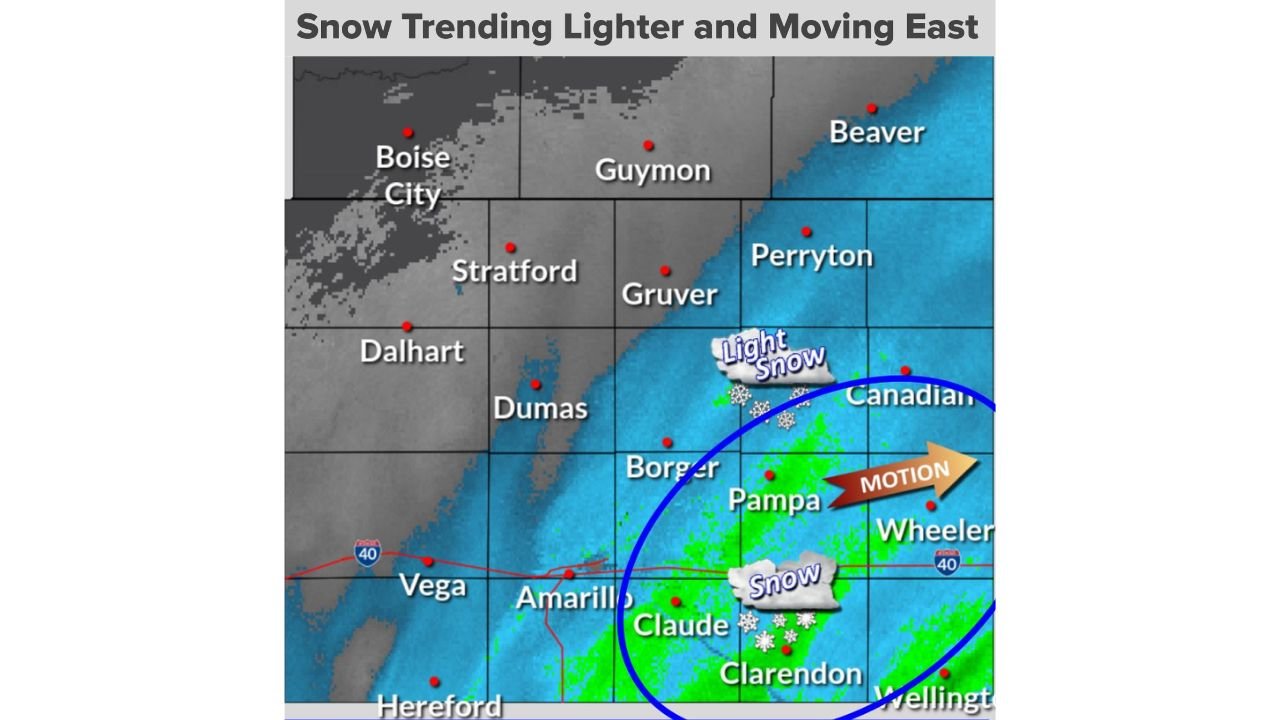
According to updated National Weather Service data out of Amarillo, the heaviest snowfall rates are now focused in the southeastern Texas Panhandle, closest to a low-pressure system moving east through the region. In this zone, snowfall rates have reached up to 1 inch per hour at times, while areas farther north are seeing lighter snow as drier air pushes in.
What’s Happening Right Now
Snow coverage continues from Amarillo through Claude, Clarendon, Pampa, Wheeler and Canadian, with the most persistent snow bands gradually shifting eastward. Locations such as Borger and parts of Hutchinson County are still seeing periods of steady snow, while communities farther north toward Dumas, Stratford and Guymon are trending drier with diminishing snowfall.
Meteorologists note that while overall snow intensity is decreasing, visibility remains reduced at times within lingering bands, particularly along and south of Interstate 40.
Timing: When Conditions Improve
The current round of snow is expected to continue through around midnight, after which precipitation should taper off from west to east. Even as snowfall ends, cold temperatures will allow snow and slush to linger on roadways into early Sunday morning.
Travel and Safety Impacts
Drivers across the southeastern Panhandle should remain cautious overnight due to:
- Slippery and snow-covered roadways
- Localized slick spots on bridges and overpasses
- Potential temporary road closures if conditions worsen in heavier bands
Officials recommend staying indoors if possible and slowing down significantly if travel is unavoidable.
Bottom Line
This winter system is gradually weakening, but the southeast Texas Panhandle remains the trouble spot tonight. While snowfall rates are trending lighter overall, the combination of lingering snow, cold pavement temperatures and reduced visibility means travel hazards will persist until conditions fully improve overnight.
For live weather updates, road conditions and regional impact reports, stay connected with ChicagoMusicGuide.com as we continue tracking major weather systems affecting travel and events across the U.S.