Mid-Atlantic and Northeast on Alert as Virginia, Maryland, New Jersey, New York, and New England Track Potential Weekend Nor’easter
UNITED STATES — Weather models are increasingly signaling the potential for another winter storm along the East Coast this coming weekend, but forecasters stress that confidence remains low on the storm’s exact track, intensity, and timing.
Recent guidance from the European (ECMWF), GFS, and Canadian models suggests a disturbance diving out of central Canada could help spawn a strong low-pressure system near or offshore of the Southeast and Mid-Atlantic coast, with very cold air already in place across much of the region. That setup raises the possibility of widespread precipitation, including snow, if the system tracks close enough to shore.
Why This Storm Is Being Watched Closely
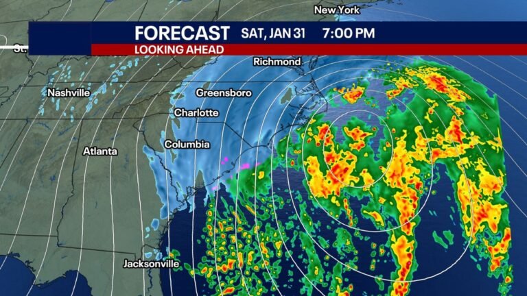
Unlike the recent inland winter systems, this potential storm would behave more like a classic coastal nor’easter — a storm that strengthens rapidly as it moves north along the Atlantic coastline.
If the low pressure deepens by 24 millibars or more within 24 hours, a process known as bombogenesis, impacts could escalate quickly. That scenario remains on the table, though far from guaranteed.
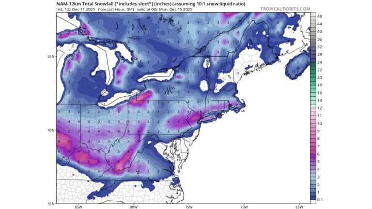
With cold air already established, snow would be favored over rain for many interior locations, while strong winds and coastal impacts could accompany the system if it intensifies offshore.
What the Models Are Showing Right Now
Forecast confidence is limited because models disagree on where the storm develops and how close it tracks to the coast.
Current ensemble data highlights three primary scenarios:
Scenario A — Impactful Nor’easter (40%)
The storm tracks near the benchmark offshore route, producing heavy snow, strong winds, and possible coastal flooding from the Mid-Atlantic into parts of the Northeast.
Scenario B — Offshore but Close Enough (40%)
The system tracks farther east but still close enough to bring fringe snowfall, breezy conditions, and higher-than-normal tides, especially along the shoreline.
Scenario C — Misses Completely (20%)
The storm remains well offshore and has little to no impact on land.
At this time, Scenario C appears least likely, but even small shifts in the upper-level pattern could dramatically change the outcome.
Timing and Impacts
If the storm develops, timing currently favors Saturday night into Sunday. That window could still shift as models refine the storm’s evolution.
Potential hazards — if the storm strengthens and tracks close enough — include:
- Heavy snow in colder interior areas
- Strong coastal winds
- Coastal flooding enhanced by astronomical tides
- Travel disruptions during the weekend period
Forecasters emphasize that it is too early to panic or change plans, especially for areas like the Mid-Atlantic and Northeast corridor, where outcomes depend heavily on storm placement.
Bottom Line
There is legitimate potential for another East Coast winter storm this weekend, but uncertainty remains high. The next few model cycles will be critical in determining whether this becomes a significant nor’easter, a glancing blow, or a complete miss.
Stay tuned to ChicagoMusicGuide.com as we continue tracking the evolving pattern and break down what it could mean for different regions as confidence improves.