Florida, Georgia, the Carolinas, and the Northeast Face Growing Winter Storm Threat as Record Cold and Bomb Cyclone Risks Build
UNITED STATES — A rapidly evolving winter pattern is raising concern across Florida, Georgia, South Carolina, North Carolina, and the Northeast, as meteorologists track a strengthening East Coast storm that could deliver snow, blizzard conditions, and historic cold into the weekend and early next week.
Forecast data shows deep Arctic air already locked in place, setting the stage for a coastal low to intensify quickly — potentially into a bomb cyclone — as it tracks offshore. While exact snowfall placement remains uncertain, confidence is growing that at least minor winter storm impacts are likely in several coastal and near-coastal regions.
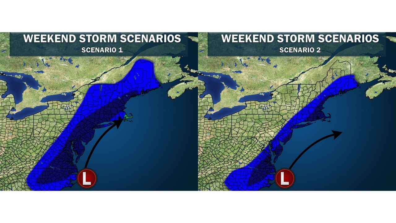
East Coast Storm Track Still Uncertain, but Impacts Increasing
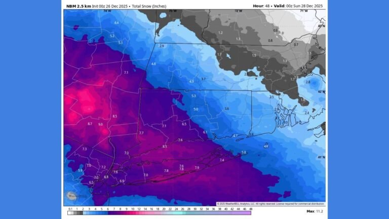
Forecast guidance outlines three primary storm scenarios, with the most likely outcome favoring coastal snow impacts along the I-95 corridor, while interior regions see lighter accumulations or miss the core precipitation entirely.
If the storm phases early enough offshore, snow could spread inland across parts of Georgia, the Carolinas, and the Mid-Atlantic, with heavier bands possible near coastal zones. A farther-east track would limit impacts inland but still deliver a significant snow event along the coastline, particularly from the Carolinas northward.
A third, less likely scenario would see the system remain mostly offshore, producing only fringe snow or flurries — but current data suggests this outcome is not favored.
Florida Bracing for Rare and Potentially Historic Cold
Regardless of snow outcomes, cold is a certainty, especially across Florida, where the impacts may be historic.
Forecasts show:
- Wind chills dropping into the 20s as far south as Miami
- Single-digit wind chills in Florida’s Panhandle
- Two consecutive nights of hard freeze conditions, beginning early Sunday
Cities including Miami, West Palm Beach, and Orlando are expected to experience their coldest air temperatures since the historic 2010 cold outbreak, with central Florida potentially seeing a top-10 coldest wind chill event on record.
These conditions pose risks to agriculture, infrastructure, pets, and people unaccustomed to prolonged cold, especially across southern and central Florida.
Great Lakes Ice Cover Adds Another Complication
Meanwhile, the Great Lakes are freezing rapidly, with total ice cover now measured at 43.3%, well above the historical average for late January.
This matters because increased ice cover:
- Limits lake-effect snow production
- Reinforces colder surface temperatures
- Helps sustain Arctic air masses longer
With more cold days ahead, forecasters expect ice coverage to continue increasing, further locking in winter conditions across the eastern half of the country.
What to Watch Over the Next 48 Hours
Meteorologists are closely monitoring:
- The exact timing and strength of storm phasing
- How quickly the coastal low intensifies
- Whether snow bands shift inland or stay offshore
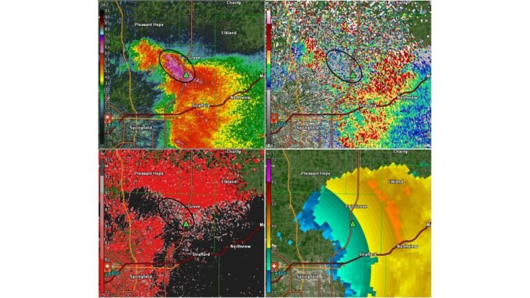
- The extent of blizzard-like conditions where snow overlaps strong winds
Forecast confidence will improve as the storm window approaches, but officials stress now is the time to prepare for cold and winter travel disruptions, especially along the East Coast.
Winter isn’t done yet — and this setup has the potential to deliver one of the most impactful cold and winter weather events of the season for parts of the eastern United States.
What are conditions like where you live, and are you preparing for the cold or possible snow? Share your experience and stay updated with the latest coverage at ChicagoMusicGuide.com.