Maryland, Virginia, and Washington, D.C. Brace for Light Tuesday Night Snow as Weak Clipper Brings Slick Wednesday Morning Commute
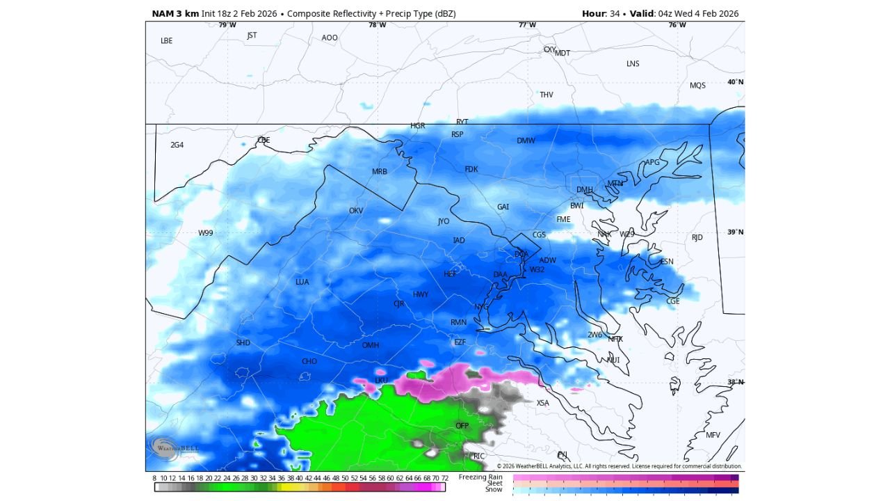
WASHINGTON, D.C. — The DMV region is preparing for a light snow event developing Tuesday evening and lasting into early Wednesday morning, as a weak clipper system tracks just south of the area, according to the latest high-resolution model guidance.
While this system is not expected to be a major winter storm, the combination of very cold ground temperatures and lingering untreated roads could still lead to slick travel conditions, particularly during the Wednesday morning commute.
What’s Happening Tuesday Evening Into Overnight
Snow is expected to gradually spread into the region Tuesday evening, with light but steady snowfall continuing overnight into early Wednesday.
- Most of Washington, D.C., central and northern Maryland, and northern Virginia will see a coating up to 1 inch of snow
- Snow intensity remains light due to limited moisture and weak forcing
- Accumulation will be efficient despite low totals because temperatures remain well below freezing
High-resolution guidance shows widespread snow across the entire DMV, with no meaningful warm-air intrusion, keeping precipitation solidly frozen.
Why Even Light Snow Could Cause Problems
Although snowfall totals remain modest, recent Arctic cold means snow will stick quickly, especially:
- On side streets and residential roads
- In areas not fully cleared from the previous storm
- On bridges, overpasses, and shaded roadways
This raises concerns for patchy slick spots, even where snowfall remains under an inch.
Wednesday Morning Commute Impact
The highest impact window appears to be early Wednesday morning, when lingering snow and icy patches may affect travel.
- Road conditions may vary block-to-block
- Untreated neighborhoods are most vulnerable
- Main highways should improve faster, but on-ramps and exits may remain slick
Because of these factors, isolated school delays cannot be ruled out, especially in areas slower to clear snow.
No Major Storm — But Still a Winter Reminder
This system lacks the moisture and strength needed for heavier snow, but it serves as a reminder that winter is still very much in control of the Mid-Atlantic, despite recent hints of moderation elsewhere.
Residents are advised to use caution Tuesday night and Wednesday morning, allow extra travel time, and watch for localized slick spots, particularly before sunrise.
Stay Tuned
ChicagoMusicGuide.com will continue tracking Mid-Atlantic and national winter patterns, including upcoming cold shots, snow chances, and early signs of seasonal shifts.
Have you noticed icy roads where you live, or are conditions improving?
Share your experience and keep following ChicagoMusicGuide.com for the latest weather updates.