Mid-February Winter Weather Signal Emerges for Virginia and the Carolinas Between February 14–18
UNITED STATES — New ECMWF AIFS ensemble guidance is beginning to flag a small but notable winter weather signal for the February 14–18 time window, with attention focused on Virginia, North Carolina, and surrounding Mid-Atlantic areas. While confidence remains low at this extended range, the data suggests a corridor where cold air and moisture could briefly align, opening the door for another winter setup later in the month.
This signal does not yet point to a high-impact storm, but it is strong enough to warrant monitoring as ensemble probabilities for measurable snowfall have increased across parts of the region.
ECMWF Ensembles Highlight a Focused Snow Probability Zone
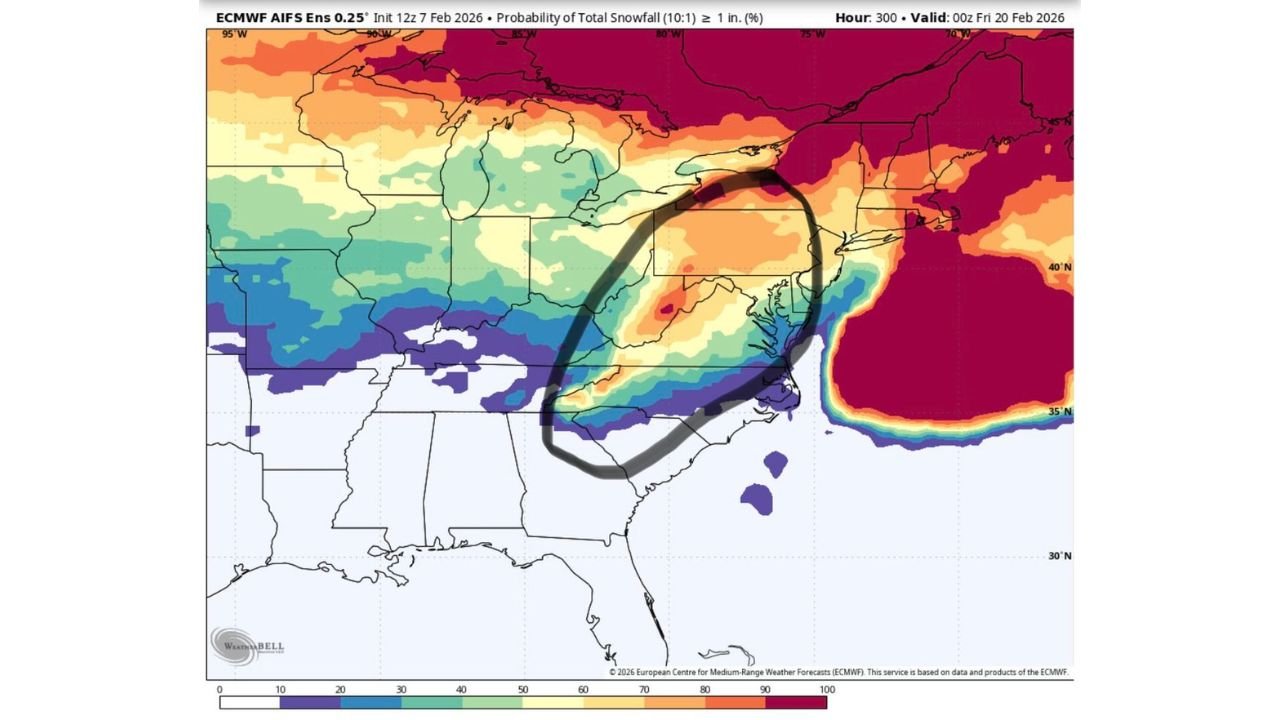
The latest ECMWF AIFS ensemble probability maps show a narrow, elongated zone of increased odds for at least 1 inch of snow stretching from central and northern North Carolina into southern and central Virginia, with extensions toward the southern Mid-Atlantic.
Probabilities are not extreme, but the consistent placement of this signal across multiple ensemble members suggests pattern support rather than a one-off outlier. The highest probabilities appear inland, while coastal areas trend lower due to potential marginal temperatures and marine influence.
February 14–18 Window Key for Any Winter Development
Timing is one of the most important aspects of this setup. The signal clusters around the February 14–18 period, a range that historically can still support cold air damming east of the Appalachians and southern-stream disturbances.
At this range, models are not resolving a specific storm track. Instead, they are highlighting a background pattern favorable for winter precipitation, should a shortwave and surface low align properly during that window.
Virginia North vs. Another Carolina Event
One of the primary uncertainties is location placement. Ensemble spread shows two main scenarios:
- A Virginia-focused outcome, where colder air holds stronger across the Mid-Atlantic, favoring snow farther north
- A Carolina-centered event, where moisture tracks slightly south and cold air briefly undercuts the system, supporting snow or mixed precipitation inland
Small shifts in the upper-level pattern could dramatically change which state sees the greatest impact — or whether impacts remain minor.
Why This Signal Matters Despite Low Confidence
Although probabilities remain modest, ensemble agreement is the key takeaway. When long-range guidance repeatedly highlights the same region, it often signals pattern evolution rather than random noise.
The broader setup suggests:
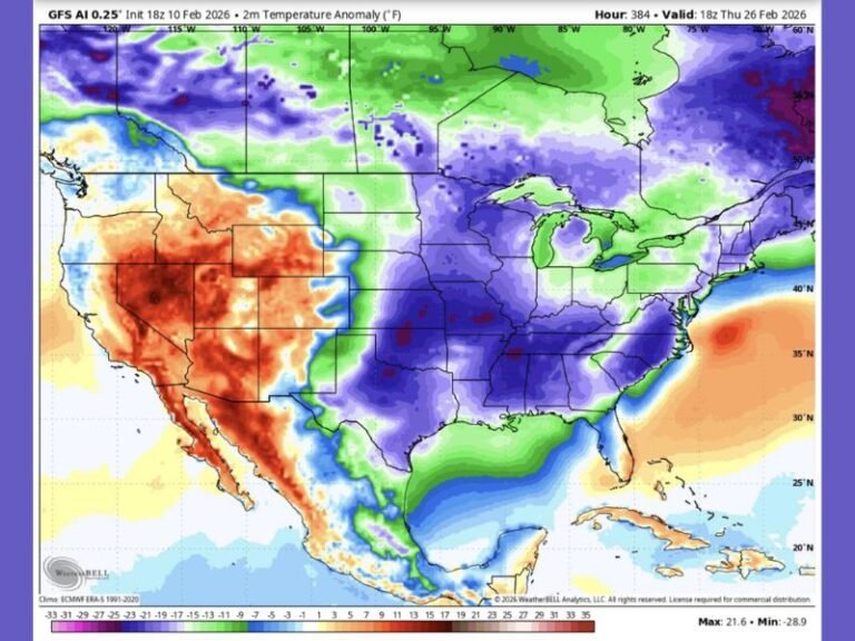
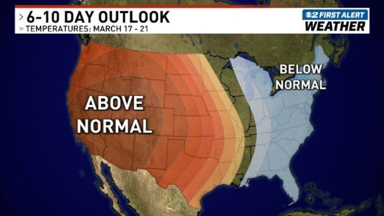
- A potential dip in temperatures across the eastern U.S.
- Continued active southern-stream energy
- A window where cold air availability is not yet exhausted
That combination is often necessary for late-season winter weather in the Mid-Atlantic and Southeast interior.
What Is Not Showing Yet
At this stage, there is no clear signal for a major snowstorm, nor is there strong evidence of widespread disruptive impacts. Snow amounts, if they occur, would likely be localized and highly dependent on exact storm timing and track.
Rain remains a possibility closer to the coast, while higher elevations and inland locations would be more favorable for snow should the setup materialize.
What to Watch Over the Next Week
Forecast confidence will improve as the window approaches. Key things forecasters will monitor include:
- Trends in ECMWF and GFS ensemble agreement
- Strength and persistence of cold air east of the Appalachians
- Placement of any southern-stream shortwaves
- Changes in snow probability shading, especially increases above current levels
If future runs continue to reinforce this signal, it could mark another winter weather chapter for the Mid-Atlantic or Carolinas before February ends.
As mid-February approaches, this is a setup worth keeping on the radar. For continued winter weather outlooks, long-range model trends, and regional forecast updates, visit ChicagoMusicGuide.com.