Massachusetts Winter Storm Showed Extreme Snowfall Contrast as Boston’s North Shore Saw 17-Inch Difference Over Just Seven Miles
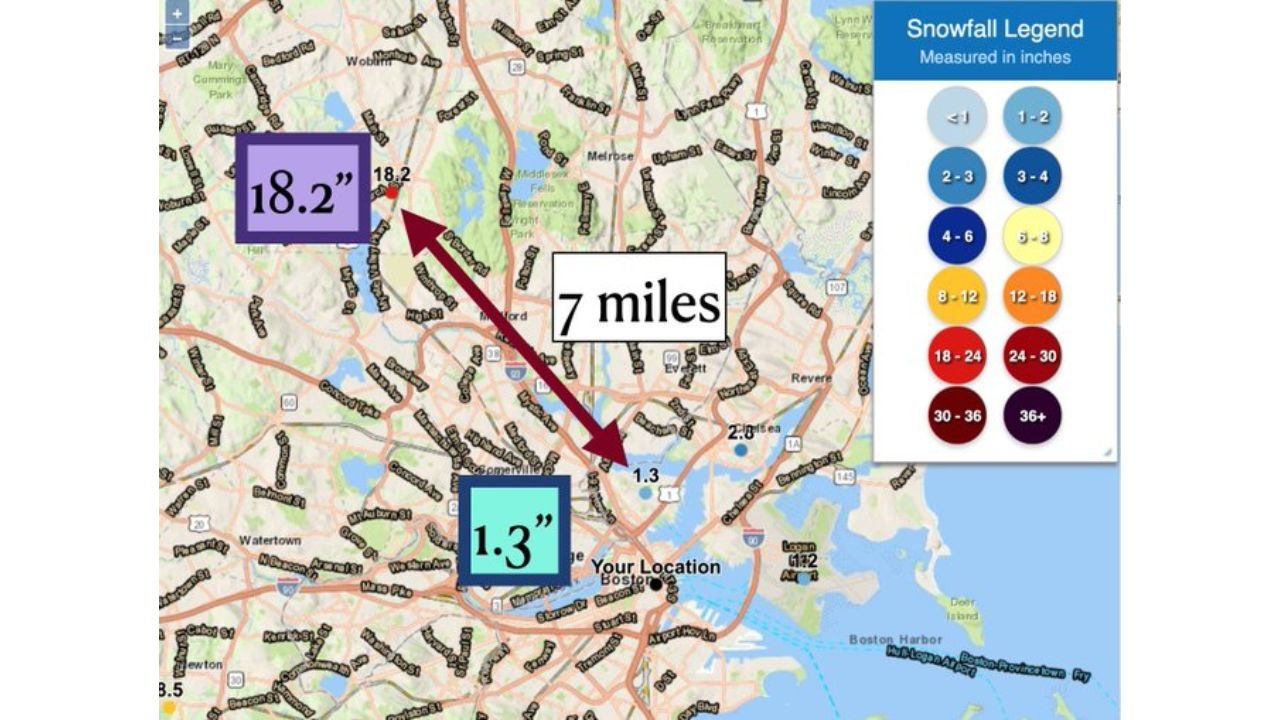
BOSTON, MASSACHUSETTS — A striking winter weather reminder is resurfacing for meteorologists and snow lovers alike as current forecasts highlight how difficult small-scale winter prediction can be. On February 1, 2021, parts of Massachusetts’ North Shore experienced one of the most dramatic snowfall gradients in recent memory, with a 17-inch difference in accumulation across just seven miles in the greater Boston area.
The event remains a textbook example of how mesoscale features can overwhelm even well-modeled winter storms.
A 17-Inch Snowfall Gradient Across Boston’s North Shore
During the storm, snowfall totals varied wildly across short distances. Some inland communities north of Boston measured 18 to 19 inches of snow, while locations closer to the immediate coastline received barely 1 to 2 inches.
Mapping from the National Weather Service Boston/Norton office showed the sharp cutoff clearly, with the transition occurring over only a few miles. For residents, the contrast was startling — snow-covered neighborhoods sat just minutes away from nearly bare roads.
This kind of gradient is exceptionally rare but not unheard of in coastal New England winter storms.
Coastal Front And Thermal Boundary Drove The Extreme Contrast
Meteorologists attributed the dramatic difference primarily to a coastal front combined with subtle thermal gradients. Cold air locked in place inland allowed snow to pile up efficiently, while slightly warmer marine air near the coast limited accumulation or caused precipitation to mix or change phase.
Once the coastal front stalled, snowfall rates intensified on the cold side of the boundary, producing localized bands of heavy snow. Meanwhile, areas just southeast of the front saw totals collapse rapidly.
The setup illustrates how temperature differences of just one or two degrees can dramatically alter snowfall outcomes.
Why Mesoscale Winter Forecasting Is So Difficult
Events like this highlight one of winter forecasting’s biggest challenges: mesoscale uncertainty. While large-scale models can accurately predict a major storm, they often struggle to pinpoint exactly where narrow zones of intense snow will set up.
In this case, even a small shift in the coastal front would have moved the heavy snow band miles east or west, completely changing who saw double-digit totals. Forecasters often describe these scenarios as “high confidence, low precision” events.
For Boston-area meteorologists, the storm underscored why snowfall maps can change right up until — and even during — an event.
Why The February 2021 Storm Still Matters Today
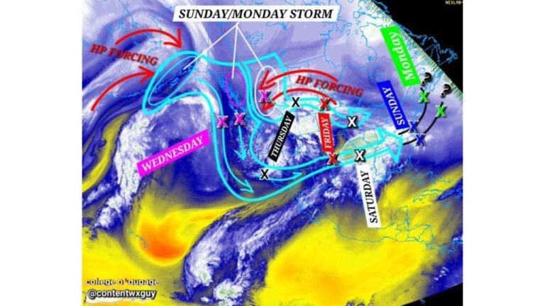
The resurfacing discussion around this storm comes as current winter setups show similar sharp gradients developing across coastal regions. While not every storm produces such an extreme outcome, the February 2021 Massachusetts storm remains a powerful reminder that winter weather impacts can vary dramatically within short distances.
It also explains why forecasters often emphasize ranges rather than exact snowfall numbers, especially in coastal states like Massachusetts, where ocean influence plays a major role.
A Lasting Lesson For Winter Weather Forecasts
The Boston North Shore snowfall gradient continues to be referenced because it perfectly illustrates the limits of predictability in winter storms. Even with modern modeling, small-scale boundaries can dictate outcomes that look unbelievable after the fact.
As winter forecasting continues to evolve, events like this remain valuable case studies for understanding — and respecting — the complexity of cold-season weather.
For more insights into notable winter storms, forecasting challenges, and regional weather stories that shape how events are planned and experienced, visit ChicagoMusicGuide.com for continued coverage.