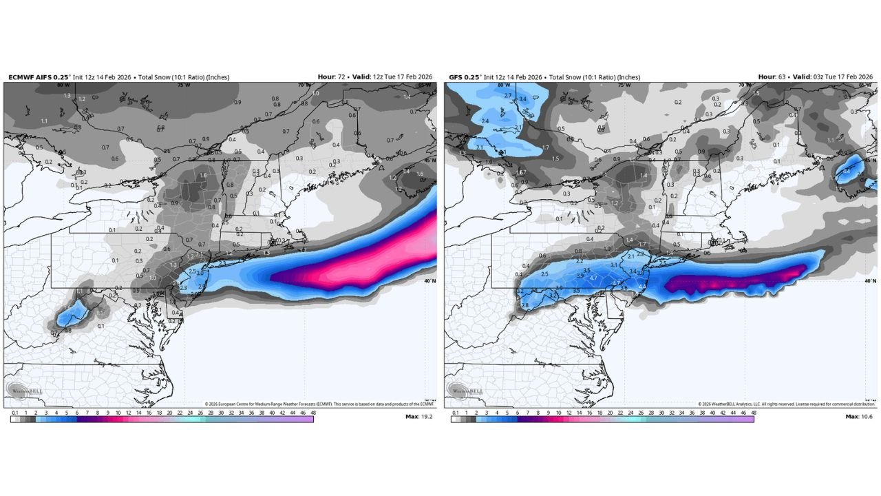
Baltimore Metro Storm Timeline: Chilly Sunday Rain Turns to Late-Night Snow North and West of I-95, With Around 1 Inch Possible Before Monday Dawn

BALTIMORE, MARYLAND — A weekend storm system is set to bring a chilly, steady rain to the entire Baltimore Metro by mid-afternoon Sunday before colder air works in and flips parts of the region to snow late Sunday night — especially north and west of the I-95 corridor.
Forecasters indicate the system will begin as an all-rain event for most communities, but the back side of the storm will cool just enough to allow a transition to snow in select areas between 10 PM and midnight, mainly across interior sections away from the immediate Chesapeake Bay influence.
Rain Arrives First Across the Entire Metro Sunday Afternoon
By Sunday afternoon, temperatures across the Baltimore region are expected to hover in the mid-30s, with readings around:
- 33°–34° in Westminster, Frederick, and York
- 33° in Baltimore City
- 35° in Washington, D.C.
- 37° in Annapolis and Waldorf
- Upper 30s to near 40° toward the Eastern Shore
At this stage, precipitation will be entirely rain across the metro area. The atmosphere remains marginally above freezing, especially closer to the Bay and south of the city.
Snow Transition Late Sunday Night North & West of I-95
As the storm pulls east and colder air wraps in on the backside, a transition to snow becomes increasingly likely for:
- Northern Baltimore County
- Carroll County
- Frederick County
- Areas west of I-95
- Higher elevations north of the city
The rain-to-snow changeover window is expected between 10 PM and midnight, with snow continuing into the early morning hours.
The heaviest burst of snow would occur between midnight and 3 AM, tapering off between 3 AM and 5 AM Monday as the system exits.
Around 1 Inch of Snow Possible Before Daybreak Monday
Current projections suggest around 1 inch of accumulation is possible in areas north and west of I-95 before the storm ends early Monday morning.
Because temperatures will be marginal — generally near 32–33° — accumulations may be limited to grassy surfaces and elevated objects at first. However, brief moderate bursts could allow for minor roadway impacts in colder pockets.
Closer to the Bay and along the I-95 corridor, precipitation may remain a mix or end before significant accumulation occurs.
What This Means for the Monday Morning Commute
If the snow materializes as expected, some localized slick spots could develop in:
- Carroll County
- Northern Baltimore County
- Frederick area
- Portions of south-central Pennsylvania
Most of Baltimore City and communities southeast of I-95 are more likely to see a cold rain or minimal accumulation.
Road temperatures and exact timing will determine impact levels, but the storm is not currently expected to produce widespread major travel disruptions.
Bottom Line
This system is primarily a chilly rain event for the Baltimore Metro, but a late-night transition to snow north and west of I-95 could deliver around 1 inch before dawn Monday.
The margin between rain and accumulating snow is thin — meaning small temperature changes could shift totals slightly higher or lower.
ChicagoMusicGuide will continue monitoring updates as the storm evolves and colder air works into the region.
Stay weather-aware, especially if traveling late Sunday night into early Monday morning.
