Midwest and Ohio Valley Brace for Dual Weather Threat as Severe Storms and Heavy Snow Collide Thursday
INDIANAPOLIS, INDIANA — A powerful late-week system is setting up a rare two-part weather threat across the central United States, bringing the risk of severe thunderstorms and possible tornadoes in the Ohio Valley while heavy snow and accumulating ice impact parts of the Upper Midwest late Thursday into early Friday.
This dynamic storm will split the region into dramatically different impacts depending on location, with warm, unstable air surging north ahead of the system and sharply colder air wrapping in behind it.
Severe Storm Risk Across Illinois, Indiana, Ohio, Kentucky and Tennessee
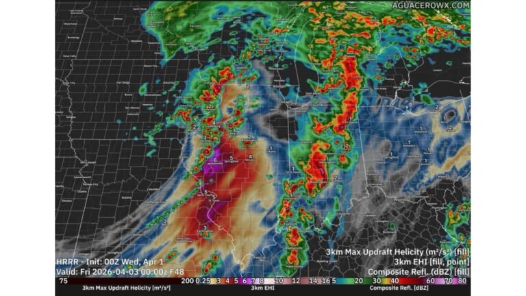
The southern side of the system will bring damaging winds and a few tornadoes Thursday afternoon into early evening across portions of Illinois, Indiana, Ohio, Kentucky, and Tennessee.
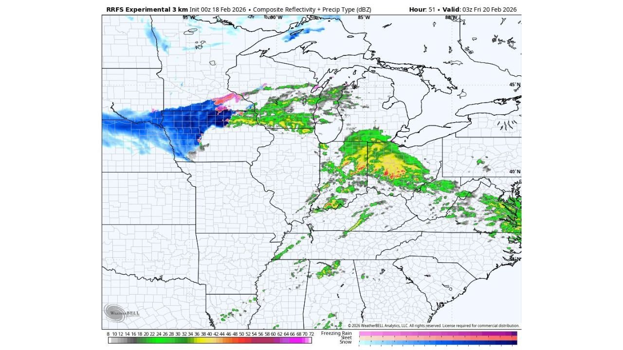
Model guidance shows a concentrated corridor of stronger storms extending from central and southern Indiana into Kentucky and southwest Ohio, with heavy rainfall and embedded severe cells possible. If instability increases as forecast, isolated tornadoes could develop, particularly along the advancing cold front.
This severe threat will peak during the late afternoon and early evening hours, before storms push eastward toward the Appalachian region overnight.
Heavy Snow Targets Nebraska, Iowa, Minnesota and Wisconsin
Meanwhile, on the northern and western side of the system, colder air will dominate. Heavy snow is expected across Nebraska, Iowa, southern Minnesota, and Wisconsin late Thursday into early Friday.
Forecast guidance shows a broad swath of accumulating snow, with several inches possible in many areas. Snowfall rates may become intense at times, particularly across portions of eastern Nebraska and northern Iowa, where deeper moisture overlaps with stronger lift.
Travel impacts are likely as snow bands intensify overnight. Areas near Minneapolis and southern Wisconsin could see moderate accumulations as the system tracks east.
Sharp Temperature Drop Behind the Front
Following record-breaking warmth across parts of the Ohio Valley and Midwest, a strong cold front will sweep through Thursday night. Temperatures are expected to fall rapidly behind the front, especially across Indiana, Ohio, and Kentucky.
This temperature crash may create additional hazards, including slick roads where rain transitions to colder conditions.
The contrast across the region will be striking: springlike warmth and severe storms ahead of the front, and wintry conditions with accumulating snow behind it.
Timing and What to Watch
The timeline for impacts is becoming clearer:
- Thursday afternoon: Severe storms develop across Illinois, Indiana, Kentucky, and Ohio
- Thursday evening: Storms intensify across the Ohio Valley while snow spreads across Iowa and Minnesota
- Late Thursday night into early Friday: Heavy snow expands into Wisconsin and portions of the Upper Midwest
- Friday morning: Cold air settles in across much of the Midwest and Ohio Valley
While not every location will experience extreme conditions, nearly the entire region from the Central Plains to the Ohio Valley will feel some impact from this storm.
Residents should prepare for rapidly changing weather conditions and stay updated as the system evolves.
Stay with ChicagoMusicGuide.com for the latest updates as this active pattern unfolds and for detailed regional breakdowns as confidence increases.