Southern Indiana and Central Indiana Face Rising Tornado Concerns as HRRR Signals Unstable Thursday Setup Across Illinois, Kentucky, and Ohio
INDIANA — Evening data is beginning to paint a more concerning picture for parts of southern and central Indiana, where updated high-resolution guidance suggests increasing tornado potential Thursday afternoon into the early evening.
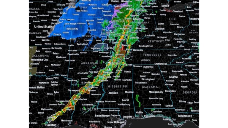
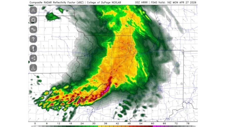
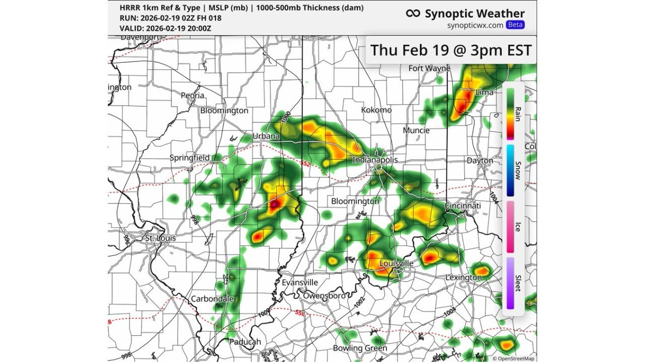
The latest HRRR (High-Resolution Rapid Refresh) model run valid Thursday, February 19 at 3 PM EST (20Z) shows scattered but potentially intense thunderstorms developing across Indianapolis, Bloomington, Terre Haute, Evansville, Louisville (Kentucky), and stretching east toward Cincinnati, Ohio. While the setup may appear messy on radar, forecasters caution that this type of environment should not be underestimated.
HRRR Reflectivity Shows Discrete Cells Near Indianapolis and Bloomington
The 18Z HRRR run indicates:
- Thunderstorm clusters forming west and southwest of Indianapolis
- Stronger cores near Bloomington and Terre Haute
- Additional cells developing near Louisville, Kentucky
- Activity extending east toward Cincinnati, Ohio
Unlike a solid squall line, storms appear semi-discrete — meaning individual cells could briefly intensify. That matters because discrete storms have a higher chance of producing rotating updrafts if wind shear supports it.
Southern Indiana, in particular, appears to sit near a favorable zone where surface winds back slightly to the southeast — a subtle but important signal in severe weather setups.
Surface to 925mb Wind Profile Raises Tornado Questions in Southern Indiana
One of the more notable changes in the evening data is the improvement in low-level wind structure from the surface up to around 925mb.
Model soundings for Spencer, Indiana (southern Indiana) show:
- Surface-based CAPE near 1700 J/kg
- Minimal convective inhibition (CIN near zero)
- Low cloud bases (LCL around 260–480 meters)
- Strong curvature in the hodograph indicating directional shear
This combination supports organized thunderstorms capable of producing damaging winds and hail — and in isolated cases, a tornado if storm mode cooperates.
Low cloud bases are especially important in February setups. When LCL heights are lower, storms do not have to work as hard to stretch rotation downward.
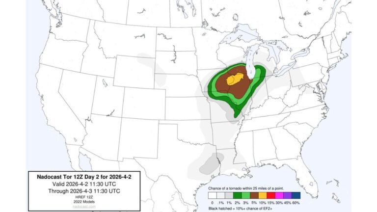
SPC Risk Assessment Appears Justified for Illinois, Indiana, and Ohio
Current thinking aligns with the broader outlook:
- 5% tornado risk
- 15% hail risk
- 15% damaging wind risk
Those numbers may seem modest, but in early-season events — particularly in February — even a 5% tornado probability signals meaningful concern.
The highest risk corridor appears focused on:
- Southern Indiana
- Central Indiana including Indianapolis
- Western Ohio
- Northern Kentucky near Louisville and Cincinnati
Timing Will Be Critical Across Central Indiana and Western Ohio
Forecasters emphasize that this setup is extremely timing-dependent.
Storms that develop earlier in the afternoon could tap into stronger instability and better shear. If storms consolidate too quickly into a messy cluster, tornado potential may be reduced but damaging winds could become more widespread.
This type of event often evolves quickly, making Thursday an active nowcasting situation across:
- Indianapolis metro
- Bloomington
- Terre Haute
- Evansville
- Louisville, KY
- Cincinnati, OH
February Pattern Still Active Across the Midwest and Ohio Valley
This event is part of a broader active weather pattern impacting the Midwest and Ohio Valley. While instability levels are not extreme, they are sufficient for severe weather given favorable wind profiles.
Even if radar appears chaotic, environments with:
- Backed surface winds
- Strong low-level shear
- Moderate instability
- Low cloud bases
can produce brief but impactful tornadoes.
Residents across Indiana, Illinois, Kentucky, and Ohio should stay weather-aware Thursday afternoon and evening.
Chicagomusicguide.com will continue monitoring model trends and updates as this developing situation unfolds across the Midwest and Ohio Valley.