Mid-Atlantic and Northeast Winter Storm Showdown as Models Clash Over Major Snow and Inverted Trough Threat
PHILADELPHIA, PENNSYLVANIA — A growing significant winter storm risk is taking shape for portions of the Mid-Atlantic and Northeast, but major forecast models remain sharply divided on the storm’s evolution. While the GFS model continues to depict a stronger, more consolidated coastal system, other guidance suggests a different structure — including the development of an inverted trough, a setup historically known for producing localized but intense snowfall.
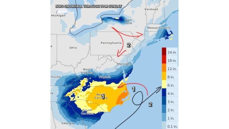
The system is projected to impact the region late Sunday into early Monday, with snowfall potential stretching from Virginia and Maryland through Pennsylvania, New Jersey, New York, and southern New England.
Model Battle: GFS Versus ECMWF
The forecast debate is now centered on the contrast between the GFS (Global Forecast System) and the ECMWF (European Model).
The ECMWF 0.1° guidance valid early Monday morning shows a coastal low positioned farther offshore, with precipitation primarily focused east of the Delmarva Peninsula and off the New Jersey coast. While snow spreads inland across Pennsylvania, upstate New York, and parts of New England, the system appears less consolidated and not as aggressively deepened near the coastline.
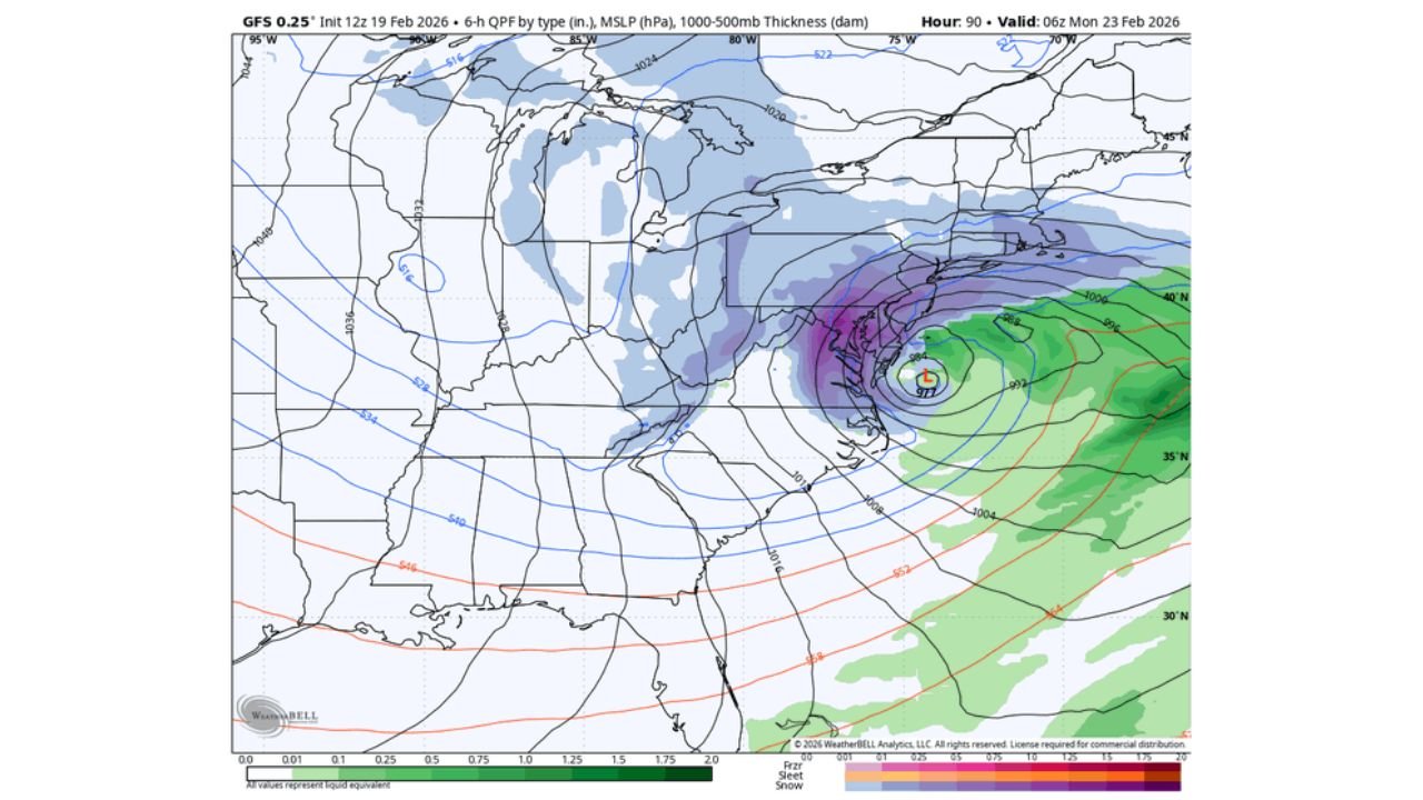
By contrast, the GFS 0.25° model indicates a more defined and stronger coastal circulation near the Virginia Capes, with heavier precipitation wrapping back into the I-95 corridor. This solution brings more robust snowfall bands into Maryland, Delaware, southern New Jersey, and possibly into the Philadelphia and New York City metro areas.
The key takeaway: nearly every other model run is currently pushing back against the more aggressive GFS solution. Forecasters caution that resolution of this disagreement will determine who sees moderate snow and who could face heavier accumulations.
Inverted Trough Raises Overachieving Snow Concern
A notable feature appearing in several model runs is the development of an inverted trough — a northwest-to-southeast oriented extension of low pressure that can pivot heavy snow bands inland.
Historically, inverted trough setups have a reputation for overachieving snowfall totals, especially across parts of central Pennsylvania, northern Maryland, and interior New Jersey. When these bands lock into place, localized areas can receive significantly higher snow totals than surrounding communities.
Forecast discussions suggest this possibility remains on the table, though confidence in exact placement remains low. Even a shift of 50 to 75 miles could dramatically alter accumulation forecasts.
Snowfall Projections and Ensemble Signals
The ECMWF Ensemble (ENS) 48-hour snowfall output highlights a swath of accumulating snow from the Ohio Valley through Pennsylvania, New Jersey, and into southern New England.
Ensemble averages suggest:
- 2–4 inches across broad portions of Pennsylvania and northern Maryland
- Higher localized amounts possible where banding develops
- Lighter accumulations south toward Virginia and along parts of the coast
However, the ensemble spread — meaning variation between individual runs — remains significant. That variability reflects ongoing uncertainty in storm strength and track.
If the GFS solution verifies, heavier snow could extend closer to the coastline. If the ECMWF remains dominant, snowfall may stay more modest and focused inland.
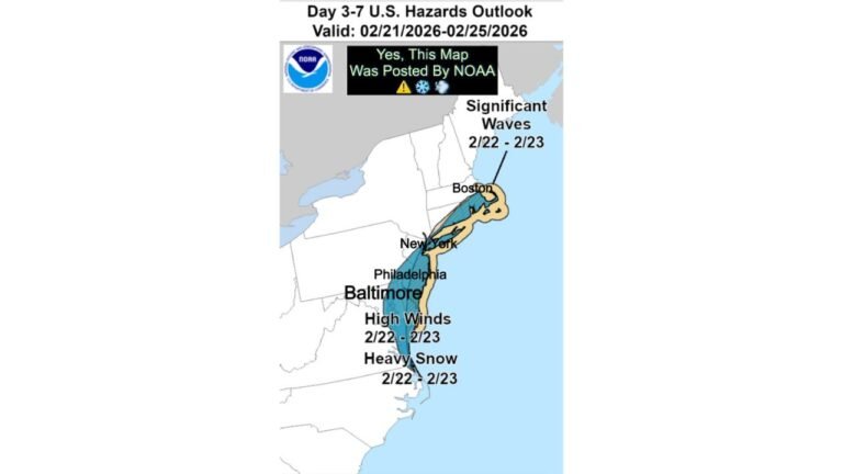
Timing and Impact Window
Model guidance indicates the storm reaches peak organization late Sunday night into early Monday (around 06z Feb. 23). Precipitation would likely begin Sunday evening across the Mid-Atlantic, expanding northeast overnight.
Travel impacts are most likely early Monday morning across:
- Pennsylvania Turnpike corridor
- Interstate 95 from Washington, D.C. to New York City
- Portions of southern New England
Temperatures appear cold enough for primarily snow across interior areas, though coastal zones could see mixing depending on exact storm positioning.
What Forecasters Are Watching Now
Meteorologists are closely monitoring three primary factors:
- Storm consolidation offshore
- Placement of the inverted trough axis
- Thermal profiles along the I-95 corridor
The battle between the GFS and other global models remains the central forecasting challenge. With several runs still shifting, confidence in specific snowfall totals remains moderate at best.
For residents in Pennsylvania, New Jersey, New York, and surrounding states, this remains a high-uncertainty but potentially impactful winter setup. Even if the more aggressive solution does not materialize, moderate snowfall could still disrupt early-week travel.
As the Mid-Atlantic and Northeast await clarity in this developing winter storm scenario, model trends over the next 24–36 hours will be critical in determining who sees routine snow and who may face heavier banded accumulations. For continued weather updates and regional forecast analysis, visit ChicagoMusicGuide.com.