Appalachian Mountains Snowstorm Set to Dump Up to a Foot From Tennessee to North Carolina Through Monday Night
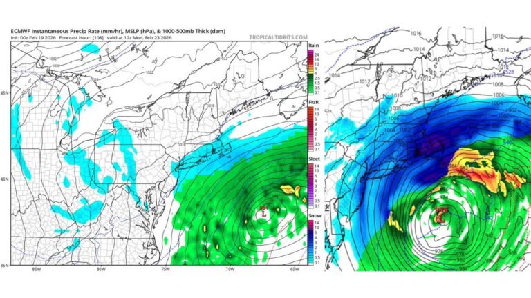
JOHNSON CITY, TENNESSEE — A significant winter storm is tracking across the Appalachian Mountains, bringing a sharp snowfall gradient from eastern Tennessee into western North Carolina and parts of southwest Virginia through Sunday and Monday night. Forecast maps show a narrow but intense band of heavy snow, with some mountain communities expected to see 6–10 inches, and isolated higher elevations potentially reaching locally one foot.
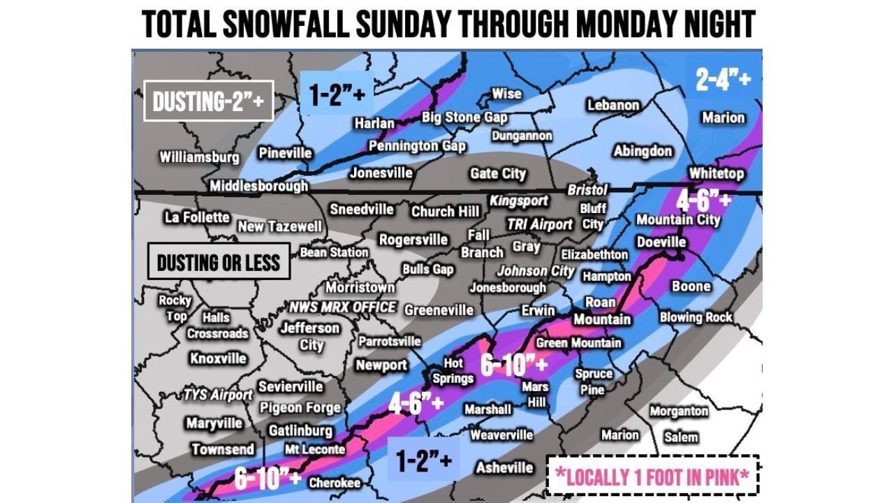
According to the final snowfall outlook issued for Sunday through Monday night , snowfall totals will vary dramatically depending on elevation and location, especially along the spine of the mountains.
Heavy Snow Band Targets High Elevations
The most significant snowfall is projected along a corridor stretching from Hot Springs, Mars Hill, and areas near Roan Mountain, extending northeast toward Mountain City and Boone, North Carolina. These communities sit directly within the highlighted pink zone on the forecast map, indicating potential totals of 6–10 inches, with locally higher amounts approaching 12 inches in favored mountain ridges.
Higher elevations such as Mount LeConte, Roan Mountain, and surrounding peaks are especially vulnerable to enhanced snowfall due to upslope flow. Meteorologists note that terrain will play a critical role, meaning snowfall amounts could increase rapidly over short distances.
Communities including Green Mountain, Spruce Pine, and portions of Madison County, North Carolina, are also positioned within the heavier accumulation band.
Moderate Snow Expected From Big Stone Gap to Abingdon
Further north, areas including Big Stone Gap, Pennington Gap, Harlan, and parts of Wise County, Virginia, are forecast to receive 1–2 inches or more, with localized pockets reaching higher totals where elevation increases.
Cities such as Lebanon, Marion, and Abingdon, Virginia, appear within the broader 2–4 inch zone, especially toward the eastern fringe of the system. Meanwhile, Whitetop and communities near the North Carolina–Virginia border could see totals pushing into the 4–6 inch range as the snow band shifts eastward.
Travel through mountain passes and elevated roadways in these areas may become hazardous late Sunday into Monday night, particularly during heavier bursts of snowfall.
Light Snow or Dusting Across Tennessee Valley
The forecast sharply drops off west of the mountains. Cities including Kingsport, Johnson City, Bristol, and areas near TRI Airport may see only a dusting to under an inch, depending on how far west the snow band shifts.
Further west into Greeneville, Morristown, Jefferson City, and Knoxville, accumulations are expected to remain minimal. The map indicates a “dusting or less” across much of the Tennessee Valley, including Sevierville, Pigeon Forge, and Maryville.
This tight snowfall gradient underscores how critical storm track and elevation will be. A slight shift in the band could significantly change totals in borderline communities.
Locally One Foot Possible in Pink Zones
The most eye-catching detail in the outlook is the notation: “Locally 1 foot in pink.” This refers to the deepest core of the snow band across the highest elevations of western North Carolina and the Tennessee–North Carolina border.
Mountain communities near Hot Springs, Mars Hill, and elevated ridgelines surrounding Roan Mountain could approach that threshold if snowfall rates remain steady through Monday evening. Meteorologists caution that localized enhancement is possible where moisture wraps into colder air at elevation.
Residents in these areas should prepare for:
- Reduced visibility during heavy snowfall
- Snow-covered and potentially icy roads
- Possible delays or closures Monday night into early Tuesday
Emergency managers typically monitor these types of narrow mountain snow bands closely due to their high-impact potential despite limited geographic coverage.
As this winter system unfolds across Tennessee, North Carolina, and Virginia, communities along the Appalachian spine will likely see the greatest impact while valley locations experience only minor accumulation. For continuing updates on winter weather developments, storm tracking, and regional impacts across the country, visit ChicagoMusicGuide.com.