Illinois, Indiana and Michigan Face Severe Storm Threat Tuesday as Supercells May Form Across North-Central Illinois
NORTH-CENTRAL ILLINOIS — Meteorologists are closely monitoring Tuesday’s developing severe weather setup across Illinois, where atmospheric conditions appear unusually favorable for early March storms. Forecast models suggest that supercell thunderstorms could begin forming Tuesday afternoon across north-central Illinois, potentially expanding and intensifying into the evening hours as warm, moisture-rich air pushes into the region.
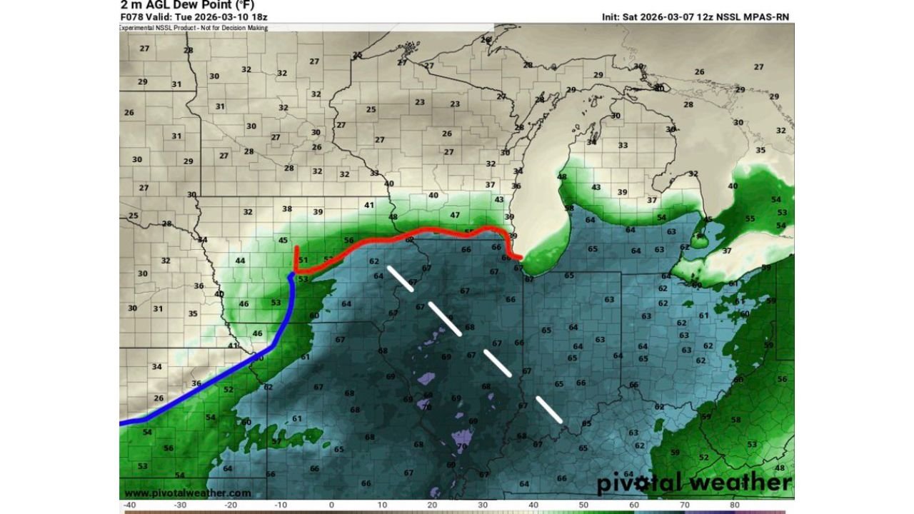
Forecast data indicates high dew points spreading across Illinois from the south, creating a humid and unstable environment that could support severe thunderstorms. With multiple weather models signaling similar patterns, forecasters say the situation will require careful monitoring throughout the day.
Warm Moisture Surge Creates Favorable Storm Environment Across Illinois
Forecast maps show a strong moisture surge moving northward through Missouri and Illinois, pushing dew points into the mid-60s to near 70°F across much of central and southern Illinois by Tuesday afternoon. These values are considered unusually high for early March, significantly increasing the potential for storm development.
A warm frontal boundary stretching across northern Illinois and southern Wisconsin appears to be a key feature in the developing weather pattern. Areas just south of this boundary—including north-central Illinois—may experience the most favorable conditions for severe storms, as warm and humid air interacts with cooler air farther north.
Meteorologists note that storm formation could initially occur along this frontal boundary during the afternoon, where rising air and temperature contrasts help trigger thunderstorms. Once storms form, the increasingly unstable atmosphere could allow them to strengthen quickly.
Forecast Models Indicate Possible Supercell Development Tuesday Afternoon
Several weather models show discrete thunderstorms developing across central and north-central Illinois during the afternoon hours Tuesday, with the potential for organized supercells capable of producing severe weather.
Supercells are a particularly concerning type of thunderstorm because they contain rotating updrafts, which can increase the risk of hazards such as large hail, damaging wind gusts, and possible tornadoes. Forecast model simulations suggest clusters of stronger storms forming from central Illinois toward northern Indiana and southern Michigan as the evening approaches.
The model-generated storm tracks indicate storms may organize into multiple storm lines or clusters, potentially spreading severe weather impacts across a broader portion of the Midwest later in the evening.
Meteorologists emphasize that early storm development in Illinois could influence the overall severity and coverage of storms later in the day, making Tuesday afternoon a critical period for monitoring weather conditions.
Helicity and Wind Patterns Suggest Rotating Storm Potential
Another important signal appearing in the forecast models involves elevated storm-relative helicity values across parts of Illinois, particularly during the late afternoon and early evening hours. Helicity measures the potential for rotating air currents within thunderstorms, which can support supercell development.
Maps showing maximum updraft helicity projections highlight several potential storm tracks stretching from central Illinois into northern Indiana and southern Michigan, suggesting that storms developing in Illinois could continue strengthening as they move east.
This wind pattern, combined with increasing atmospheric instability and strong moisture levels, may create an environment capable of supporting organized severe thunderstorms across the region.
However, meteorologists caution that forecast models several days in advance can still change, and the exact locations of the strongest storms may shift as new data becomes available.
Early March Severe Weather Setup Raises Attention Across the Midwest
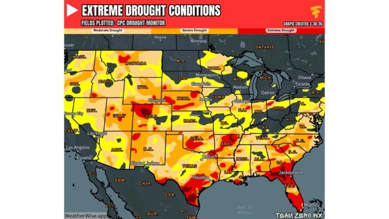
Severe weather events are less common in the Midwest during early March, but forecasters say the current pattern resembles conditions typically seen later in the spring severe weather season.
The presence of rich Gulf moisture, strong temperature contrasts, and favorable wind patterns has prompted meteorologists to begin highlighting the potential for an “all-hazards severe weather threat” across north-central Illinois.
Areas across Illinois, northern Indiana, southern Michigan, and parts of Missouri could eventually see storm activity depending on how the weather system evolves. While it is too early to determine exact impacts, forecasters say Tuesday afternoon and evening will be key timeframes to watch for severe weather development.
Residents across Illinois—particularly in north-central parts of the state—are encouraged to stay updated with the latest forecasts as meteorologists refine their outlooks over the coming days.
As weather conditions continue to evolve heading into Tuesday, ChicagoMusicGuide.com will provide ongoing updates on developing storms, severe weather alerts, and regional forecasts affecting Illinois and the Midwest.