Powerful Spring Storm to Slam Illinois, Wisconsin, Michigan and Indiana This Weekend with Heavy Snow North of Chicago and Strong–Severe Storms to the South
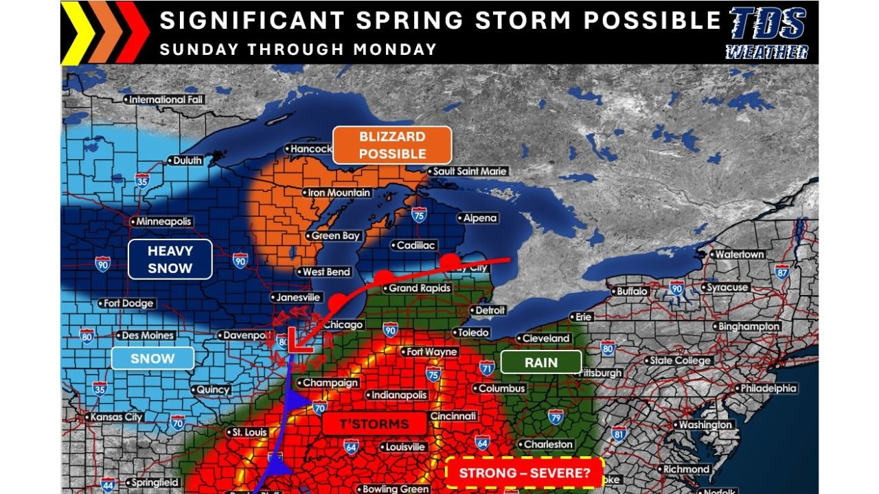
CHICAGO, ILLINOIS — A significant and potentially high-impact spring storm is expected to move across the Midwest Sunday through Monday, bringing a sharp divide in weather hazards across Illinois, Wisconsin, Michigan, Indiana, and surrounding states.
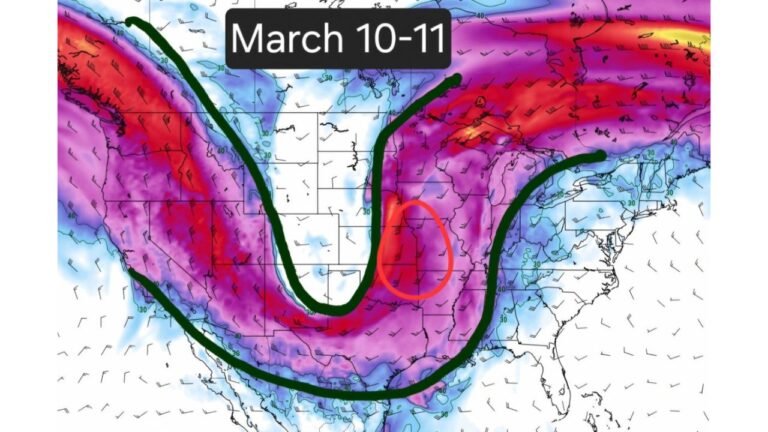
Forecast guidance shows a strengthening low-pressure system tracking through the region, creating a classic spring setup: heavy snow and possible blizzard conditions to the north of the storm track, with strong to severe thunderstorms in the warm sector to the south.
Heavy Snow and Blizzard Potential North of Chicago
Colder air wrapping around the northwest side of the low will support a swath of heavy snowfall across portions of:
- Eastern Iowa
- Northern Illinois
- Much of Wisconsin
- The Upper Peninsula of Michigan
- Northern Lower Michigan
Communities including Duluth, Minneapolis, Green Bay, Hancock, Iron Mountain, and Sault Ste. Marie are positioned within the heavier snow axis.
Forecast signals show a high probability of 12 inches or more across parts of Wisconsin and the Upper Peninsula of Michigan. As the system strengthens, increasing wind speeds could combine with heavy snow to produce blizzard conditions, particularly across northern Wisconsin and the U.P., where open terrain may allow blowing and drifting snow to significantly reduce visibility.
For the Chicago metro area, the exact track of the low will determine snowfall intensity. Areas just northwest of the city could see accumulating snow, while locations slightly south and east may experience more rain or a rain-to-snow transition.
Severe Weather Risk Across Central and Southern Illinois and Indiana
South of the storm track, a very different scenario unfolds.
The warm sector will stretch across portions of:
- Central and southern Illinois
- Indiana, including Indianapolis and Fort Wayne
- Western and central Ohio
Cities such as Champaign, Springfield, Indianapolis, Louisville, Bowling Green, and Cincinnati are highlighted in the corridor of strongest thunderstorm potential.
Forecast data indicates periods of rain and thunderstorms Sunday into Monday, with the potential for another round of strong to severe storms. The greatest concern would be:
- Damaging wind gusts
- Heavy downpours
- Isolated tornado potential depending on storm organization
If instability and wind shear overlap sufficiently, a line of strong storms could sweep northeast across Indiana and into Ohio late Sunday or Monday.
Sharp Weather Gradient Across the Midwest
One of the most striking features of this system is the sharp gradient between winter and spring hazards.
While heavy snow falls across Wisconsin and Michigan, locations just a few hundred miles south — including parts of Illinois and Indiana — may deal with thunderstorms and even severe weather.
Detroit and Grand Rapids appear near the transition zone, where precipitation type could vary depending on the exact storm track.
Wind Impacts Region-Wide
Beyond snow and thunderstorms, strong winds will be a widespread concern as the low deepens. Gusty conditions are likely across much of Illinois, Indiana, Wisconsin, and Michigan.
In the north, those winds could create near-whiteout conditions. In the south, they may enhance thunderstorm intensity and increase the risk of localized damage.
Timing and What to Watch
The most active period appears to be Sunday through Monday, with conditions evolving as the system strengthens and tracks northeast.
Key factors to monitor:
- The exact path of the low-pressure center
- Placement of the heavy snow band
- Degree of instability in the warm sector
- Wind speeds as the system intensifies
Small shifts in the track could significantly alter snowfall totals around Chicago and adjust the severe weather corridor farther north or south.
Residents across Illinois, Wisconsin, Michigan, Indiana, and Ohio should stay alert as forecast details continue to be refined.
For ongoing updates on this developing Midwest storm system, continue following coverage on ChicagoMusicGuide.com.