Illinois, Missouri, Arkansas, Tennessee and Kentucky Included in Expanding April 1–5 Tornado Threat as Multi-Day Severe Storm Pattern Develops Across Central United States
UNITED STATES — A long-range, multi-day threat for tornadoes and severe thunderstorms is now emerging for April 1 through April 5, 2026, with parts of the Midwest, Mid-South and Lower Ohio Valley increasingly in focus.
Forecast data initialized Sunday morning (March 22) highlights a broad corridor of concern stretching from the Southern Plains into the central United States, including Illinois, Missouri, Arkansas, Tennessee, Kentucky, Indiana and portions of Iowa and Mississippi.
While this remains a longer-range outlook, the consistency of the signal across multiple forecast days suggests the potential for a prolonged active period rather than a single isolated event.
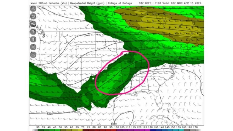
April 1–2: Central U.S. Under the Gun
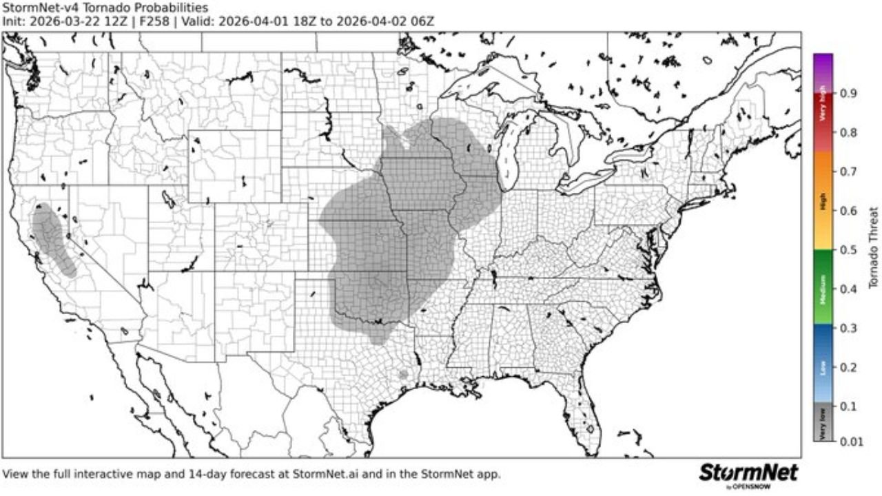
The early phase of the setup — April 1 into April 2 — shows a concentrated zone of tornado probabilities centered over:
- Missouri
- Arkansas
- Illinois
- Western Tennessee
- Western Kentucky
- Eastern Oklahoma
- Eastern Kansas
This region includes major metro areas such as St. Louis, Little Rock, Springfield, Memphis and southern Illinois communities, placing millions within the early risk corridor.
The geographic footprint suggests a classic spring pattern, with warm, moist Gulf air surging northward and interacting with a strengthening storm system tracking out of the Plains.
April 3–4: Threat Shifts but Persists
As the system evolves, the core risk area appears to shift slightly east and southeast while maintaining coverage across:
- Illinois
- Indiana
- Kentucky
- Tennessee
- Mississippi
- Alabama
- Western Ohio
This suggests a multi-round setup, where severe weather redevelops on successive days as upper-level energy and surface boundaries reposition across the region.
For Chicago-area readers, while northern Illinois may not be in the highest probability zone at this time, southern and central Illinois remain within the broader shaded risk area.
April 5: Gradual Southward Focus
By April 4 into April 5, the highest probabilities consolidate farther south and west again, targeting parts of:
- Arkansas
- Missouri
- Oklahoma
- Eastern Texas
This shift indicates that the severe weather pattern may oscillate over several days rather than sweep cleanly eastward in one pass.
Why a Multi-Day Threat Matters
Unlike single-day severe weather events, multi-day setups can increase overall tornado counts and storm impacts because:
- Atmospheric instability can reload daily
- Surface boundaries can stall
- Successive storm systems can move through the same region
This pattern is often associated with early April severe weather seasons across the Mississippi Valley and Midwest.
What to Watch Going Forward
Because this forecast extends 7–14 days out, important details such as:
- Exact tornado intensity
- Specific city impacts
- Timing of peak severe windows
will become clearer as higher-resolution models begin resolving the system.
However, the broad agreement on a multi-day signal from April 1–5 is enough to warrant early awareness across Illinois, Missouri, Arkansas, Tennessee, Kentucky and surrounding states.
Residents in these areas should monitor updates closely as the calendar turns toward April.
ChicagoMusicGuide.com will continue tracking this developing severe weather pattern and provide updated state-by-state breakdowns as confidence increases.