Illinois, Indiana, Missouri and Michigan Included in 15 Percent Severe Storm Risk March 26 as Cold Front Targets Midwest With Supercell Potential
CHICAGO, ILLINOIS — Parts of the Midwest, including Illinois, Indiana, Missouri and southern Michigan, are now outlined in a 15 percent severe weather risk for Thursday, March 26, 2026, as a sagging cold front moves through the region.
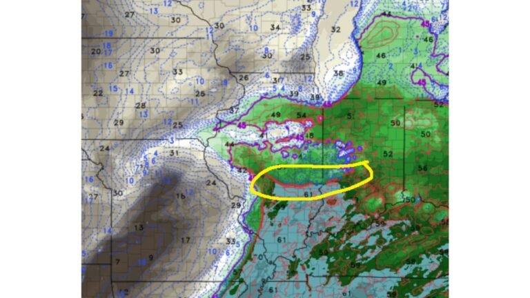
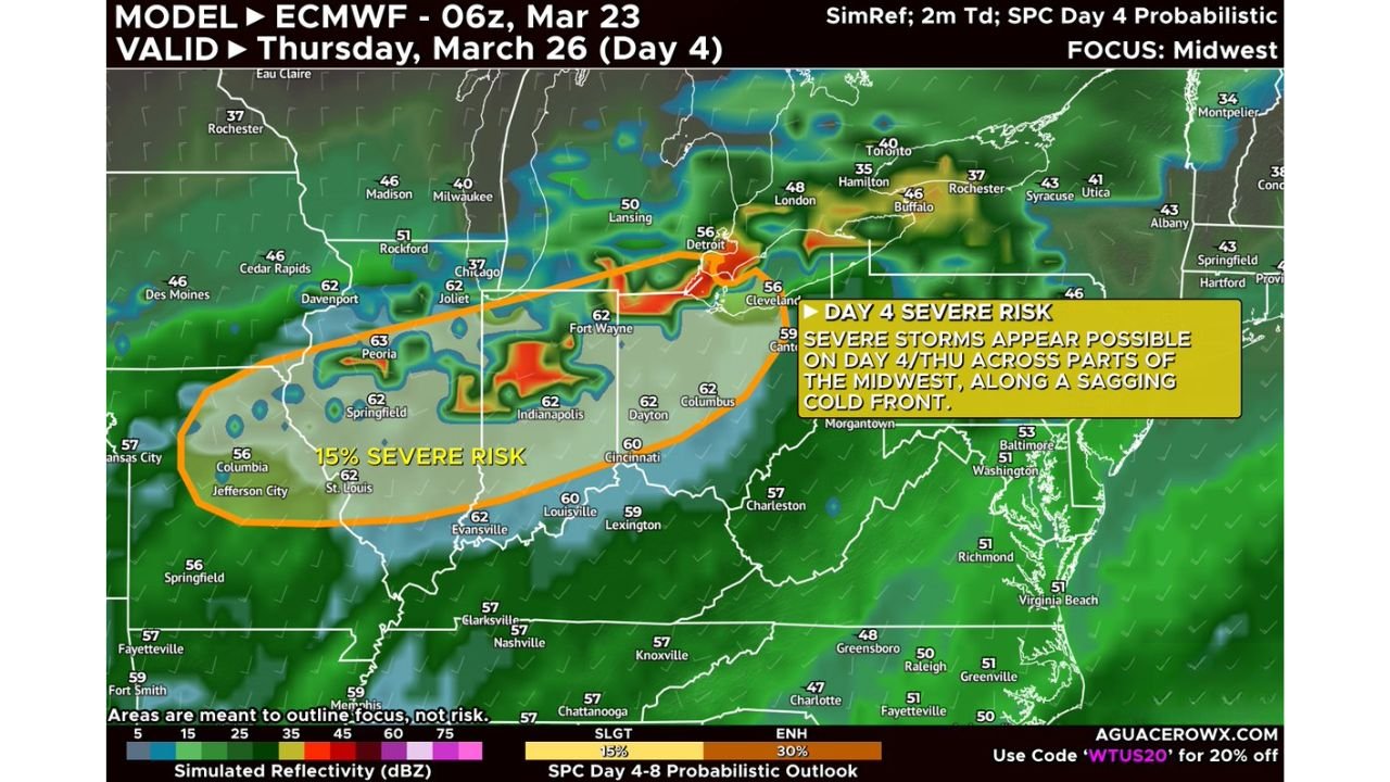
The Storm Prediction Center’s Day 4 outlook highlights a corridor stretching from central Missouri through central Illinois and into northern Indiana and southern Michigan, where scattered strong to severe thunderstorms could develop.
15 Percent Severe Risk Zone Covers Key Midwest Cities
The highlighted risk area includes:
- St. Louis, Missouri
- Columbia and Jefferson City, Missouri
- Springfield and Peoria, Illinois
- Chicago and Joliet, Illinois
- Fort Wayne, Indiana
- Detroit, Michigan
This 15 percent risk level indicates a meaningful chance of severe storms within 25 miles of any given point in the outlined zone.
Setup Driven by Sagging Cold Front and Upper-Level Trough
Forecast guidance shows storms forming along a cold front dipping southeast across the Midwest. At the same time, the region will sit beneath the influence of a passing upper-level trough.
This combination may provide enough lift and wind shear to support organized thunderstorms. However, forecasters note that capping — a layer of warm air aloft that suppresses storm development — could limit how widespread storms become.
If storms do break through that cap, they are expected to form in a moderate to strongly sheared environment, increasing the risk for more organized structures.
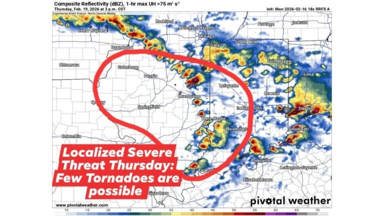
Supercells and All Severe Hazards Possible
Model guidance suggests that any storms that develop Thursday afternoon or evening could:
- Exhibit supercellular characteristics
- Produce large hail
- Generate damaging wind gusts
- Possibly support isolated tornadoes
Simulated reflectivity highlights pockets of more intense storms across central Illinois, northern Indiana and into southern Michigan, particularly near and west of Detroit.
Storm coverage may remain scattered rather than widespread, but individual cells could intensify quickly given favorable shear profiles.
Timing and What to Watch
Storm initiation would most likely occur during the afternoon and evening hours as daytime heating interacts with the advancing cold front.
Residents across Illinois, Indiana, Missouri and southern Michigan should monitor updates as Thursday approaches, particularly in and around the Chicago metro area.
ChicagoMusicGuide.com will continue to track the evolving setup and provide additional updates as new forecast data becomes available ahead of March 26.