Wetter Pattern Returns to Colorado With Mountain Snow Increasing and Rain Chances Building for Denver in 8 to 14 Day Outlook
COLORADO — After a relatively quiet stretch, the longer-range outlook is signaling a shift toward a wetter pattern across Colorado, with increasing mountain snow potential and possible rain chances for Denver over the next 8 to 14 days.
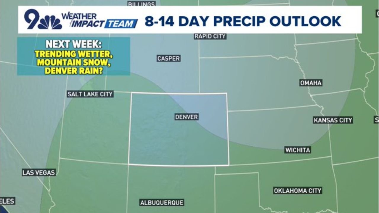
The latest precipitation outlook highlights much of Colorado within a zone trending wetter than average as the calendar moves deeper into early April.
8–14 Day Outlook Shows Moisture Increase
The extended outlook map places Colorado, including Denver, within a broad area shaded to indicate above-normal precipitation potential.
The wetter signal extends across:
- The Front Range
- Central Colorado
- Mountain regions west of Denver
- Portions of eastern Colorado
Nearby cities such as Salt Lake City, Rapid City, Omaha, Wichita and Oklahoma City sit near the edge of the broader moisture field, but the core focus appears centered over Colorado.
Mountain Snow Likely to Increase
With a wetter pattern setting up, higher elevations are favored for accumulating snowfall. Mountain snow becomes more likely as incoming systems tap Pacific moisture and move across the Rockies.
Given typical elevation-based temperature differences, areas above the foothills could see:
- Periodic snow events
- Improved late-season snowpack conditions
- Fresh accumulations during passing systems
This marks a noticeable change from recent quieter or drier intervals.
Denver Rain Chances Possible
While mountains would primarily see snow, lower elevations — including Denver — could see rain opportunities as systems pass through.
The outlook suggests:
- At least a few precipitation chances
- Potential rain events across the metro area
- Variability depending on storm track and timing
Temperatures during this period will determine whether any mixed precipitation occurs during overnight or early morning hours, but the primary signal for Denver is increased moisture rather than significant cold.
Pattern Becoming More Active
The broader atmospheric setup indicates multiple disturbances tracking through the region rather than a single storm event. This increases the likelihood of:
- Repeated precipitation opportunities
- Fluctuating temperatures
- Periods of unsettled weather
Although exact placement and totals remain subject to change, the consistent wetter shading across Colorado supports confidence in a more active stretch ahead.
What to Watch Going Forward
As Colorado transitions into early April, attention will turn to:
- Snow levels in the mountains
- Rain potential along the I-25 corridor
- Storm track shifts that could enhance or reduce totals
For Denver and surrounding communities, this shift may provide beneficial moisture while also introducing periodic wet travel conditions.
ChicagoMusicGuide.com will continue tracking updates as the 8–14 day outlook evolves and more precise storm timing becomes clearer across Colorado.