United States Braces for Early April Heat Surge as Great Plains and Mississippi Valley Face Multi-Day Severe Storm Risk
UNITED STATES — A significant warm air surge is expected to expand across much of the country during the first week of April, setting the stage for a multi-day stretch of severe storms across the Great Plains and Mississippi Valley. Forecast data highlights widespread above-normal temperatures, with the strongest heat anomalies centered over the central United States.
This developing pattern signals a transition into a more active spring severe weather season, with conditions aligning for repeated storm development over several consecutive days.
Widespread Warm Air Expands Across the Central United States
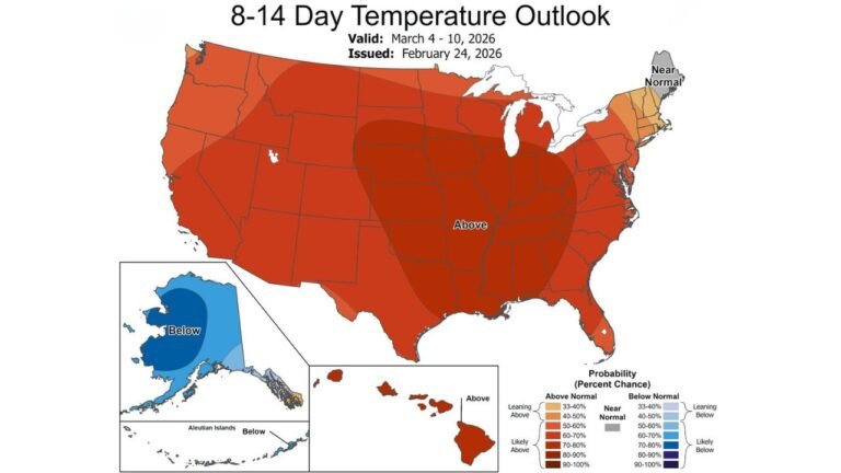
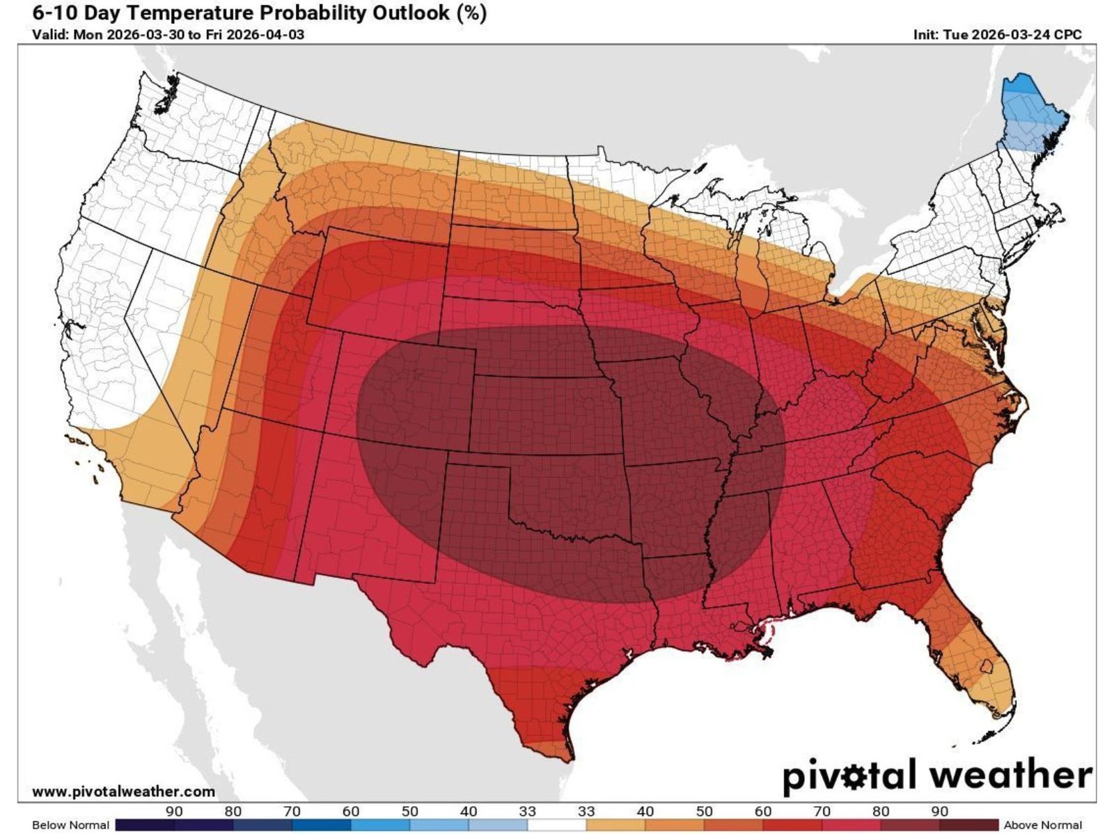
The latest 6–10 day temperature outlook shows a large swath of the country experiencing above-normal temperatures, stretching from Texas and Oklahoma through Kansas, Nebraska, and into the Midwest. The most intense warming is projected across the central Plains, where temperature probabilities exceed typical seasonal levels by a significant margin.
States including Oklahoma, Kansas, Nebraska, Missouri, and Arkansas are positioned in the core of this heat dome, where persistent warmth will dominate both daytime and overnight conditions. This level of warming during early April is notable because it provides the necessary fuel for atmospheric instability, a key ingredient in severe storm formation.
Further east, regions such as Illinois, Indiana, Tennessee, and Mississippi are also expected to experience above-normal temperatures, though slightly less intense than the central Plains. Even along parts of the Southeast and Mid-Atlantic, warmer-than-average conditions will extend, reinforcing a broad national warming trend.
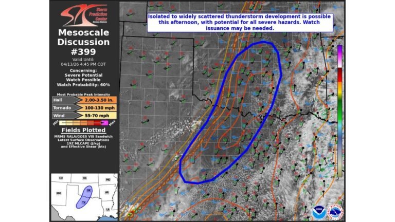
Severe Storm Setup Targets Great Plains and Mississippi Valley
As warm, moist air builds across the Great Plains and Mississippi Valley, it will interact with incoming weather systems, creating a favorable environment for thunderstorms and severe weather outbreaks. This combination of heat, moisture, and atmospheric lift often leads to organized storm systems capable of producing damaging impacts.
The concern is not limited to a single day. Instead, the pattern suggests a prolonged window of storm activity, where multiple rounds of storms could develop over several days. Areas from Texas and Oklahoma through Missouri, Illinois, and into the lower Midwest may experience repeated storm threats.
This type of setup increases the likelihood of damaging winds, large hail, and potential tornado activity, especially as storm systems track along the boundary between warm and cooler air masses.
Midwest and Chicago Region in the Transition Zone
The Chicago region and broader Illinois area sit near the northern edge of the strongest heat anomalies, placing them in a transition zone where warm air meets cooler conditions to the north. This boundary is often a focal point for storm development and intensification.
While the most extreme heat remains centered farther south and west, Illinois and surrounding states could still experience periods of unstable weather, particularly as storm systems move northeast from the Plains. Cities like Chicago, Indianapolis, and St. Louis may see changing conditions as the pattern evolves through early April.
This positioning means the Midwest could face both warm temperature swings and intermittent severe weather risks, especially during peak afternoon and evening hours.
What This Pattern Means for Early April Weather
The combination of persistent warmth and active storm systems suggests that early April will bring a dynamic and potentially volatile weather period across much of the United States. Unlike isolated storm days, this setup points toward a sustained period of weather activity, increasing the chances for multiple severe weather events within a short timeframe.
For residents across the Great Plains, Mississippi Valley, and parts of the Midwest, this means staying alert for forecast updates, watches, and warnings as conditions evolve. The early arrival of this pattern also signals that the spring severe weather season is ramping up quickly, with more activity likely in the weeks ahead.
As this nationwide warming trend continues to build, its interaction with seasonal storm systems will play a critical role in shaping weather conditions across the central and eastern United States.
As the United States enters a more active spring pattern, staying informed will be essential for communities across the Great Plains, Mississippi Valley, and Midwest. For more updates on severe weather trends, regional forecasts, and developing conditions, visit ChicagoMusicGuide.com.