Texas, Louisiana, Mississippi, Arkansas, Tennessee, Kentucky, Illinois, Indiana, and Michigan Face April 4–10 Heavy Rain Threat With Flooding Risk Expanding From Southern Plains to Great Lakes
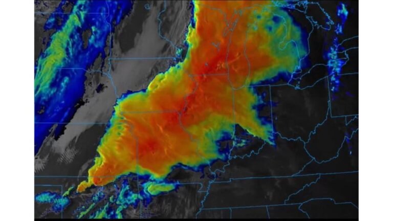
TEXAS — A significant heavy rainfall and thunderstorm pattern is expected to develop between April 4 and April 10, 2026, stretching from the Southern Plains and Lower Mississippi Valley northeast into the Midwest and Great Lakes region. Forecast models indicate that a low-pressure system combined with strong Gulf moisture will drive this widespread precipitation event.
Meteorologists are highlighting the potential for prolonged rainfall, embedded thunderstorms, and localized flooding, especially across a corridor extending from Texas through Arkansas, Mississippi, Tennessee, Kentucky, Illinois, Indiana, and into Michigan.
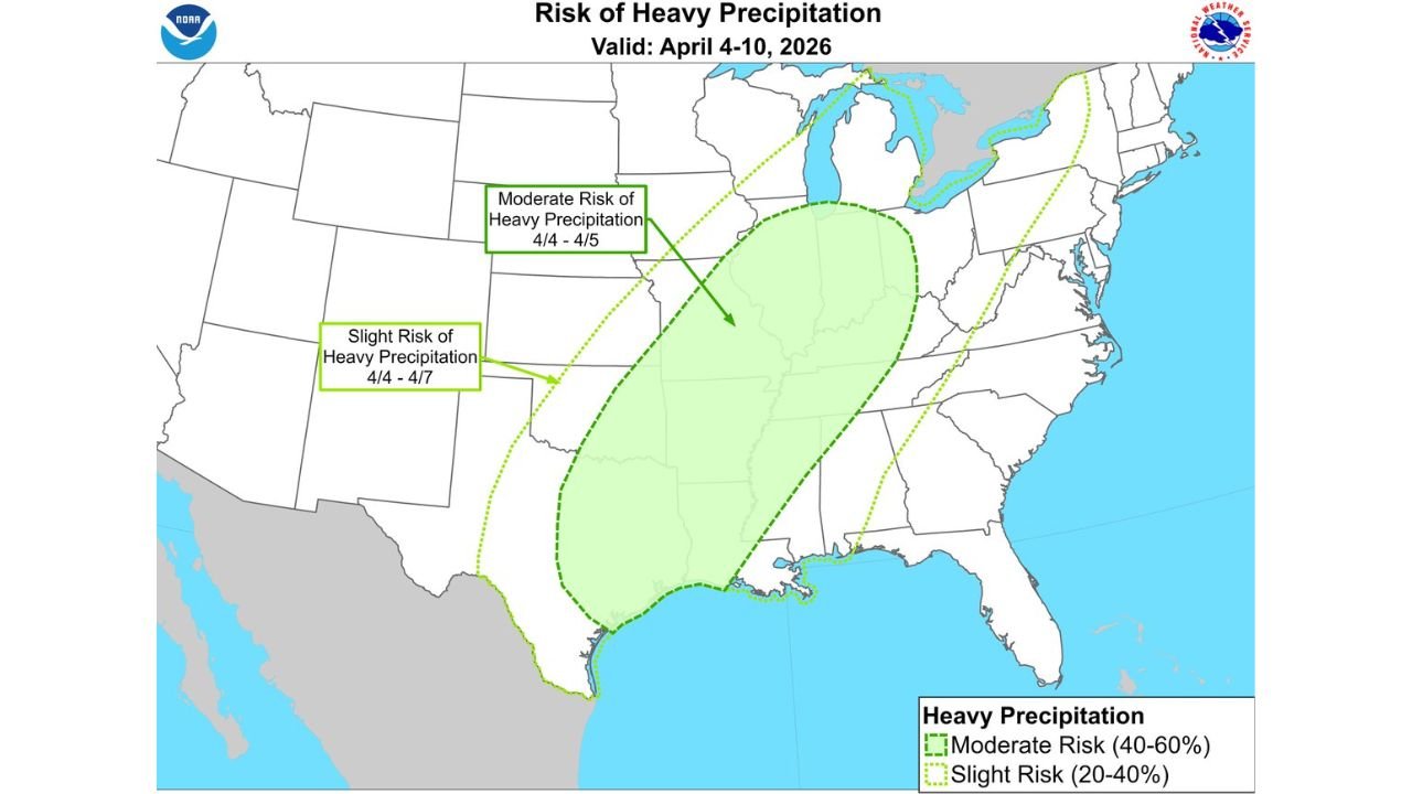
Where the Heaviest Rainfall Is Expected
The latest outlook shows a moderate risk (40–60%) of heavy precipitation centered across portions of the Lower Mississippi Valley into the Mid-Mississippi Valley, particularly impacting Arkansas, Mississippi, western Tennessee, western Kentucky, and southern Illinois during the April 4–5 timeframe.
This zone represents the highest confidence area for persistent rainfall and possible flooding concerns, as storms repeatedly track over the same regions. Cities and communities along major river systems could see rising water levels if rainfall totals accumulate quickly.
A broader slight risk (20–40%) area extends much farther, covering parts of Texas, Louisiana, Oklahoma, Missouri, Indiana, Michigan, and even into the eastern Great Lakes region, indicating that widespread rainfall—though less intense—will still impact millions of people.
What Is Driving This Widespread Weather Pattern
The primary driver behind this event is a large-scale low-pressure system interacting with rich Gulf of Mexico moisture, creating an ideal setup for continuous rounds of rain and thunderstorms.
As warm, moist air flows northward from the Gulf, it collides with cooler air masses across the central United States. This clash fuels storm development along a broad frontal boundary, allowing precipitation to expand northeastward toward the Great Lakes, including Illinois, Indiana, and Michigan.
Additionally, the pattern appears slow-moving, meaning rainfall could linger over the same areas for multiple days, increasing the risk of flash flooding and saturated ground conditions.
Flooding and Travel Concerns Across Multiple States
With rainfall expected to span several days, concerns are growing over flood-prone regions, especially in low-lying areas, river basins, and urban locations across the Midwest and Southern Plains.
Travel disruptions could become an issue along major corridors, particularly in states like Illinois, Indiana, Kentucky, and Tennessee, where repeated rounds of rain may reduce visibility and create hazardous driving conditions.
Emergency management officials may begin monitoring conditions closely as the event approaches, especially if forecast confidence continues to increase regarding rainfall totals.
What This Means for Chicago and the Midwest Music Scene
For areas near Chicago, Illinois, the extended stretch of unsettled weather could impact outdoor events, concerts, and local music gatherings scheduled during early April. While exact rainfall totals for the city remain uncertain, the broader pattern suggests periods of rain and thunderstorms are likely across the region.
Event organizers and attendees are encouraged to stay updated on local forecasts, as conditions could shift depending on how the storm system evolves.
As this developing weather pattern unfolds, stay connected with ChicagoMusicGuide.com for updates on how major weather events may affect concerts, festivals, and live music experiences across the Midwest.