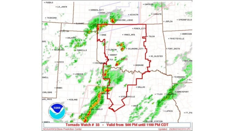
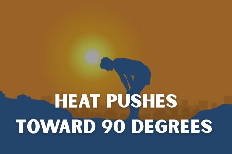
Moderate Risk Severe Weather Day Threatens Oklahoma, Texas, Arkansas and Kansas With Giant Hail, Tornadoes and Damaging Winds on April 25

MCALESTER, OK — The southern Plains woke up Saturday morning already behind the eight ball. A potent severe weather setup is unfolding across a broad corridor stretching from central Oklahoma through northeast Texas, northwest Arkansas, and into southeast Kansas — and current analysis indicates this afternoon and evening will deliver a dangerous combination of giant hail, strong tornadoes, and destructive wind gusts to millions of residents across the region.
The Storm Prediction Center has issued a Moderate Risk designation for today — that is a Level 4 out of 5 on the severe weather scale, one step below the highest possible category. This is not a routine severe weather day. A Moderate Risk means forecasters have high confidence that widespread, organized, and potentially violent thunderstorms are coming. If you live in the highlighted zone, your plan of action needs to be in place right now, before the first storm fires.
What Is Driving This Outbreak
The atmospheric setup today is textbook southern Plains severe weather. A closed upper-level low is anchored over the central part of the country, pulling Gulf moisture northward into Texas and Oklahoma while a dry line — the boundary where dry desert air meets warm, humid surface air — sets the trigger line for storm initiation this afternoon. Surface dewpoints surging into the upper 60s Fahrenheit across southeast Oklahoma are providing the fuel. That combination of instability and wind shear is what allows ordinary thunderstorms to organize into supercells capable of producing violent hail, rotating walls, and tornadoes.
Numbers That Define the Threat
Current analysis shows CAPE values — which stands for Convective Available Potential Energy, a measure of how explosive the atmosphere is — running between 2,500 and 4,000 joules per kilogram across the southern Plains target zone. That is an extremely high energy environment. Strong directional and speed wind shear in the atmosphere above the surface will allow thunderstorms to rotate aggressively. The hail threat is particularly striking today.
Breaking Down the Three Primary Threats
The hail outlook is one of the most significant data points from today’s analysis. The core hail zone centered on the McAlester, Oklahoma area and extending into northeast Texas carries a 45% probability of significant hail, meaning hail of at least 2 inches in diameter. The innermost zone shows a meaningful probability of hail reaching 2 to 4 inches or larger — golf ball to baseball-sized stones falling at terminal velocity. Hail of that size causes catastrophic damage to vehicles, roofing, crops, and anything left outside.
The tornado outlook places a 10% probability zone — which represents a significant tornado threat by meteorological standards — across southeastern Oklahoma, portions of the ArkLaTex region (where Arkansas, Louisiana, and Texas converge), and adjacent northeast Texas. A couple of strong tornadoes are considered possible today. Strong tornadoes are classified as EF2 or higher on the Enhanced Fujita scale, meaning winds of at least 111 mph with the potential for significant structural damage.
The wind threat is concentrated with a 30% damaging wind probability zone centered tightly near McAlester and extending into adjacent counties, covering roughly 28,954 square miles and affecting an estimated 903,302 people in the highest-risk corridor. Wind gusts of 60 mph or greater are the threshold for this category.
Threat Summary by State
Oklahoma — Highest overall risk. The Moderate Risk zone is centered here. McAlester, Ada, Okmulgee, and surrounding communities face all three primary threats simultaneously: giant hail, tornadoes, and damaging winds. This is the bull’s-eye for today’s event.
Texas — Northeast Texas including Sherman, Paris, Denison, Texarkana, and the greater Dallas-Fort Worth metro area fall within the significant hail and wind threat corridors. The tornado risk extends into this zone as well. Dallas and Fort Worth sit within the broader severe weather watch area.
Arkansas — The ArkLaTex corridor including Texarkana and areas of southwest Arkansas are included in the tornado probability zone. The storm system will push eastward into this region during the evening hours.
Kansas — Southeast Kansas sits within the general severe thunderstorm risk area on the northern fringe of today’s outlook. Hail and wind remain the primary concerns here.
Model Data Comparison
| Threat | Peak Probability Zone | Estimated Population at Risk |
|---|---|---|
| Significant Hail (2″+) | McAlester, OK / NE Texas core | 1,007,174 (45% zone) |
| Damaging Winds (60+ mph) | McAlester, OK tight core | 903,302 (30% zone) |
| Tornado (any) | SE Oklahoma / ArkLaTex | 1,291,896 (10% zone) |
| Severe Thunderstorm (general) | OK, TX, AR, KS broad zone | 14,253,586+ |
| Overall Risk Level | Moderate — Level 4 of 5 | Highest in OK/TX corridor |
Forecast Confidence
Confidence in a significant severe weather outbreak today is HIGH. The atmospheric ingredients are in place and well-analyzed. The exact positioning of the most intense storms will depend on precise dry line placement this afternoon, but the overall threat corridor is well-defined. Confidence in the giant hail threat specifically is very high. Tornado confidence is moderate to high for the southeastern Oklahoma and ArkLaTex zone.
Have multiple ways to receive warnings active right now. A weather radio, a reliable app with push alerts, and a local TV signal are the three pillars of warning reception. Know where your shelter location is before you hear the sirens.
More severe weather coverage is always on the horizon. Stay informed at ChicagoMusicGuide.com — your source for severe storm tracking, tornado coverage, and breaking weather alerts across the southern Plains and the entire United States.