North Dakota Arctic Outbreak Brings Life-Threatening Wind Chills as Temperatures Plunge Far Below Zero
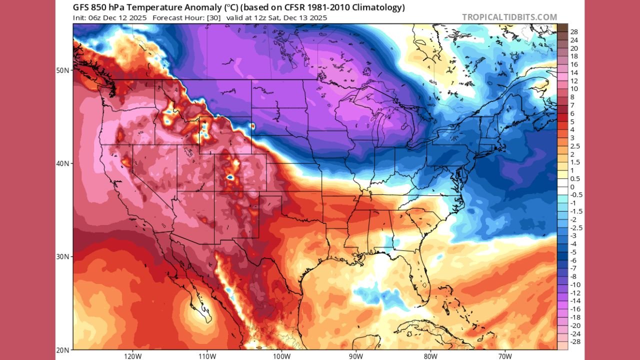
NORTH DAKOTA – One of the most intense Arctic air masses of the season is surging into the north-central United States, placing North Dakota at the center of a dangerous cold outbreak that will deliver temperatures well below zero and wind chills capable of causing frostbite in minutes. Forecast guidance shows this air mass pushing south and east, but conditions will be most severe across the Northern Plains, where the cold originates and settles first.
Why North Dakota is taking the hardest hit
Weather pattern analysis shows a direct pipeline of Arctic air plunging out of Canada into the Northern High Plains, allowing North Dakota to experience the core of the cold before it moderates farther south.
Key impacts expected across the state include:
- Air temperatures dropping well below zero, especially overnight
- Wind chills potentially reaching 20 to 40 degrees below zero in exposed areas
- A prolonged cold stretch rather than a brief overnight dip
- Dangerous conditions for anyone outdoors, even for short periods
Unlike areas farther south that may briefly warm during the day, many North Dakota locations may struggle to climb above zero, keeping cold stress elevated around the clock.
Wind chills are the main danger
While subzero temperatures alone are extreme, gusty winds accompanying the Arctic high pressure system significantly increase risk. Wind strips heat from exposed skin rapidly, meaning frostbite can develop in as little as 5 to 10 minutes in the coldest conditions.
This combination is particularly hazardous for:
- Ranchers, farmers, and oilfield workers
- Anyone traveling long distances on rural highways
- Students waiting outdoors
- People without reliable heating or shelter
Even brief exposure—such as refueling a vehicle or clearing snow—can become dangerous without full cold-weather protection.
Travel and daily life impacts across the state
Extreme cold affects more than just comfort. Across North Dakota, residents should expect:
- Vehicle issues, including dead batteries and frozen fuel lines
- Increased strain on heating systems, especially in older homes
- School and activity disruptions if wind chill thresholds are reached
- Slower emergency response times in rural areas due to weather stress
Road conditions may remain dry in some areas, but cold alone can be just as dangerous as snow, particularly if vehicles fail in remote locations.
Safety steps residents should take now
With conditions expected to worsen, preparation is critical.
Important precautions include:
- Avoiding unnecessary outdoor exposure during peak cold
- Wearing layered clothing with insulated gloves, hats, and face coverings
- Keeping emergency supplies in vehicles, including blankets and chargers
- Checking on elderly neighbors and those living alone
- Bringing pets indoors and ensuring livestock have wind protection
Authorities consistently emphasize that wind chill values, not just temperature, should guide safety decisions.
What happens next
As this Arctic air mass slowly spreads east and south, other regions will feel the cold—but North Dakota remains ground zero for the most extreme impacts. Forecast updates over the next 24–48 hours will refine just how low wind chills drop and how long the cold persists.
Residents should prepare for prolonged, dangerous cold conditions and avoid underestimating how quickly exposure can become life-threatening.
How cold is it where you are right now? Share your local conditions and stay updated with weather coverage at ChicagoMusicGuide.com.