California Faces High Risk of Catastrophic Flooding as Excessive Rainfall Targets Southern Counties
LOS ANGELES, CALIFORNIA — A rare and dangerous High Risk of Excessive Rainfall has been issued for parts of Southern California, signaling a significant threat of catastrophic flooding, mudslides, and debris flows as an intense storm system moves into the region. Forecasters warn that rainfall rates may become extreme enough to overwhelm drainage systems, rapidly flood roadways, and trigger life-threatening conditions, particularly in vulnerable terrain.
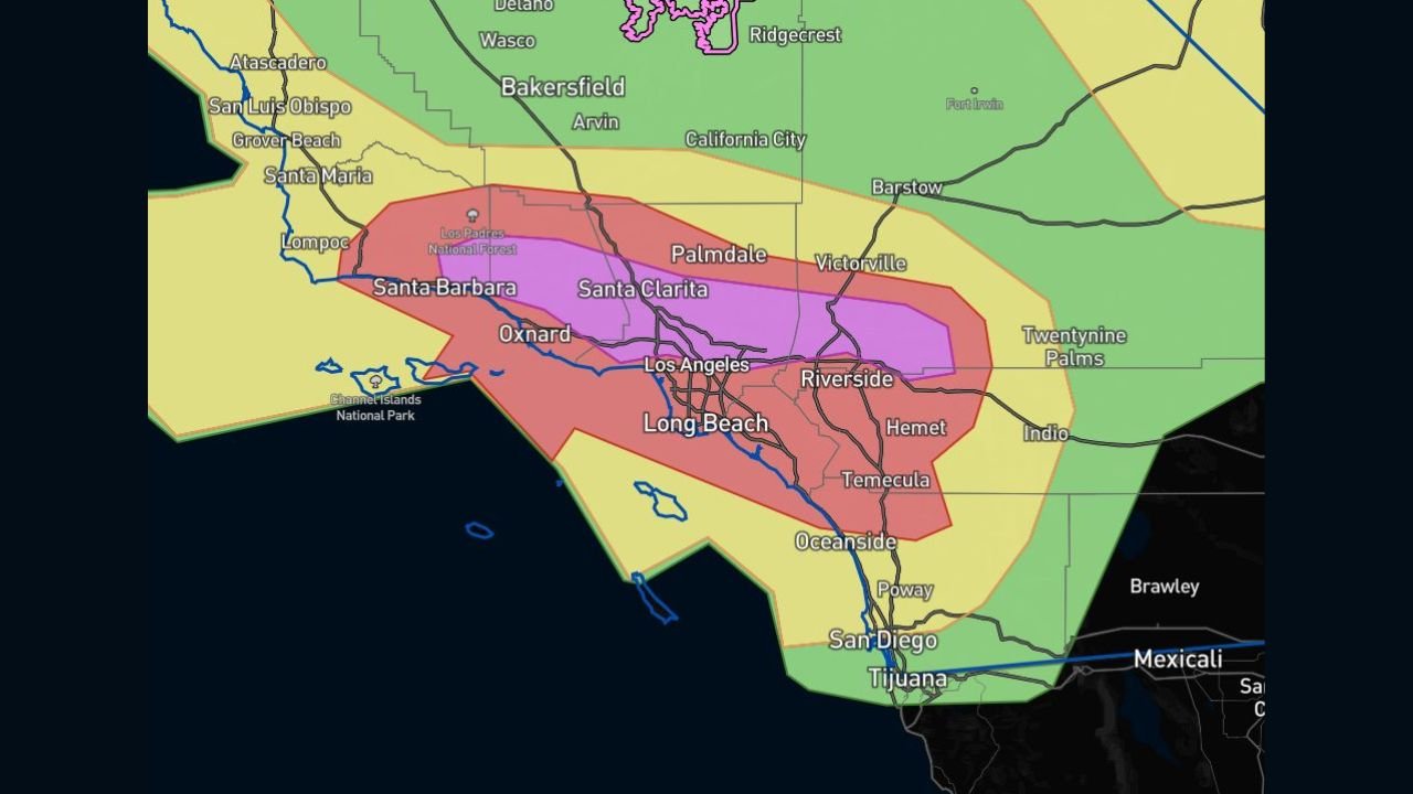
The alert places Southern California in the most serious category used by forecasters, a designation reserved for only the most impactful rainfall events nationwide.
High Risk Designation Signals Exceptional Flood Threat
The High Risk outlook represents the most severe level issued by the Weather Prediction Center and is extremely uncommon. Historically, only about 4 percent of excessive rainfall outlooks receive this designation, yet these events account for nearly 80 percent of flood-related damage nationwide and more than one-third of flood-related fatalities.
This classification reflects a strong confidence that widespread, dangerous flooding is likely rather than just possible. Forecasters emphasize that impacts could escalate quickly once heavy rain begins.
Southern California Counties Most at Risk
The greatest flood risk is centered across Santa Barbara, Ventura, Los Angeles, and parts of Riverside and San Diego counties, where forecast maps highlight a broad zone of significant concern. Urban corridors including Los Angeles, Long Beach, Santa Clarita, Oxnard, Riverside, Temecula, and Oceanside fall within the area most likely to experience serious impacts.
Low-lying neighborhoods, flood-prone roadways, and areas with poor drainage are expected to be especially vulnerable if rainfall rates intensify as projected.
Burn Scar Areas Face Extreme Danger
Forecasters stress that recent burn scar areas represent the most dangerous locations during this event. Steep terrain stripped of vegetation is highly susceptible to rapid mudslides and debris flows, even with short bursts of heavy rain.
Communities near wildfire burn scars in the Santa Monica Mountains, San Gabriel Mountains, and foothill regions could see sudden and destructive flows of mud, rocks, and debris with little warning. These events can occur before rivers or creeks show signs of flooding, making them particularly hazardous.
Why This Storm Is Especially Concerning
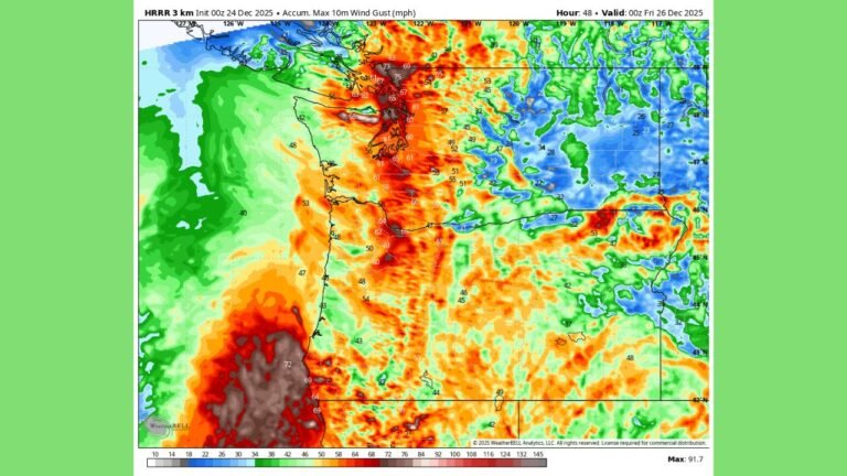
The incoming storm is expected to tap into a deep plume of moisture, producing intense rainfall rates over a short period of time. When combined with saturated soils and complex terrain, the setup significantly increases the risk of flash flooding rather than slow-rising river flooding.
Urban areas may experience rapid street flooding, while canyon roads and mountain passes could become impassable due to debris. Emergency officials warn that road closures, evacuations, and power disruptions are all possible if worst-case rainfall totals are realized.
Travel and Infrastructure Impacts Likely
Residents and travelers across Southern California should prepare for hazardous travel conditions, particularly during periods of heavy rain. Flooded roadways, reduced visibility, and sudden debris flows could make travel dangerous or impossible in some locations.
Major highways, including routes through mountain passes and coastal corridors, may face temporary closures. Officials urge motorists never to drive through flooded roads, as water depth and road integrity can be deceptive.
What Residents Should Do Now
Authorities urge residents in at-risk areas to take this threat seriously and prepare ahead of time:
- Stay informed through official weather alerts and local emergency notifications
- Avoid flood-prone roads and canyon areas during heavy rainfall
- Be ready to move to higher ground if flooding develops
- Follow any evacuation orders immediately, especially near burn scars
Emergency services may become overwhelmed during peak impacts, making early preparation critical.
A Rare and High-Impact Weather Event
This rainfall event stands out as one of the most serious flood threats Southern California has faced in recent years. While rainfall impacts can vary over short distances, the overall pattern strongly supports dangerous and potentially life-threatening flooding in multiple counties.
As conditions evolve, forecasters will continue refining rainfall projections and impact zones. Residents across Southern California are urged to remain vigilant and prepared for rapidly changing conditions.
For continued updates on California flooding threats, severe weather alerts, and public safety information, visit ChicagoMusicGuide.com.