Massachusetts, Connecticut, Rhode Island, New York, and New Jersey Braced for Overnight Snow as Clipper System Moves Through the Northeast
UNITED STATES — A fast-moving clipper system is forecast to bring accumulating snowfall across multiple Northeast states from Friday evening into early Saturday, with Massachusetts, Connecticut, Rhode Island, New York, and New Jersey each facing different snowfall totals and travel impacts as the system progresses east.
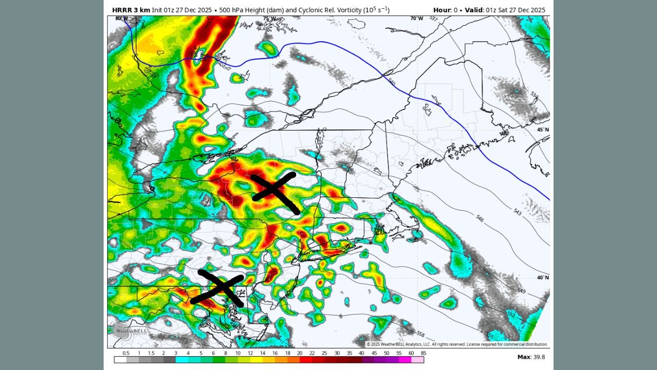
Meteorologists say the storm’s structure — including dry slots and sinking air between upper-level disturbances — will limit the potential for extreme snowfall totals, but localized snow bands may still briefly intensify conditions overnight.
Massachusetts Snow Forecast
Massachusetts is expected to see widespread snowfall beginning Friday evening, moving west to east across the state.
- Western and Central Massachusetts: Forecast totals range from 3 to 6 inches, with locally higher amounts possible in elevated terrain.
- Eastern Massachusetts and Boston Metro: Lighter totals of 1 to 3 inches, tapering quickly toward the coast.
Snowfall rates may briefly increase overnight before diminishing early Saturday morning, potentially impacting early travel.
Connecticut Snow Forecast
Connecticut is expected to be one of the most impacted states, particularly across central and western areas.
- Central and Western Connecticut: Snowfall totals of 4 to 8 inches are likely, with higher elevations favored.
- Eastern Connecticut: Totals generally 2 to 4 inches, with snow weakening closer to the shoreline.
Forecasters caution that temporary dry air intrusions could reduce snowfall rates at times, lowering the risk of extreme totals.
Rhode Island Snow Forecast
Rhode Island will experience overnight snowfall mainly late Friday night into early Saturday.
- Most areas are expected to receive 2 to 4 inches.
- Coastal locations may see slightly lower totals due to marginal temperatures and shorter-duration snowfall.
Road conditions may become slick overnight, especially on untreated surfaces.
New York Snow Forecast
Snowfall impacts in New York will vary significantly by location.
- New York City and Long Island: Expected totals of 1 to 3 inches, with snow ending quickly Saturday morning.
- Hudson Valley and Interior Southern New York: Higher totals of 3 to 6 inches possible, especially north and west of the city.
High-resolution guidance suggests the heaviest snow bands remain north and east, limiting accumulation closer to the coast.
New Jersey Snow Forecast
New Jersey will see lower snowfall totals than earlier projections, particularly due to dry air suppressing precipitation.
- Northern New Jersey: Generally 1 to 3 inches, mainly north of Interstate 80.
- Central and Southern New Jersey: Little to no accumulation expected.
While snowfall may briefly redevelop overnight, forecasters say high-end totals are unlikely to verify.
Why Snowfall Totals Will Vary by State
Meteorologists explain that the system is caught between two upper-level vortices, creating areas of sinking air that weaken snowfall. While additional snow is possible late overnight, confidence has increased that earlier higher-end snowfall scenarios will not materialize, particularly for New Jersey and coastal areas.
What Happens After the Snow Ends
Drier conditions are expected to move in later Saturday across all affected states. However, forecasters are monitoring another potential system late Sunday into early Monday, which could introduce freezing rain or mixed precipitation in parts of the Northeast.
Travel conditions may deteriorate overnight, especially in Massachusetts and Connecticut, where snowfall rates could briefly intensify. Drivers are urged to use caution through early Saturday morning.
For continued weather updates, snow forecasts, and regional impacts, follow ongoing coverage at ChicagoMusicGuide.com.