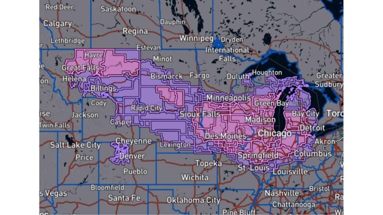
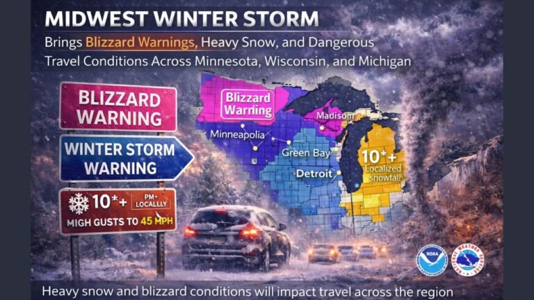
Wisconsin Winter Storm Warning Issued as Heavy Snow, Strong Winds, and Dangerous Travel Expected Sunday Night Into Monday
GREEN BAY, WISCONSIN — A Winter Storm Warning is now in effect across much of Wisconsin as a strong winter storm is expected to move through the region from Sunday afternoon through Monday, bringing significant snowfall, falling temperatures, and powerful winds. Forecasters warn that travel conditions could rapidly deteriorate Sunday night, especially in areas along and north of Highway 8, where the heaviest snow is expected.
According to the National Weather Service in Green Bay, precipitation will initially begin as rain or a wintry mix before transitioning to mainly snow Sunday night as colder air moves in.
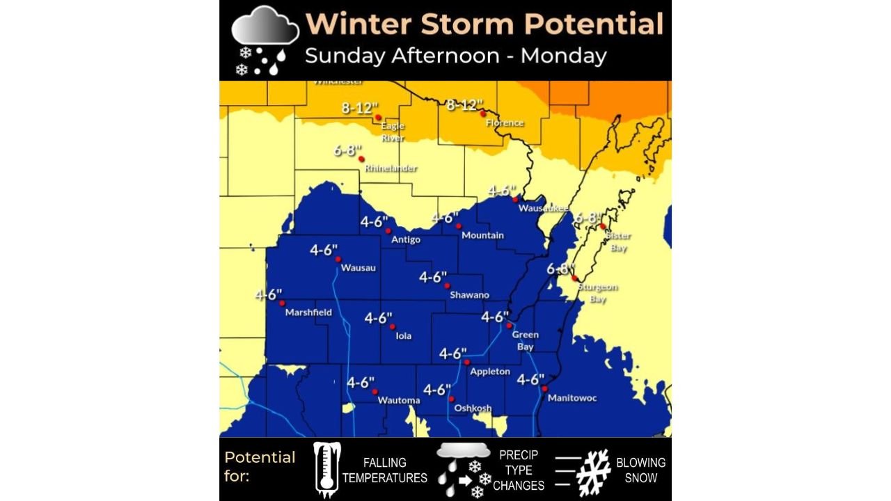
Snowfall Totals Highest in Northern Wisconsin
Forecast maps show a clear north-to-south snowfall gradient across Wisconsin. Northern counties, particularly those along and north of Highway 8, are expected to receive 8 to 12 inches of snow, with locally higher totals possible near the Michigan border.
Across central and east-central Wisconsin, including areas such as Wausau, Green Bay, Appleton, and Oshkosh, snowfall totals are generally expected to range from 4 to 6 inches. While amounts are lower farther south, accumulating snow will still create slick roads and reduced visibility.
Forecasters note that snowfall rates may increase quickly Sunday evening as the storm strengthens.
Strong Winds Create Blowing and Drifting Snow
In addition to heavy snowfall, strong northwest winds will significantly worsen conditions. Sustained winds of 20 to 30 mph, with gusts between 35 and 50 mph, are expected late Sunday through Monday.
These winds will cause blowing and drifting snow, particularly in open and rural areas, leading to sharply reduced visibility. Even after snowfall tapers off, blowing snow may continue to impact travel and road-clearing efforts.
Falling Temperatures Increase Travel Risks
Temperatures are forecast to fall below freezing Sunday night, allowing any moisture on roadways to freeze quickly. The combination of heavy snow, falling temperatures, and strong winds raises the risk for icy surfaces, especially on bridges, overpasses, and untreated roads.
Officials warn that conditions could change rapidly overnight, catching travelers off guard during late-night or early-morning hours.
Travel Conditions Expected to Deteriorate Quickly
The most hazardous period is expected Sunday night into Monday, when snowfall intensity and wind speeds peak simultaneously. Travel may become difficult or dangerous, particularly in northern and central parts of the state.
Emergency officials urge residents to avoid unnecessary travel, prepare winter survival kits if travel is unavoidable, and allow extra time for commutes. Snow-covered roads and reduced visibility may lead to delays and closures.
Winter Storm Warning Covers Entire Forecast Area
The Winter Storm Warning currently covers the entire forecast area issued by the National Weather Service Green Bay office, underscoring the widespread nature of this storm. While impacts will vary by location, nearly all areas are expected to experience hazardous winter weather.
As Wisconsin braces for another significant winter system, staying informed and prepared will be critical. For continued updates on Wisconsin winter weather, storm warnings, and regional forecasts, visit ChicagoMusicGuide.com for the latest coverage and analysis.