
California Storm System Brings Flood Watches to the North Bay as Heavy Rain and 45-MPH Winds Impact the Bay Area
SANTA ROSA, CALIFORNIA — A strong Pacific storm system is bringing a period of heavy rain, gusty winds, and rising flood concerns to Northern California, with the North Bay emerging as the most impacted region as flood watches remain in effect and rain intensifies through Sunday night and into early Monday.
Forecasters say the system marks another round of weather whiplash, transitioning the region from foggy and calm conditions into a wetter, windier pattern that could push smaller streams and creeks toward flood stage, especially in North Bay communities.
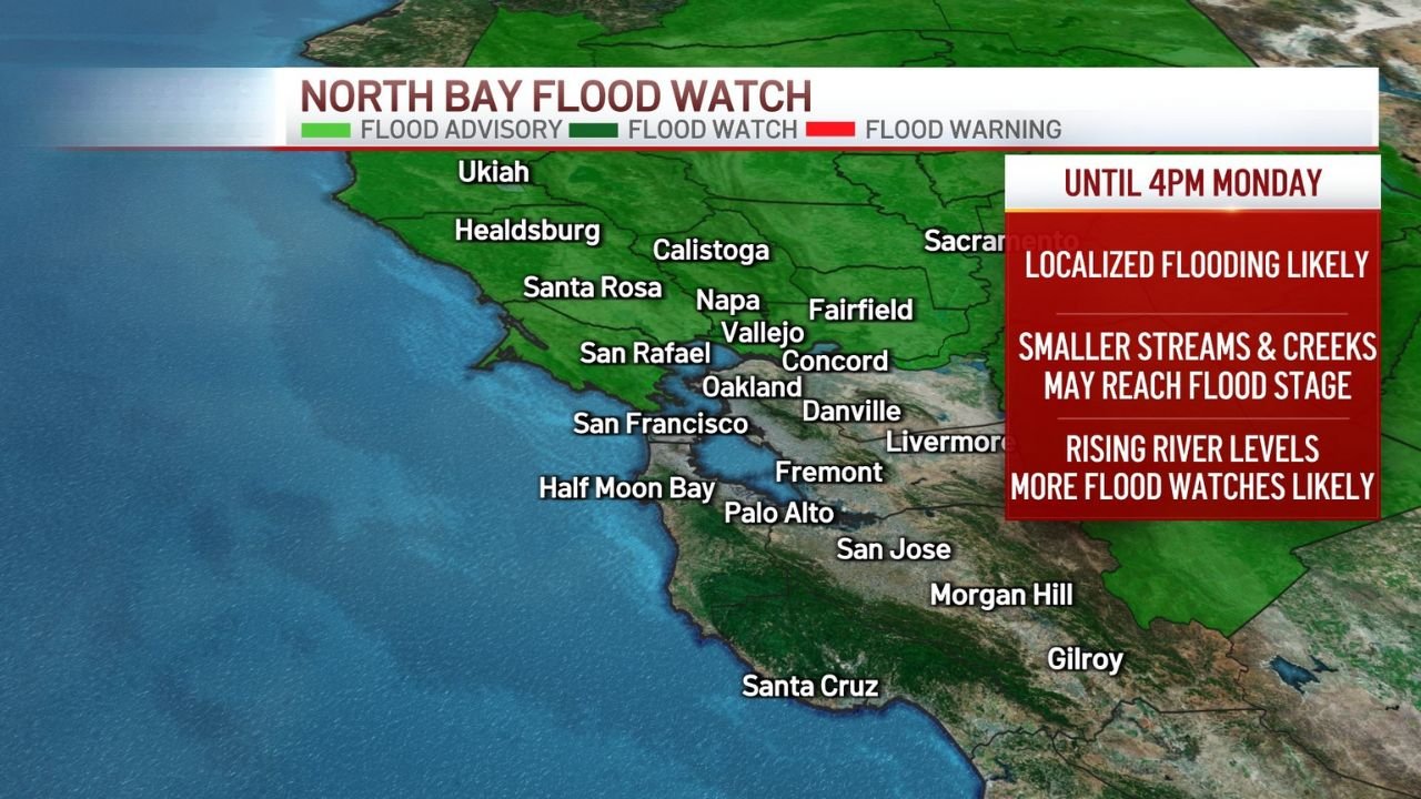
North Bay Flood Watch Remains in Effect
The North Bay, including areas around Santa Rosa, Napa, Calistoga, Ukiah, and San Rafael, remains under a Flood Watch through Monday afternoon, as rainfall rates increase and runoff accelerates.
Meteorologists warn that localized flooding is possible, particularly in low-lying areas and near smaller waterways.
“Smaller streams and creeks may reach flood stage as river levels continue to rise,” forecasters cautioned.
Rain estimates show the heaviest totals focused over the North Bay hills and coastal ranges, where several inches of rain could fall in a relatively short period of time.
Creeks and Streams Rising Toward Monitor and Flood Stage
Hydrologic data indicates Mark West Creek near Mirabel Heights and Laguna de Santa Rosa near Cotati are expected to rise above monitor stage, with a realistic chance of approaching flood stage if rainfall totals verify on the higher end.
Officials say residents living near waterways should closely monitor conditions overnight, as water levels can rise quickly once heavier rain bands move through.
Rain Shadow Limits Totals Farther South
While rain will be widespread across the Bay Area, totals will vary significantly.
A pronounced rain-shadow effect is expected south of the North Bay, particularly across parts of the Santa Clara Valley, including San Jose, where downslope winds off surrounding terrain will limit rainfall amounts.
“Air descends and dries in the valley, leading to noticeably less rain compared to the North Bay,” meteorologists explained.
This means communities farther south may see steady rain, but significantly lower totals than areas closer to the North Bay mountains.
Strong Winds Add to Storm Impacts
In addition to heavy rain, gusty winds are developing across much of the Bay Area. Wind forecasts show gusts reaching 30 to 45 mph, especially along the coast and higher elevations.
Peak wind gusts are expected in areas such as:
- Half Moon Bay
- San Francisco
- Santa Rosa
- Napa
These winds could bring downed tree limbs, isolated power outages, and hazardous driving conditions, especially on bridges and exposed roadways.
More Storms Ahead Before Christmas
Although this storm is not expected to produce widespread major flooding, forecasters say it is part of an active pattern that continues into the upcoming week.
Two additional storm systems are still expected Tuesday-Wednesday and again on Christmas Day, raising concerns that saturated ground conditions could worsen impacts from future rainfall.
“This system may not deliver extreme snowfall or major flooding on its own, but it reinforces a wet pattern that keeps flood risk elevated,” meteorologists noted.
What Residents Should Do
Officials recommend the following precautions:
- Avoid flooded roadways
- Secure loose outdoor items ahead of strong winds
- Monitor creek and river levels closely
- Allow extra travel time during heavy rain periods
As Northern California heads deeper into an active winter pattern, residents are urged to stay weather-aware and be prepared for changing conditions over the next several days.
For continued weather updates, storm coverage, and local impact reports, stay connected with ChicagoMusicGuide.com and join the conversation as this evolving storm system moves through California.