
California Tornado Threat? Forecasters Flag Rare Morning-to-Evening Severe Weather Window From Southern Coast to Central Valley
LOS ANGELES, CALIFORNIA — Forecasters are highlighting a Marginal Risk of severe weather across parts of California, including the southern coast and the Central Valley, with a narrow but notable window for isolated tornadoes and damaging winds. The setup is expected to unfold between 8 a.m. and 7 p.m. local time, driven by a strengthening surface low and increasing instability.
While tornado threats are uncommon in California, meteorologists stress this type of pattern can occur during late winter or early spring, especially when Pacific moisture and favorable wind dynamics align.
Southern Coast: Morning Line of Storms Could Carry Brief Tornado Risk
The severe window begins along the Southern California coast, where a line of convection is forecast to move ashore between 8 a.m. and 2 p.m. Low-level moisture and weak but sufficient instability will be in place as the system approaches from the Pacific.
Forecast models indicate:
- Increasing low-level winds
- Embedded rotation potential within a narrow convective band
- Surface-based instability that could briefly support tornado spin-ups
The key factor will be CAPE (Convective Available Potential Energy). Even modest instability, when combined with favorable wind shear, can produce brief, embedded tornadoes in fast-moving coastal squall lines. The tornado risk is conditional but present, especially if instability trends higher than currently projected.
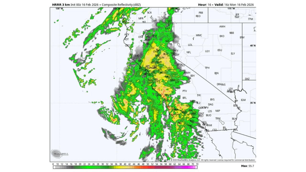
Radar simulations show a consolidated band of heavy rain and thunderstorms pushing inland from the Pacific, bringing periods of intense rainfall and gusty winds to coastal communities.
Central Valley: Afternoon Instability Raises More Serious Questions
The more intriguing portion of the setup shifts inland into the Central Valley, where timing becomes critical. Unlike the coastal threat, the tornado potential here is not tied to the initial morning line of storms.
Instead, forecasters are watching the period between 3 p.m. and 7 p.m., when:
- Daytime heating increases surface temperatures
- Instability builds across the valley floor
- 0–1 km Storm-Relative Helicity (SRH) values support rotating updrafts
Model data shows pockets of stronger CAPE developing across the Central Valley, along with enhanced low-level helicity that could support organized rotating storms if convection aligns with peak instability.
However, meteorologists emphasize that storm timing is everything. If convection arrives too early, before instability maximizes, the tornado threat may remain limited. If storms align with the late-afternoon heating window, the environment could briefly become more supportive of rotation.
Pacific Moisture and Surface Low Driving the Pattern
This event is being driven by multiple areas of low pressure consolidating into a more substantial surface low system, drawing significant Pacific moisture inland.
Key atmospheric ingredients include:
- Deep moisture transport into coastal California
- Favorable wind profiles for storm organization
- Marginal but sufficient instability
This type of setup is not unheard of in California but remains relatively uncommon compared to the central United States. Late-winter systems can occasionally produce embedded tornadoes, particularly when strong dynamics compensate for limited instability.
Rainfall will also be a major factor, with periods of moderate to heavy precipitation likely across both coastal areas and inland valleys.
What Residents Should Watch Closely
Communities from San Diego and Los Angeles northward through portions of the Central Valley should monitor updated forecasts throughout the day.
The greatest concern areas include:
- Southern coastal counties during the late morning
- Central Valley locations during the mid-to-late afternoon
Because the tornado window is narrow and conditional, residents may see heavy rain and wind without tornadic development. However, brief warnings cannot be ruled out if storms organize.
Forecasters will be watching real-time trends in instability and wind shear to determine whether the threat intensifies or remains isolated.
Although classified as a Marginal Risk, the potential for tornadoes in California always draws heightened attention due to its rarity. As this Pacific system moves ashore, preparedness and awareness will be key across the southern coast and the Central Valley.
For continued updates on severe weather patterns, storm timing, and regional forecasts across the United States, visit ChicagoMusicGuide.com.