
Florida Skies Explode With Over 12,000 Lightning Strikes as Powerful Sea-Breeze Collision Ignites Storms Across Western Peninsula
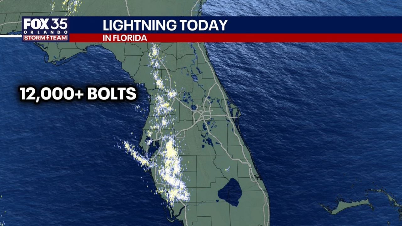
FLORIDA — A surge of intense thunderstorms lit up the skies across Florida on Wednesday as meteorologists recorded more than 12,000 lightning strikes, most of them concentrated along the western side of the Florida Peninsula.
The burst of lightning activity is unusually intense for early March and offered a preview of Florida’s summer-style thunderstorm season, according to weather analysts monitoring the storms.
Maps tracking lightning strikes show a dense corridor of activity stretching from north-central Florida down through the Tampa Bay region and toward Southwest Florida, where repeated cloud-to-ground bolts illuminated the afternoon sky.
Sea-Breeze Collision Triggered the Storms
Meteorologists say the outbreak was driven by a classic Florida weather setup: colliding sea-breeze boundaries from both coasts of the state.
During the day, winds from the Atlantic Ocean along the east coast push inland while weaker breezes form along the Gulf Coast on the west side of the peninsula. When those boundaries meet, the rising air can rapidly generate thunderstorms.
On this day, the stronger east-coast sea breeze pushed across the peninsula and eventually collided with the weaker west-coast breeze, triggering explosive thunderstorm development across central and western Florida.
This interaction focused lightning strikes mainly along the Gulf side of the peninsula, leaving the eastern side relatively quieter.
Lightning Concentrated Along the Western Peninsula
Lightning detection data shows that the most intense clusters occurred across several areas including:
- Central Florida west of Orlando
- The Tampa Bay region
- Parts of southwest Florida
- Inland sections of the central peninsula
These storms produced numerous cloud-to-ground lightning bolts, which are among the most dangerous types of lightning because they strike directly from the storm to the ground.
Forecasters say the storms developed rapidly during the afternoon as daytime heating combined with the colliding sea breezes.
Early Taste of Florida’s Summer Storm Pattern
Meteorologists often associate this type of lightning-heavy thunderstorm pattern with Florida’s summer wet season, when daily sea-breeze collisions routinely spark storms across the peninsula.
Seeing this level of lightning activity in early March suggests that atmospheric instability across Florida is already beginning to increase as spring approaches.
While the storms were not widespread enough to produce severe weather warnings in many areas, the sheer number of lightning strikes made the storms hazardous, particularly for people outdoors.
Lightning Remains One of Florida’s Biggest Weather Dangers
Florida consistently ranks among the most lightning-prone states in the United States, with the peninsula’s geography allowing sea breezes from both the Atlantic and Gulf to interact frequently.
When these boundaries collide during warm and humid conditions, thunderstorms can intensify quickly, producing dangerous lightning bursts even in relatively short-lived storms.
Residents across the state are typically urged to seek shelter immediately when thunder is heard, as lightning can strike miles away from the core of a thunderstorm.
Storm Pattern May Continue Into Spring
As temperatures warm and moisture levels rise heading deeper into spring, meteorologists expect similar thunderstorm setups to become more common across Florida.
These storms may continue to bring frequent lightning, brief heavy rain, and occasional gusty winds, especially during afternoons when sea-breeze boundaries collide.
For continued coverage of major weather events across the United States, follow updates from ChicagoMusicGuide.com.