
Missouri, Illinois, Indiana, Tennessee, and Arkansas Face Unseasonably Warm and Humid Christmas Day as Record Highs Threaten
ST. LOUIS, MISSOURI — A powerful upper-level ridge is expected to dominate much of the central and southern United States on Christmas Day, driving temperatures far above seasonal norms and introducing unusual levels of humidity for late December, according to multiple long-range forecast models.
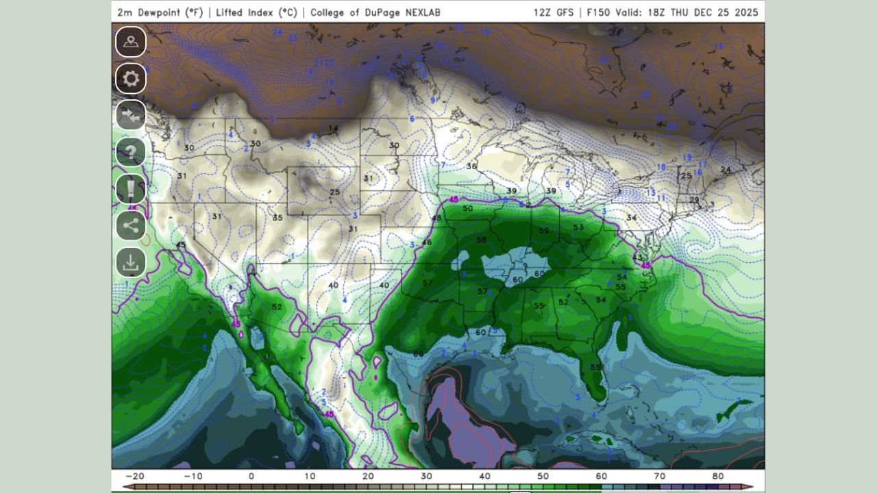
Meteorological data from the European (ECMWF) and U.S. Global Forecast System (GFS) models indicate that large portions of the Midwest, Lower Ohio Valley, and South could experience spring-like warmth, with some cities approaching or exceeding long-standing Christmas Day temperature records.
Strong Upper-Level Ridge Driving Widespread Warmth
Forecast anomaly maps show a pronounced ridge of high pressure centered over the central United States, extending from the Southern Plains through the Midwest and into parts of the Great Lakes region. Temperature departures are projected to run 20 to more than 30 degrees above average in several states.
Areas most likely to feel the strongest effects include:
- Missouri and Illinois, where afternoon highs are projected into the upper 60s and 70s
- Indiana and Kentucky, with temperatures well into the 60s
- Tennessee, Arkansas, and parts of Oklahoma and Texas, where mid- to upper-70s are possible
This setup effectively forces colder Arctic air to remain bottled up across Canada, preventing any meaningful winter air intrusion into the central and eastern United States through at least the end of the holiday period.
Unusual Humidity Levels for Late December
Beyond the warmth, forecasters are also highlighting unseasonably high dew points, a rare feature for Christmas Day in the Midwest.
Model guidance shows dew points approaching 60°F in cities such as St. Louis and Indianapolis, levels more typical of late spring. Historical climatology charts suggest these values sit near the upper edge of what has ever been observed locally in December.
One meteorologist described the setup as “a Christmas forecast that looks and feels more like April than December.”
Elevated humidity may result in:
- A muggy feel despite the winter calendar
- Areas of fog, especially during overnight and early morning hours
- Reduced overnight cooling, keeping nighttime temperatures unusually mild
Record-Breaking Potential Across Multiple States
With such strong atmospheric support, daily temperature records are at risk across several regions. Forecast highs in the central Midwest and parts of the South may challenge or surpass Christmas Day records that have stood for decades.
Climate data suggests that dozens of cities could log one of their warmest Christmas Days on record if forecast trends hold.
“This is not just a warm day — it’s a broad, organized heat pattern affecting nearly half the country,” one long-range outlook noted.
No Immediate Return to Winter Cold
Long-range projections indicate that the dominant ridge pattern may persist beyond Christmas, delaying any meaningful return to winter-like conditions until closer to the New Year.
While cooler air may eventually return, current guidance does not support a significant cold outbreak across the central or eastern U.S. in the immediate post-holiday period.
What This Means for Holiday Plans
Travel conditions are expected to remain largely winter-weather free across much of the Midwest and South, but the combination of warmth, humidity, and occasional fog could still impact early-morning visibility in some areas.
Residents planning outdoor holiday gatherings may find the conditions unusually comfortable — if not downright surprising — for late December.
As one forecaster put it, “If you’re celebrating Christmas in a T-shirt across the Midwest this year, you won’t be alone.”
Forecast updates will continue as Christmas approaches and confidence in temperature and humidity levels increases.