
Next Week’s Storm Outlook Raises Questions Across Midwest, South, Appalachians, Carolinas, and Mid-Atlantic as Forecast Models Suddenly Shift
UNITED STATES — Confidence remains low but concern is growing as forecast guidance for a potential storm next week suddenly shifts, raising new questions about impacts across the Midwest, Southern states, Appalachians, Carolinas, and Mid-Atlantic. Recent upper-level model runs show a notable change in the expected evolution of the system, with what had looked like a more pronounced eastern trough now appearing weaker and displaced farther south in the latest data.
This abrupt shift is fueling debate among meteorologists, particularly given how close the system is on the forecast timeline.
Upper-Level Pattern Shift Raises Red Flags for Forecasters
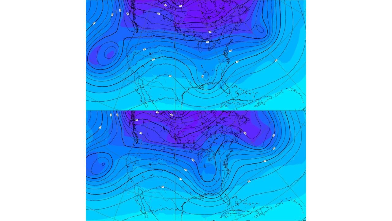
At the center of the uncertainty is the 500-millibar (mb) pattern, which plays a critical role in determining storm strength and track. Earlier model runs consistently showed a deep trough across the eastern United States, a setup that would favor a more organized and potentially impactful storm.
However, the latest guidance instead depicts a weaker, less amplified disturbance moving through the southern tier of the country. Such a dramatic change within a short timeframe has prompted skepticism, especially since the system is now less than a week away from impacting land.
Why the Sudden Change Is Being Questioned
Forecast models, particularly those driven by artificial intelligence, are designed to improve consistency and reduce volatility at shorter lead times. That makes the sudden reversal especially puzzling. After multiple consecutive runs advertising a stronger eastern trough, the newest output shows a much less robust feature.
Meteorologists are questioning what hemispheric-scale changes could realistically justify such a swing, especially without a clearly identified trigger event like a major upstream blocking pattern shift or polar vortex displacement.
Storm Track Will Dictate Who Sees What
The ultimate impacts of this system depend heavily on where the surface low develops and how it tracks. A track farther north or east would increase the likelihood of colder air being drawn southward, raising winter weather potential across parts of the Appalachians, Mid-Atlantic, and possibly the Carolinas.
A more southern or weaker track would instead favor milder conditions, with much of the South and Southeast remaining on the warm side of the system. In that case, precipitation would largely fall as rain, with limited winter impacts confined to higher elevations.
Cold Air Placement Remains the Biggest Unknown
One of the most critical unanswered questions is whether cold air can become entrenched east of the Appalachians. Without a strong high-pressure system supplying cold air from the north, wintry precipitation becomes far less likely outside mountain regions.
If cold air does manage to hold its ground, even modest moisture could result in snow or ice, particularly in elevated terrain or interior Mid-Atlantic locations. Right now, model guidance offers no clear consensus.
Why It’s Still Too Early for Specifics
Adding to the uncertainty is the fact that the upper-air disturbance driving this storm is still well upstream, limiting the quality of observational data feeding into forecast models. Until that energy moves closer and is better sampled, volatility in model solutions is expected to continue.
This makes it premature to pin down snow totals, ice accumulation, or severe weather probabilities, even though the calendar suggests the system is approaching quickly.
What Meteorologists Will Be Watching Next
Over the coming days, forecasters will focus on:
- Whether the eastern U.S. trough re-amplifies in future model runs
- Signs of hemispheric pattern changes that could justify the sudden shift
- The placement of cold air relative to the Appalachians
- Increasing agreement among multiple models rather than isolated solutions
Consistency across successive runs will be key in determining whether the latest trend is real or simply short-term noise.
As questions continue to surround this evolving next-week storm threat across the Midwest, South, Appalachians, Carolinas, and Mid-Atlantic, ChicagoMusicGuide.com will keep tracking forecast trends and explaining what they mean as confidence improves. For continued weather updates tied to travel, events, and regional impacts, visit ChicagoMusicGuide.com.