
North Carolina, South Carolina and Virginia Face Mid-March Cold Blast as Arctic Air Could Bring Snow Chances Across the Carolinas
WESTERN NORTH CAROLINA — Meteorologists are warning that the mild springlike conditions many residents across North Carolina, South Carolina, and Virginia have been enjoying may soon come to an abrupt end. Forecast models indicate that mid-March will feature multiple strong cold fronts and dramatic temperature swings, bringing the possibility of Arctic air and even snow chances across parts of the Carolinas and the Mid-Atlantic region.
The first potential weather shift is expected around March 12–13, when a strong cold front could push southward across the eastern United States. While the cold surge may be relatively brief, forecasters say it could be strong enough to trigger a northwest-flow snow event across the higher elevations of western North Carolina and nearby mountain regions.
Strong Cold Front Expected to Trigger Major Temperature Swings Across the Carolinas
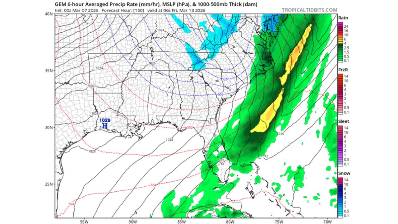
Forecast data suggests a large storm system moving along the East Coast during the second week of March, bringing widespread rain across parts of the Southeast before colder air sweeps into the region behind it. Weather models show a strong cold front stretching from the Gulf Coast through Georgia and the Carolinas and extending north toward Virginia and the Mid-Atlantic states.
Ahead of the system, warm and moist air from the Gulf of Mexico is expected to bring widespread rainfall, particularly across Georgia, South Carolina, North Carolina, and parts of Virginia. Heavy rain bands may develop along the frontal boundary as the system moves northeast along the Atlantic coast.
However, the most dramatic change could come after the system passes, when a surge of colder Arctic air plunges southward into the eastern United States. This sharp shift may cause rapid temperature drops across the Carolinas, marking one of the stronger cold intrusions of the month.
Arctic Air Could Produce Northwest Flow Snow in the North Carolina Mountains
As the colder air arrives behind the storm system, forecasters say conditions could become favorable for northwest-flow snow events across the Appalachian Mountains, particularly in western North Carolina and eastern Tennessee.
Northwest-flow snow occurs when cold air moves across the Appalachian Mountains and moisture from the Great Lakes or passing weather systems produces snow showers on the windward side of the mountains. Even short bursts of cold air can create localized snowfall in higher elevations such as the Blue Ridge Mountains.
Weather models currently suggest the best window for potential mountain snow could occur late March 12 into early March 13, when the coldest air moves into the region. While snowfall totals remain uncertain, meteorologists say elevation will play a major role, with higher ridges more likely to see accumulating snow than valley locations.
More Cold Fronts and Winterlike Surprises Possible Later in March
Forecasters caution that the mid-March cold blast may not be the only winterlike event remaining this month. Longer-range forecast patterns suggest additional cold fronts and temperature swings could develop before the end of March, keeping the possibility of occasional winter weather alive across parts of the Southeast and Mid-Atlantic.
Although spring officially approaches later in March, the transition between winter and spring often produces volatile weather patterns, including sharp temperature changes, strong storm systems, and occasional late-season snow events.
For residents across North Carolina, South Carolina, and Virginia, the upcoming period could serve as a reminder that winter is not finished yet, especially in mountainous areas where colder air tends to linger longer.
Meteorologists recommend that residents continue monitoring updated forecasts as the March 12–13 timeframe approaches, since the exact track and strength of the cold front will determine how much cold air reaches the Carolinas and whether snow showers develop in the mountains.
As the mid-March pattern begins to unfold, ChicagoMusicGuide.com will continue tracking temperature swings, storm systems, and potential snow chances across the Carolinas, Virginia, and the broader eastern United States.