
Severe Thunderstorm Watch Until 4 AM Monday Covers Central Ohio Including Columbus and Cincinnati Plus Parts of Indiana and Northern Kentucky
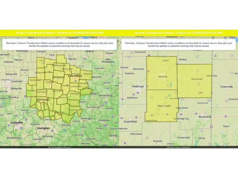
COLUMBUS, OHIO — A Severe Thunderstorm Watch remains in effect until 4:00 AM EDT Monday for a large portion of central and southwest Ohio, as well as parts of eastern Indiana and northern Kentucky, with conditions favorable for damaging winds and intense storms overnight.
The watch area stretches across major population centers including Columbus, Cincinnati, Dayton and surrounding communities.
32 Ohio Counties Under Watch
In Ohio, 32 counties are included in the Severe Thunderstorm Watch. Among those specifically highlighted are:
- Franklin County, including Columbus
- Delaware County
- Hamilton County, including Cincinnati
Other counties within the watch area extend across much of central and southwestern Ohio, forming a broad corridor of concern from near the Indiana border eastward toward Athens and Chillicothe. The highlighted map shows a dense cluster of counties under watch, signaling a widespread threat rather than isolated storms.
Indiana Counties Included
In eastern Indiana, the watch covers:
- Fayette County
- Union County
- Wayne County
Cities such as Richmond, Connersville, and Winchester fall within the outlined watch zone. The proximity to the Ohio border means storms moving east or northeast could quickly impact communities on both sides of the state line.
Northern Kentucky Also Affected
Across northern Kentucky, the Severe Thunderstorm Watch includes:
- Lewis County
- Boone County
- Bracken County
- Campbell County
- Grant County
- Kenton County
- Mason County
- Pendleton County
- Robertson County
This places much of the greater Cincinnati metro region, including northern Kentucky suburbs, under the same overnight threat.
What a Severe Thunderstorm Watch Means
A Severe Thunderstorm Watch indicates that atmospheric conditions are favorable for severe storms to develop. While not every location will experience severe weather, storms that do form may produce:
- Damaging wind gusts
- Large hail
- Frequent lightning
- Brief heavy rainfall
Residents across the tri-state region of Ohio, Indiana and Kentucky are urged to stay alert and monitor local weather updates throughout the night.
Timing and Overnight Concern
With the watch in effect until 4:00 AM EDT Monday, the greatest concern is the potential for storms to intensify during late-night hours when many residents are asleep. Overnight severe weather increases risk because warnings may be missed if devices are not set to receive alerts.
Communities from Columbus southward to Cincinnati and into northern Kentucky should ensure:
- Weather alerts are enabled on mobile devices
- NOAA Weather Radios are operational
- Outdoor items are secured in case of strong winds
Stay Prepared
The watch does not guarantee severe weather at every location, but it signals a heightened risk environment across a broad multi-state area.
Residents in Franklin, Hamilton and Delaware counties in Ohio, Fayette, Union and Wayne counties in Indiana, and Boone, Kenton and Campbell counties in Kentucky should remain vigilant.
Storm development and movement will determine which communities see the strongest impacts. Stay with ChicagoMusicGuide.com for continued updates as warnings are issued and storms evolve overnight.