
Shreveport, Louisiana Faces Dangerous Ice Storm, Heavy Snow North of I-30 and High Risk of Prolonged Power Outages Through Sunday
SHREVEPORT, LOUISIANA — A high-impact winter storm is unfolding across north Louisiana, with Shreveport and surrounding communities under a Winter Storm Warning and Watch as damaging ice accumulation, accumulating snow north of I-30, and a significant power outage threat continue through Sunday afternoon.
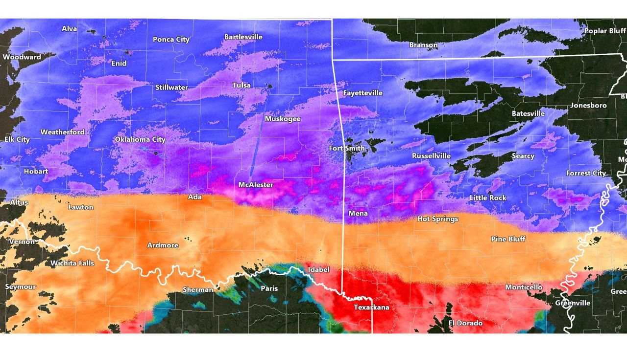
Forecast data from the National Weather Service Shreveport shows freezing rain and sleet as the dominant precipitation type in Shreveport, while heavier snow bands remain just north of the city, creating dangerous travel conditions and increasing the risk of long-duration utility disruptions.
Ice Accumulation the Primary Threat for Shreveport
Shreveport sits squarely within the core freezing-rain zone, where ice accretion of 0.50 to 0.75 inches is expected, with localized totals approaching 1 inch east and northeast of the city. This level of icing is considered crippling, capable of downing trees, snapping power lines, and making roads impassable.
Areas including Shreveport, Bossier City, Homer, and El Dorado fall within the highest ice-impact corridor shown on accumulation maps. Forecasters stress that residents should not focus on exact totals at a single point, as widespread damaging ice is the dominant signal across the region.
Heavier Snow Just North of the City Increases Impact Risk
While Shreveport itself remains mainly ice-driven, snowfall amounts increase rapidly north of I-30, where colder air allows precipitation to stay snow for longer periods. Locations north of the city are expected to see 1 to 3 inches of combined sleet and snow, with locally higher totals possible in narrow bands.
Radar imagery shows intense snowfall rates near the snow–ice transition zone, where flakes clump efficiently, allowing brief bursts of very heavy snow that can overwhelm roads in a short time.
Widespread Power Outage Risk Growing Across North Louisiana
The combination of heavy ice accumulation and increasing wind stress places Shreveport in a high-risk zone for power outages. Power-outage potential maps indicate numerous to widespread outages are possible, particularly if ice totals exceed one-half inch.
Utility disruptions could last multiple days, especially as cold air follows the storm, complicating restoration efforts. Residents are urged to prepare for extended outages, ensure devices are charged, and have access to safe alternative heating.
Why This Storm Is Especially Dangerous for Shreveport
This event is dangerous not because of one extreme element, but due to the overlap of ice, snow, and timing. Shreveport lies directly within a precipitation “battle zone,” where conditions can deteriorate rapidly and recovery becomes difficult once infrastructure is damaged.
Even small temperature changes could worsen impacts, but confidence remains high that north Louisiana will experience significant winter-weather disruption through Sunday.
Shreveport residents should finalize preparations now and limit travel once icing intensifies. ChicagoMusicGuide.com will continue monitoring updates from the National Weather Service and provide further localized impact reports as conditions evolve.