
Southeast Mississippi, Southern Alabama, and the Florida Panhandle Face Tornado Risk Sunday as Storm System Moves In
UNITED STATES — A developing storm system is expected to bring a risk of tornadoes and severe thunderstorms on Sunday, January 25, across southeast Mississippi, southern Alabama, and the Florida Panhandle, as a rapidly organizing weather pattern moves through the Deep South.
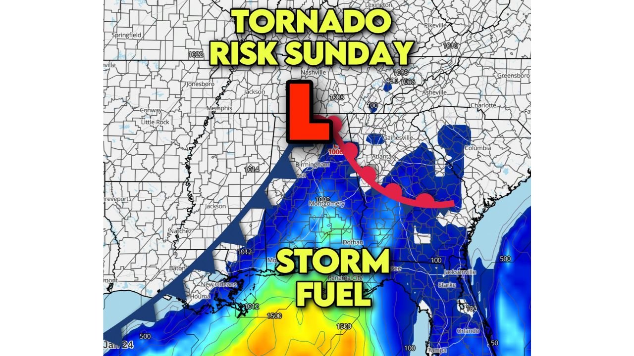
Forecasters say conditions will come together late Sunday morning through the afternoon as a new surface low pressure system forms near Birmingham, Alabama, drawing warm, moist air northward ahead of a fast-moving cold front.
How the Setup Is Forming
Meteorologists are closely monitoring a narrow but potent warm sector developing ahead of the front. Temperatures are expected to surge into the mid-60s to lower 70s, with humid and muggy air unusually strong for late January spreading north from the Gulf of Mexico.
This warm, unstable air will provide the necessary fuel for thunderstorms as the cold front pushes east.
Timing: Late Morning Through Mid-Afternoon
The main threat window is expected to run from approximately 10 a.m. to 3 p.m. Sunday, when a line of thunderstorms sweeps across the region. Some storms within the line may become strong to severe, particularly where wind shear increases.
Forecasters note that small-scale rotations (“kinks”) within the storm line could briefly tighten, creating a risk for isolated spin-up tornadoes, which can develop quickly with little warning.
Tornado Potential and Severity
While the overall tornado risk is considered low to moderate, it is not zero. Most concerns center on:
- Brief, isolated tornadoes
- Damaging straight-line winds
- Localized power outages
There is also a low-end chance of a stronger tornado (EF2 or higher) if discrete supercell storms can form ahead of the main storm line. These would be more likely in areas where storms can tap into deeper instability before merging with the line.
Areas Most at Risk
The primary areas of concern include:
- Southeast Mississippi
- Southern Alabama
- The Florida Panhandle
Communities closer to the Gulf Coast may see higher moisture levels, while inland areas could experience faster storm movement with stronger wind gusts.
What Residents Should Do
Residents in the affected areas are urged to:
- Stay weather-aware Sunday morning and afternoon
- Ensure multiple ways to receive weather alerts
- Have a safe place identified in case warnings are issued
- Avoid travel during the peak storm window if possible
Because tornadoes in winter systems can form rapidly, warnings may be short-lived but urgent.
Looking Ahead
Once the cold front passes, conditions are expected to improve quickly, with cooler and drier air moving in Sunday evening. However, officials stress that the earlier daytime hours remain the primary concern.
Weather conditions will continue to be monitored closely, and updates may be issued as the storm system evolves.
Stay tuned to ChicagoMusicGuide.com for continued weather updates, regional impact reports, and safety-focused coverage as conditions change.