
Supercell Threat Building From Central Illinois to Northern Ohio Thursday With Large Hail, Damaging Winds and Isolated Tornado Risk
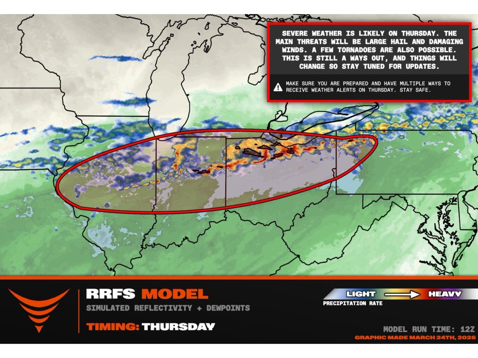
ILLINOIS, INDIANA, OHIO — A developing cold front is expected to ignite a corridor of potentially severe thunderstorms Thursday stretching from central Illinois through northern Indiana and into northern Ohio, with forecasters closely monitoring the threat for supercell development.
Current model projections indicate storms will organize along and just ahead of the advancing front, with the primary impacts likely to be large hail and damaging winds. However, while the tornado risk does not appear widespread at this time, isolated tornadoes cannot be ruled out.
Storm Corridor: Central Illinois to Northern Ohio
Simulated radar and moisture fields show a concentrated band of stronger storms developing across:
- Central Illinois
- Northern and central Indiana
- Northern Ohio
Cities near or within the projected storm zone include Springfield and Champaign in Illinois; Indianapolis and Fort Wayne in Indiana; and Toledo and Cleveland in Ohio.
Chicago and much of northern Illinois sit closer to the northern edge of the activity, with stronger storm signals focused slightly south and east of the city.
Main Hazards: Hail and Wind
Forecast guidance highlights large hail and damaging straight-line winds as the dominant threats. Supercell storms — rotating thunderstorms capable of producing intense hail cores — may form along the frontal boundary.
Hail sizes could reach severe levels in the strongest updrafts, particularly where instability overlaps with stronger wind dynamics.
Tornado Risk: Conditional but Possible
Meteorologists note that most of the upper-level winds appear relatively parallel to the cold front, which is typically less favorable for a widespread tornado outbreak.
However, a 40–50 knot low-level jet just ahead of the boundary may create localized wind profiles supportive of rotating storms. If any dominant right-moving supercells can move into the most unstable air, a tornado could develop.
This setup suggests the tornado threat is conditional — not zero, but dependent on storm mode and positioning.
Timing and Evolution
Storms are expected to intensify during the afternoon and evening hours Thursday as the front interacts with increasing moisture and instability across the region.
The severe weather window will likely shift eastward through the evening, moving from Illinois into Indiana and eventually Ohio.
Stay Alert as Details Refine
While confidence is growing in a hail and wind event, small changes in storm orientation and frontal timing could influence tornado potential. Updates are expected as higher-resolution data becomes available.
Residents across Illinois, Indiana and Ohio should remain weather aware Thursday and ensure they have multiple ways to receive alerts.
ChicagoMusicGuide.com will continue to track developments as this early-season severe weather setup unfolds.