
Texas, Oklahoma, Kansas and Missouri Face April 3 Severe Storm Setup With Expanding Risk Across Traditional Tornado Alley Into April 4
TEXAS, OKLAHOMA — Forecast models are increasingly pointing toward a potential severe weather setup on April 3, with a developing system expected to impact parts of Texas, Oklahoma, Kansas, and Missouri. Early signals suggest this could evolve into a classic Tornado Alley pattern, though uncertainty remains as different models continue to show varying levels of agreement.
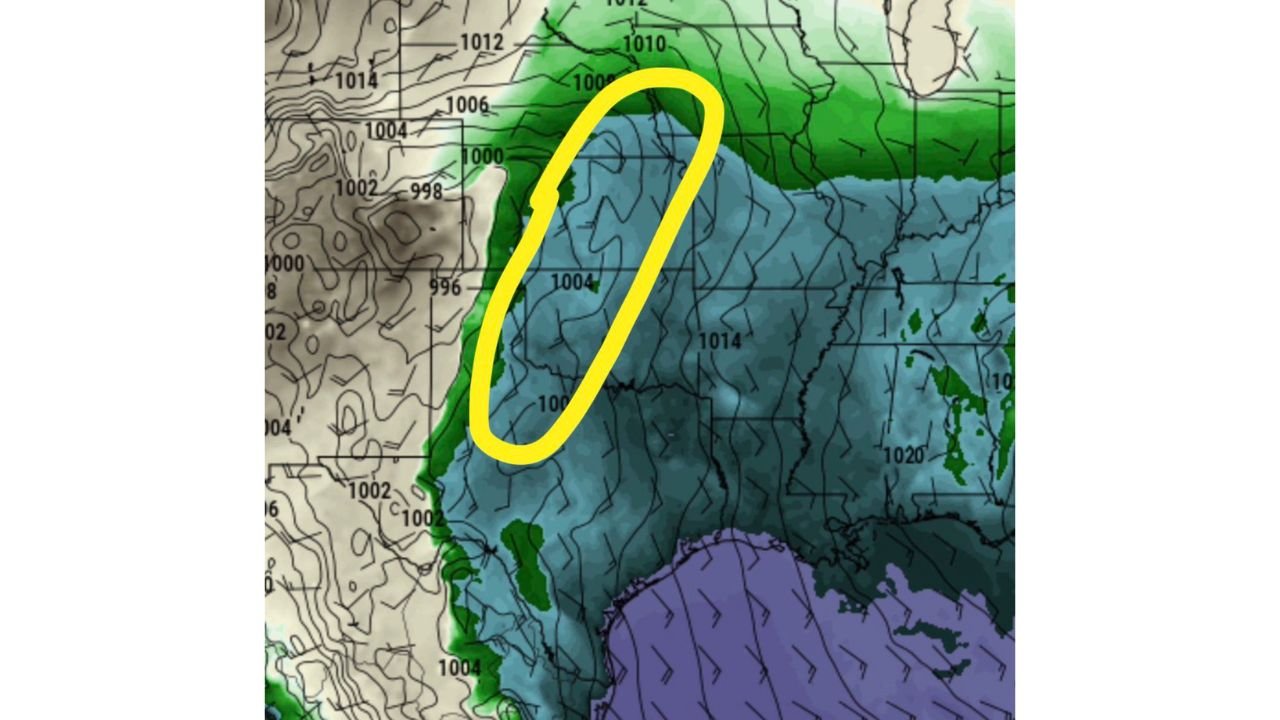
The current outlook highlights a trough ejection and surface low development, which could create the right conditions for thunderstorms, hail, damaging winds, and possibly tornadoes across a wide region.
April 3 Emerging as Key Day for Severe Weather Development
Meteorological guidance, particularly from the European model (EURO), suggests that April 3 could be the most favorable day in the upcoming stretch for severe weather development.
The setup shows a well-timed trough ejecting into the Plains, aligning with surface cyclogenesis, which is a key ingredient for organizing strong storm systems. This alignment could allow storms to develop across western Texas and Oklahoma, then expand northeast into Kansas and Missouri.
If this pattern holds, it would place large portions of central Tornado Alley under a broad severe weather risk, potentially covering multiple states at once rather than isolated areas.
Storm Evolution Could Expand Into April 4 Across Texas
Beyond April 3, attention shifts to April 4, when additional storm activity could develop, particularly across Texas.
Forecast discussions indicate the possibility of outflow boundaries playing a role, which can enhance storm intensity and create new areas of severe weather.
This extended threat window increases the likelihood of multiple rounds of storms, a scenario often associated with higher severe weather risks.
Model Differences Add Uncertainty to Forecast Confidence
Despite the growing signal, there is still notable disagreement between forecast models, particularly between the EURO and GFS.
While the EURO model strongly supports the April 3 setup, the GFS model remains less aggressive, showing weaker storm development or less organized dynamics. However, recent performance trends indicate the GFS has been improving, adding complexity to the forecast.
This divergence means that while the potential is there, details such as exact storm location, intensity, and timing remain uncertain and will likely become clearer as the event approaches.
What This Means for the Central U.S. Region
For residents across Texas, Oklahoma, Kansas, and Missouri, the upcoming period from April 3 to April 4 is worth monitoring closely.
If the forecast trends continue, the region could see:
- Large hail and damaging wind gusts
- Organized thunderstorm clusters
- A developing tornado risk, especially in stronger cells
The wide geographic coverage of this setup suggests that impacts may not be limited to one state, but rather spread across a multi-state corridor typical of spring severe weather outbreaks.
Travel, outdoor events, and local planning may need adjustments depending on how the system evolves in the coming days.
Stay updated with ChicagoMusicGuide.com for the latest severe weather developments, regional impacts, and how changing conditions could affect travel, events, and live music plans across the country.