
Washington, D.C., Virginia, Maryland Face Another Sharp Cold Front Friday as Temperatures Crash After Warm Surge
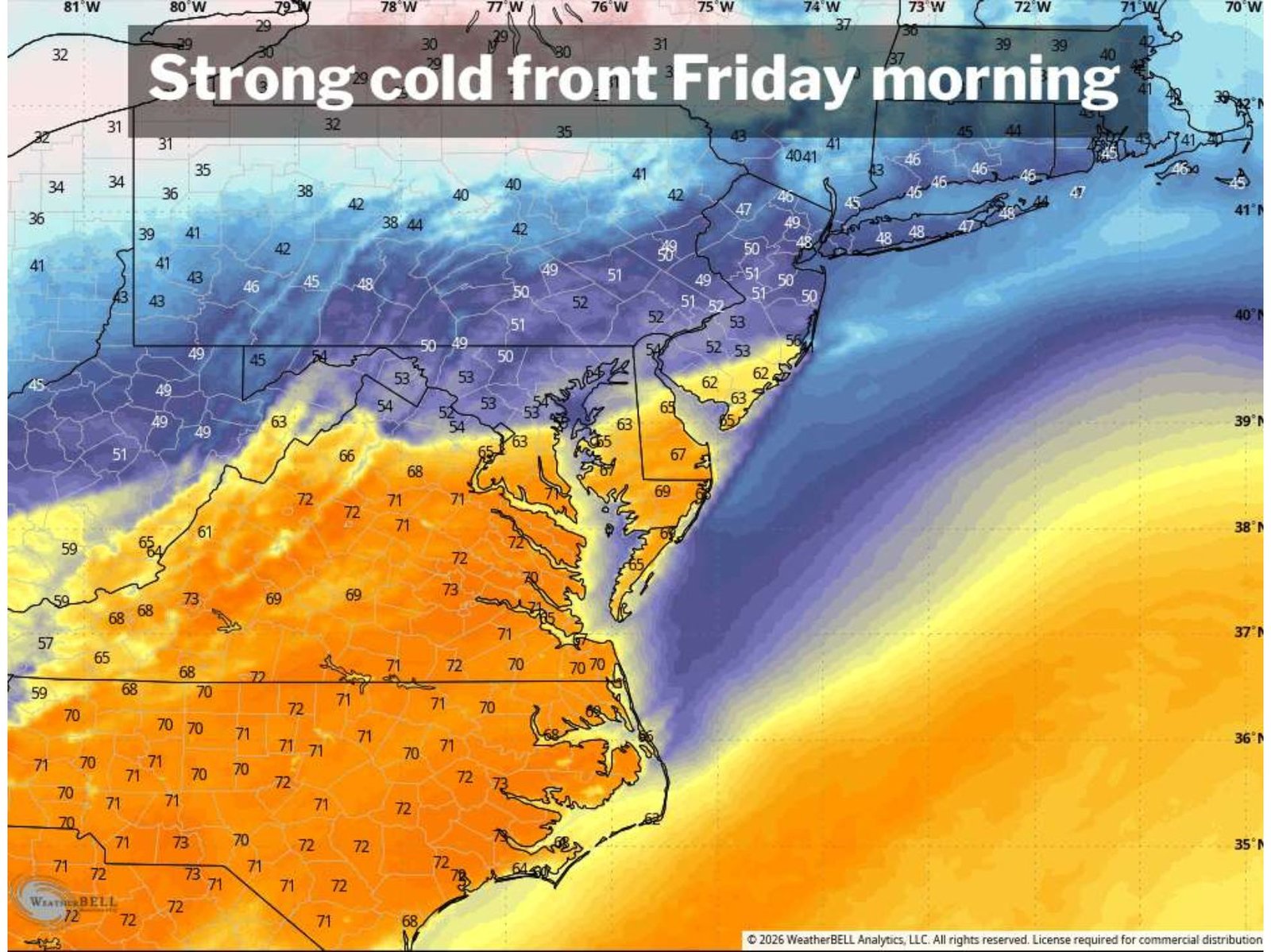
WASHINGTON, D.C. — Another strong cold front is set to move through early Friday across Washington, D.C., Virginia, and Maryland, marking the fourth major frontal passage in just two weeks. Temperatures will fall sharply from mid-70s Thursday afternoon to the low and mid-50s Friday, with rain expected along the front and near-freezing conditions possible by Friday night.
This latest system continues a pattern of dramatic air mass swings that have defined March across the Mid-Atlantic region.
Warm Conditions Quickly Replaced by Sharp Cooling
Ahead of the front, much of the region will experience mild spring warmth, with highs reaching into the mid-70s across Washington, D.C., northern Virginia, and central Maryland. However, this warmth will be short-lived as the cold front pushes through early Friday.
Behind the front, temperatures will drop into the 50s during the afternoon, bringing a noticeably cooler feel compared to the previous day. By Friday night, readings are expected to fall close to freezing, especially in areas away from urban centers.
The presence of rain along the frontal boundary will further enhance the cooling effect, making conditions feel even colder as the system moves through.
A Month Marked by Extreme Temperature Swings
March has been characterized by repeated strong cold fronts and rapid temperature changes, with this upcoming system adding to a growing list of notable weather events.
Earlier in the month, a powerful front on March 12 followed a record high of 86 degrees, dropping temperatures to 33 degrees by midday and even producing accumulating snow. This marked a 53-degree temperature drop, the largest 24-hour decline recorded at the current observation site.
Just days later, another system brought severe weather conditions, including wind gusts up to 68 mph in Washington, D.C., followed by a drop to 41 degrees the next day.
More recently, yet another front pushed through, taking temperatures from the upper 70s down into the 40s, accompanied by strong winds reaching 50 mph.
Friday’s Front Continues Active Weather Pattern
The upcoming Friday front reinforces the ongoing trend of volatile spring weather across the Mid-Atlantic, where frequent frontal passages are driving sharp changes in temperature and conditions.
Each of these systems has been followed by at least two days of below-average temperatures, and this event is expected to follow a similar pattern. After the front moves through, the region will likely experience a cool but sunny weekend, with temperatures gradually recovering.
By early next week, highs are expected to return to the 60s, signaling another rebound after the brief cold period.
What This Means for the Mid-Atlantic Region
For residents in Washington, D.C., Virginia, and Maryland, this pattern highlights the unpredictability of early spring weather. Rapid shifts from warm to cold conditions, combined with rain and gusty winds, can impact travel, outdoor plans, and daily routines.
The repeated nature of these cold fronts also underscores the importance of staying prepared for quick weather changes, especially as temperatures fluctuate significantly within short periods.
As another strong cold front moves through the Mid-Atlantic, staying informed will be key for navigating these rapid shifts in weather. For continued updates on regional forecasts, temperature swings, and evolving weather patterns, visit ChicagoMusicGuide.com.