
Washington, D.C. Weekend Storm Brings Snow-to-Rain Threat, But Milder Air Limits Major Winter Impact
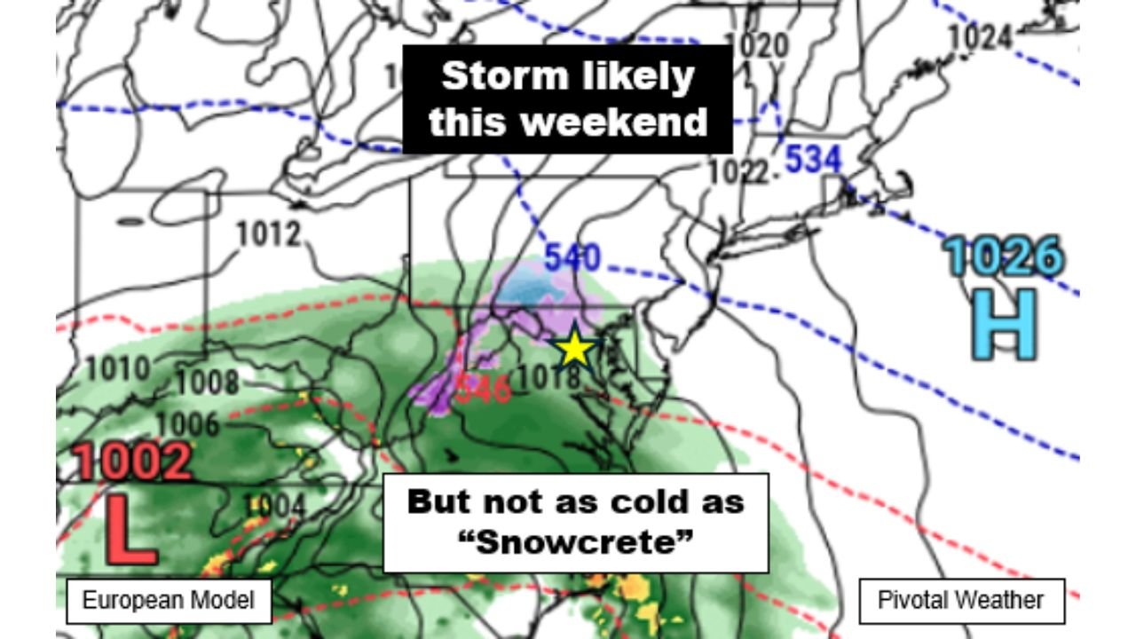
WASHINGTON, D.C. — A developing storm system is expected to impact the Washington, D.C. metropolitan area this weekend, with precipitation likely arriving sometime between late Saturday night and early Monday morning. While some winter weather is possible at the onset, forecasters say this system does not appear nearly as cold or as impactful as the recent “Snowcrete” event that affected parts of the Mid-Atlantic.
Meteorological data shows temperatures ahead of the storm will be relatively mild for early February standards, which could significantly influence how precipitation falls across D.C., Northern Virginia, and central Maryland.
Storm Timing Points to Late Saturday Night Arrival
Forecast guidance indicates that the storm’s initial precipitation shield could begin pushing into the Washington, D.C. area late Saturday night, with activity continuing through much of Sunday and potentially lingering into Monday morning. The system is associated with a surface low tracking west of the region, a setup that often brings mixed precipitation rather than a prolonged snow event.
Computer models currently suggest the heaviest precipitation window may occur overnight Saturday into Sunday morning, a time frame when temperatures are coldest but not necessarily locked below freezing.
Temperatures Not Cold Enough for Widespread Snow
Unlike previous winter storms this season, temperatures leading into the weekend are forecast to remain above average. Daytime highs from Tuesday through Saturday are expected to reach the upper 30s to mid-40s, keeping ground temperatures relatively warm.
While overnight lows Saturday night may briefly dip into the upper 20s to low 30s, there is little indication of a strong high-pressure system to the north that would lock colder air in place. This lack of sustained cold air makes it difficult for snow to accumulate efficiently, especially in urban areas like Washington, D.C..
Snow or Wintry Mix Possible, But Not Guaranteed
Forecasters note that a brief period of accumulating snow or wintry mix cannot be ruled out, particularly at the onset of the storm late Saturday night. However, most model data increasingly favors a transition to wintry mix and rain as temperatures rise above freezing on Sunday.
As warmer air aloft moves into the region, snowflakes are more likely to melt before reaching the ground or change to rain, reducing the risk of significant snowfall totals. This setup mirrors many marginal winter storms in the Mid-Atlantic, where impacts hinge on subtle temperature changes.
Sunday Trends Milder as Storm Evolves
By Sunday, temperatures across the District of Columbia are expected to climb above freezing, further supporting a changeover to rain. Any early snow or ice accumulation would likely diminish quickly as surface temperatures warm.
This warming trend may also help limit travel disruptions, though brief slick conditions could develop early Sunday if precipitation begins as snow or freezing rain.
Warmer Pattern Expected After the Storm
Looking beyond the weekend system, long-range guidance suggests even milder air could follow the storm early next week. If this trend holds, it would further reduce the likelihood of prolonged winter weather in the D.C. region in the immediate aftermath of the storm.
Meteorologists caution that small shifts in storm track or temperature profiles could still alter precipitation types, but confidence is growing that this will not be a major winter storm.
Forecast Confidence Still Developing
While the overall pattern is becoming clearer, forecasters stress that details regarding precipitation type, timing, and intensity will continue to evolve as the storm approaches. Additional clarity is expected within the next 24 to 48 hours as higher-resolution data becomes available.
Residents across Washington, D.C., Maryland, and Northern Virginia are encouraged to stay updated, especially if travel plans are in place for late Saturday night or early Sunday.
As the Mid-Atlantic monitors this developing system and prepares for possible winter weather impacts, ChicagoMusicGuide.com will continue tracking forecast updates and regional weather developments affecting major cities across the country. Visit ChicagoMusicGuide.com for the latest weather coverage, alerts, and forecast breakdowns.