
Winter Weather Advisories Issued Across North Dakota, Minnesota, Wisconsin, and Michigan as Snow and Light Ice Spread This Week
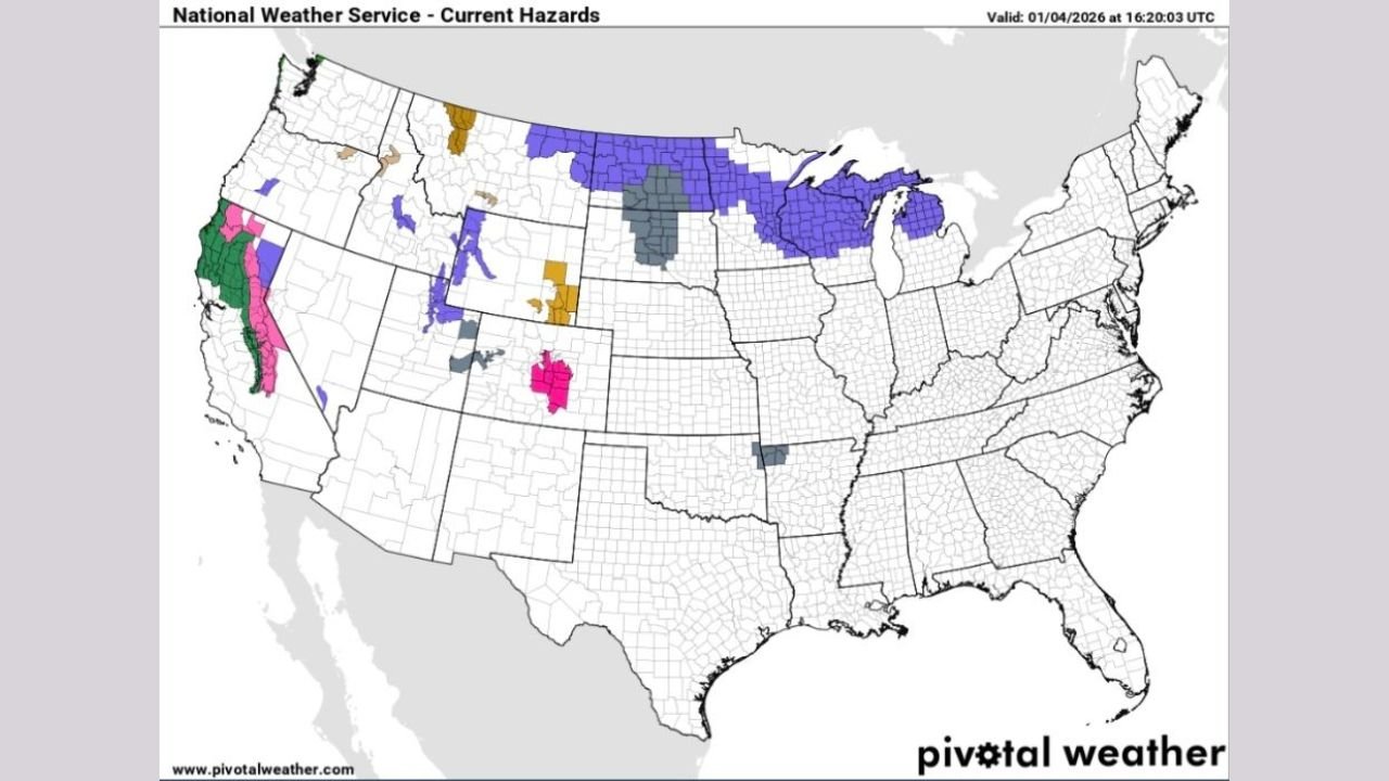
MICHIGAN — A broad swath of Winter Weather Advisories has been issued across parts of the North Central United States as the first of two winter systems moves through the region this week, bringing several inches of snow and areas of light ice accumulation.
According to the latest hazard outlooks, impacted areas stretch from the northern Plains into the Upper Midwest, where travel conditions may deteriorate as snowfall spreads and isolated icing develops.
Where Winter Weather Advisories Are in Effect
Current advisories cover portions of:
- North Dakota, including central and northern areas
- Northern and central Minnesota, extending into the Arrowhead region
- Northern Wisconsin, especially near Lake Superior
- Parts of Michigan, including the Upper Peninsula
These advisories highlight a combination of steady snowfall, locally reduced visibility, and slick road conditions, particularly during overnight and early morning hours.
Snowfall and Ice Impacts Expected
Forecast data indicates snow accumulations of a few inches are possible across much of the advisory area. While totals are not expected to be extreme, the widespread nature of the snowfall increases the potential for hazardous travel.
In addition to snow, light icing is possible in some locations, especially where surface temperatures hover near freezing. Even minor ice accumulation can significantly increase the risk of slippery roads, untreated sidewalks, and elevated surfaces such as bridges and overpasses.
Why This System Matters
This event marks the first of two snowmakers expected this week, meaning impacts may compound if snow and ice linger before the next system arrives. Snow-covered roads, combined with fluctuating temperatures, could lead to refreezing and prolonged travel hazards, particularly in rural and less-traveled areas.
Lake-enhanced snowfall may also contribute to locally higher totals in parts of northern Wisconsin and Michigan, depending on wind direction and moisture availability.
Travel and Safety Considerations
Residents across the advisory zone are encouraged to:
- Allow extra travel time, especially during commutes
- Use caution on bridges, ramps, and untreated roads
- Prepare for changing conditions, even where snowfall appears light
Drivers may encounter rapidly changing road conditions as snow bands move through, reducing visibility and traction with little notice.
What to Watch Going Forward
As this system exits, attention will turn to the next potential winter system later in the week, which could bring additional snowfall to parts of the Midwest. How quickly current snow and ice clear will play a role in determining future impacts.
Staying aware of local advisories and updated forecasts will be important as winter weather remains active across the region.
Have winter weather already affected travel or events in your area? Share your experience and stay connected with ongoing weather coverage at ChicagoMusicGuide.com.