
Greenville, Spartanburg and Asheville Under Marginal Risk as Damaging Winds and Large Hail Possible This Afternoon Across South Carolina, North Carolina and Northeast Georgia
GREENVILLE, SOUTH CAROLINA — A Marginal Risk (Level 1 of 5) for severe thunderstorms is in place today across parts of Upstate South Carolina, western North Carolina, and northeast Georgia, with forecasters warning that a few storms could become severe if conditions evolve favorably this afternoon.
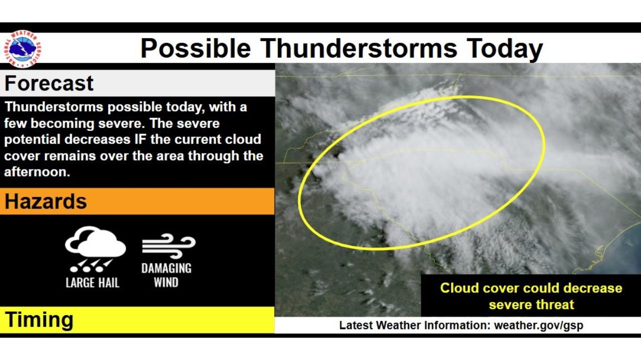
The National Weather Service in Greenville-Spartanburg indicates thunderstorms are possible through the afternoon and evening hours, with the primary threats being damaging wind gusts and large hail.
Timing: 3 PM to 11 PM
Storm chances are expected to increase between 3 PM and 11 PM, when daytime heating could help destabilize the atmosphere.
However, a key uncertainty remains: cloud cover.
Forecasters note that if the current widespread cloud cover lingers through much of the afternoon, it could significantly limit storm intensity and reduce the overall severe threat.
If skies partially clear and temperatures rise, the potential for stronger storms would increase.
Main Hazards: Wind and Hail
Should storms strengthen, the main impacts would include:
- Damaging straight-line winds
- Large hail
While this is not considered a widespread severe outbreak, even isolated severe cells can produce localized impacts, including downed tree limbs and scattered power outages.
Communities across:
- Greenville and Spartanburg, SC
- Asheville, NC
- Anderson, SC
- Portions of northeast Georgia
should monitor conditions closely through the late afternoon.
Marginal Risk, But Not Zero Risk
A Marginal Risk classification means isolated severe storms are possible, but coverage is expected to be limited.
Still, forecasters emphasize that severe potential is conditional. If cloud cover breaks and instability increases, a few storms could quickly intensify.
Stay Weather Aware
Residents across the western Carolinas and northeast Georgia should:
- Monitor forecast updates
- Be prepared to seek shelter indoors if a warning is issued
- Use caution while driving during heavy rain or strong wind
Even in lower-end risk scenarios, storms can strengthen rapidly during peak heating hours.
As the afternoon unfolds, attention will focus on whether skies clear enough to allow stronger storm development across the region.
For continued coverage of severe weather threats across the Southeast and beyond, stay with ChicagoMusicGuide.com.