
California and Pacific Northwest Face Heavy Rain, Snow, and Flooding Risk as Back-to-Back West Coast Storms Move In
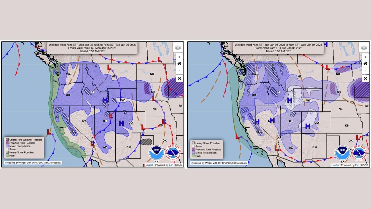
CALIFORNIA — Large portions of the West Coast are dealing with an active and unsettled weather pattern as multiple storm systems bring moderate to heavy rainfall, mountain snow, and localized flooding concerns from California into the Pacific Northwest through midweek, according to forecast maps and timing shown in the latest outlooks.
The data indicates that California remains under lingering rainfall today, while a separate, stronger Pacific system moves into Oregon and Washington on Tuesday, extending impacts northward and inland.
California: Lingering Rain and Flash Flood Concerns
Forecast data shows moderate to heavy rainfall continuing across California, particularly along coastal regions and parts of the Central Valley. The precipitation is tied to a slow-moving system that has already saturated soils in some areas.
- Isolated flash flooding is possible, especially in low-lying areas and locations with poor drainage
- Recent rainfall increases the risk of runoff near burn scars and urban corridors
- Snow levels remain higher in some regions, limiting widespread low-elevation snow but keeping mountain travel hazardous
While this is not depicted as a widespread extreme flooding event, the persistent nature of rainfall makes localized impacts more likely.
Pacific Northwest: Heavier Precipitation Arrives Tuesday
A new West Coast system is shown pushing into Washington and Oregon on Tuesday, bringing widespread precipitation across the region.
Forecast graphics indicate:
- Heavy rain along the coast and western lowlands
- Snow and mixed precipitation across higher elevations of Oregon, Washington, Idaho, and western Montana
- Increasing travel impacts in mountain passes due to snow accumulation
This system appears more expansive than the California rainfall event, affecting a broader multi-state area across the Pacific Northwest.
Interior West: Snow and Mixed Precipitation Possible
Beyond the coast, shaded regions in the forecast show snow and mixed precipitation extending into:
- Idaho
- Montana
- Utah
- Wyoming
- Northern Nevada
High pressure zones shown east of the Rockies may help limit how far east precipitation spreads, but winter travel conditions remain possible in elevated terrain.
What This Pattern Means Going Forward
The data reflects a progressive storm pattern, with systems arriving in quick succession rather than a single prolonged event. While confidence remains higher for rain and mountain snow, exact totals and localized impacts may shift as each system moves onshore.
Residents and travelers across the West Coast and Interior West should continue monitoring updated forecasts, especially where terrain and prior rainfall increase vulnerability to flooding or snow-related travel issues.
If you’re tracking how this evolving weather pattern could affect travel, events, or daily plans, stay connected with ongoing updates and coverage at ChicagoMusicGuide.com, where we continue to follow major weather developments impacting communities across the country.