Mississippi Faces Severe Storm and Flash Flood Threat Friday as Predawn Tornado Risk and Heavy Rain Develop

MISSISSIPPI — A developing storm system is expected to bring severe weather and dangerous flash flooding across much of Mississippi on Friday, with impacts beginning before dawn and continuing through Friday night, according to updated outlooks and local National Weather Service briefings.
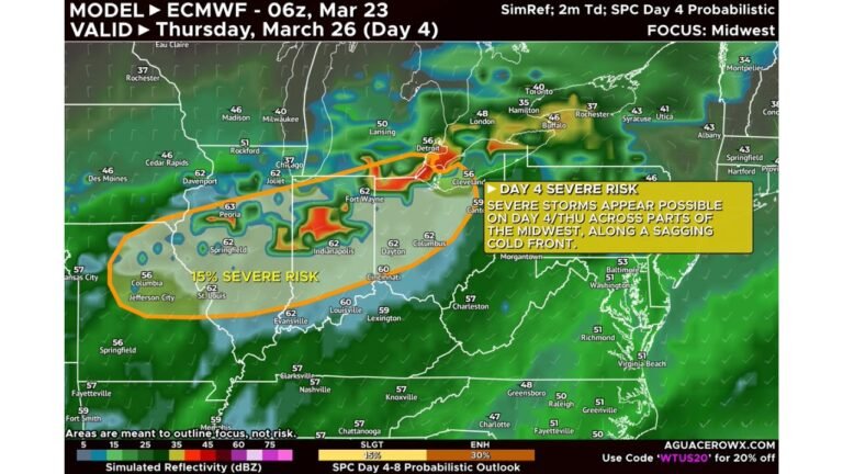
Forecast data shows a Slight Risk (Level 2 of 5) for severe storms statewide, with damaging wind gusts up to 60 mph, isolated tornado potential, and heavy rainfall capable of producing flash flooding, especially across central and eastern parts of the state.
Predawn Storms May Produce Damaging Winds and Brief Tornadoes
Storm activity is expected to begin in the pre-dawn hours Friday, particularly across western and central Mississippi, where atmospheric conditions support strong wind shear even with limited instability.
Meteorologists note that while storms may struggle to organize initially, isolated strong to severe storms remain possible, especially along and northwest of the Natchez Trace corridor between roughly 4 a.m. and mid-afternoon.
Primary early-day hazards include:
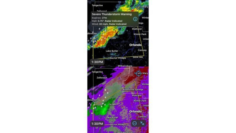
- Wind gusts up to 60 mph
- Brief, fast-moving tornadoes
- Heavy downpours reducing visibility during the morning commute
Severe Storm Coverage Expected to Increase Friday Afternoon and Evening
As temperatures rise into the upper 60s to near 70 degrees, storms are expected to become more widespread after 3 p.m., particularly across central, eastern, and southeastern Mississippi, including areas near Jackson, Meridian, Hattiesburg, and Philadelphia.
While the overall tornado threat remains limited, a tornado or two cannot be ruled out, especially during the late afternoon and evening when instability increases ahead of the advancing cold front.
Flash Flooding Risk Elevated With 3–6 Inches of Rain Possible
In addition to severe storms, heavy rainfall poses a significant concern, with some locations expected to receive 3 to 6 inches of rain, and rainfall rates potentially reaching 2 to 3 inches per hour.
The National Weather Service highlights an Elevated Flood Risk (Level 2 of 4) across much of eastern Mississippi, with localized areas facing Significant Flood Risk (Level 3).
Flood impacts may include:
- Rapid water rise in low-lying and urban areas
- Road flooding and temporary closures
- Minor river flooding
- Dangerous travel conditions during heavy rain bands
Residents are urged to avoid driving through flooded roadways, especially overnight and during periods of intense rainfall.
Storm Setup Limits Widespread Tornado Threat, But Hazards Remain
Forecasters emphasize that while wind shear is strong, overall atmospheric instability remains limited, which should help prevent widespread severe outbreaks. Storm updrafts may weaken as they form, keeping the overall severe threat lower than typical spring events.
However, even weaker storm systems can still produce isolated damaging wind gusts, brief tornadoes, and dangerous flooding, particularly when storms move quickly through saturated areas.
What Residents Should Do Friday
- Stay alert for weather warnings, especially overnight
- Have multiple ways to receive alerts, including weather radios and mobile notifications
- Avoid unnecessary travel during heavy rainfall
- Never drive through flooded roads
Conditions may continue to evolve, and forecast confidence will improve as Friday approaches.
For continued weather updates, storm safety information, and regional impact coverage, stay connected with ChicagoMusicGuide.com and join the conversation on how this system could affect travel, events, and daily life across the region.