Snow Threat Expands Across Georgia, Alabama, Florida, North Carolina, New Jersey, Pennsylvania, and Delaware as Multiple Winter Systems Line Up
UNITED STATES — Winter weather is set to impact multiple regions of the country, with forecast data showing two distinct but related snow threats developing across parts of the Southeast and the Mid-Atlantic as colder air interacts with incoming moisture this weekend into early next week.
Southeast States Face Rare Snow Setup
Forecast guidance and National Weather Service briefings indicate unusual snow potential across parts of Georgia, Alabama, and Florida, regions that rarely experience measurable winter weather.
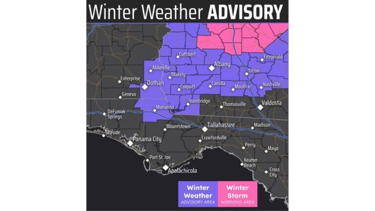
In central Georgia, confidence has increased for snow developing Sunday morning, particularly in areas under Winter Storm Warnings. These locations could see 1 to 3 inches of snow, with advisory areas receiving up to 1 inch.
Snow is expected to be most impactful near and south of Interstate 75 and Interstate 16, including cities such as Macon, Dublin, and surrounding counties. Roads may become slippery early Sunday, prompting officials to recommend shifting travel plans to later in the day where possible.
Alabama and Florida: Light Snow, Limited Impacts
Farther west and south, southeast Alabama and the Florida Panhandle will see a rain-to-snow transition Sunday morning as colder air briefly moves in behind the system.
- Snow accumulation is expected to be minor, mainly on grassy or elevated surfaces
- Ground temperatures remain relatively warm
- Roadways are expected to stay mostly wet, not icy
- Skies should clear by afternoon, reducing lingering impacts
Despite limited travel concerns, any snowfall in these areas is noteworthy and unusual for mid-January.
North Carolina Also in the Snow Zone
Model guidance highlights eastern North Carolina as another area with potential for light accumulating snow, especially where colder air overlaps coastal moisture. While totals remain uncertain, localized slick spots are possible, especially during early morning hours.
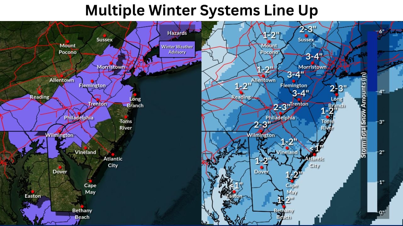
Mid-Atlantic Braces for Another Snow Round
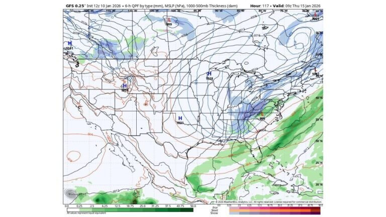
While the Southeast deals with rare snowfall, a separate winter system is tracking farther north, impacting parts of the Mid-Atlantic, including New Jersey, Pennsylvania, and Delaware.
Forecast maps from the Mount Holly Weather Forecast Office show:
- 2 to 4 inches of snow possible in parts of central and northern New Jersey
- 1 to 3 inches across portions of eastern Pennsylvania
- Lighter totals toward southern Delaware and coastal areas
- Highest snow totals aligned along and near the I-95 corridor
Winter Weather Advisories are already in effect, with snowfall expected late Saturday night through Sunday.
Why This Pattern Matters
Meteorologists note that the broader setup features cold air pressing southward while moisture-rich systems ride along the temperature boundary, allowing snow to develop in places that typically see rain.
This pattern also explains why multiple regions are being impacted simultaneously, from the Deep South to the Northeast.
What to Watch Going Forward
- Early morning travel Sunday in Georgia, New Jersey, and Pennsylvania
- Localized slick bridges and overpasses
- Rapid changes in precipitation type, especially near coastlines
- Short-term accumulations that melt quickly but still create hazards
Residents across the affected states are urged to monitor local forecasts and advisories, as small temperature shifts could still change snowfall totals.
Winter may be winding down on the calendar, but this active weather pattern shows it’s not done yet. Stay alert, plan ahead, and follow the latest updates as these systems move through.
For continued regional weather coverage and detailed breakdowns, stay connected with ChicagoMusicGuide.com.