Northern Alabama Faces High-Impact Ice and Snow Threat as Major Winter Storm Spreads From Texas to the Carolinas
UNITED STATES — Global weather models are showing increasing agreement that a high-impact winter storm will affect a wide portion of the southern United States this weekend, with northern Alabama emerging as one of the most vulnerable areas. Forecast guidance indicates a dangerous mix of snow, freezing rain, and sleet developing late Friday night and continuing through Saturday, Sunday, and possibly into Sunday night, raising concerns for power outages and hazardous travel.
Northern Alabama Identified as a Key Impact Zone
Meteorologists note that the northern half of Alabama sits directly beneath a critical transition zone in the storm. This is where cold air near the surface clashes with warmer air aloft, a setup that frequently produces significant ice accumulation. Global forecast models remain remarkably consistent in highlighting this region as a potential high-impact area rather than a marginal winter event.
Communities across Northwest and North-Central Alabama should prepare for rapidly changing conditions, with precipitation type possibly shifting multiple times during the storm. This uncertainty increases the risk of dangerous outcomes, particularly for infrastructure and travel.
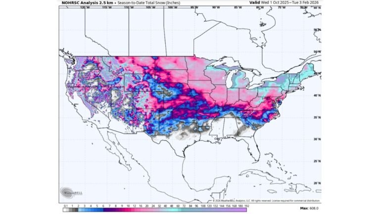
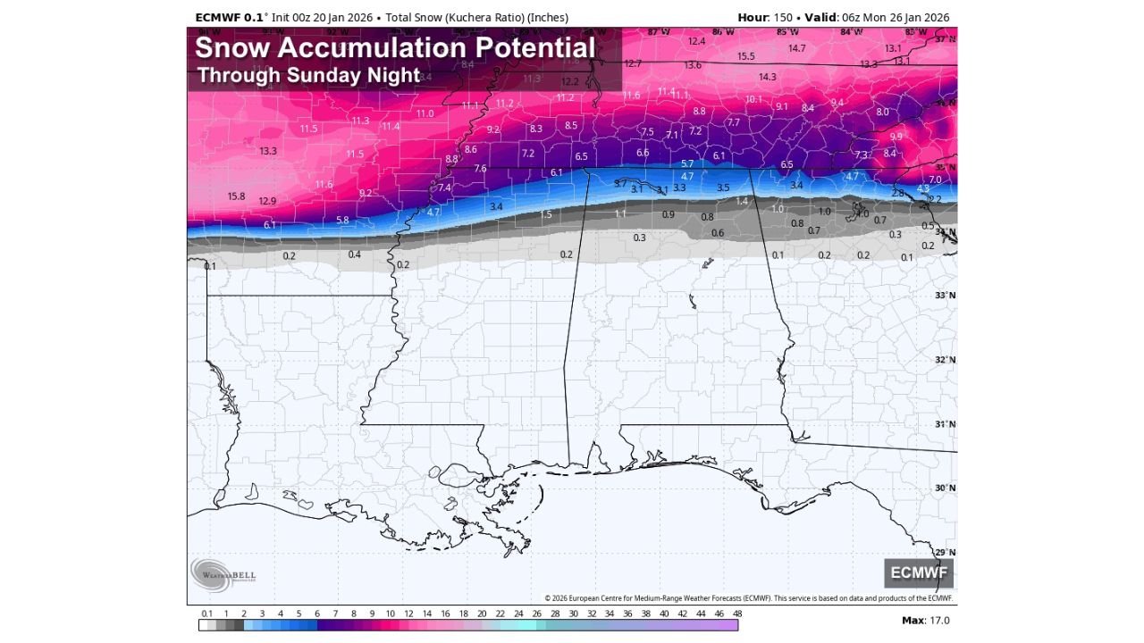
Snow Potential Highest Across the Tennessee Valley
The best chance for accumulating snow with this system appears focused across the Tennessee Valley, especially north of the Tennessee River. Forecast projections suggest that several communities could see 2 to 4 inches of snow, with locally higher totals possible where heavier bands set up.
Snowfall in this region may be accompanied by periods of reduced visibility and slick roadways, particularly during overnight and early morning hours. While snow-dominated areas tend to experience fewer power outages than ice zones, isolated disruptions remain possible.
Significant Ice Threat South of the Tennessee River
South of the Tennessee River, the threat shifts dramatically from snow to freezing rain. Because the cold air near the surface is expected to be very shallow, precipitation falling as rain aloft may freeze on contact with roads, trees, and power lines. This setup is notorious for producing widespread ice accumulation.
Forecast data suggests the potential for very significant icing, with some model guidance indicating ice totals capable of causing tree damage and prolonged power outages. Travel conditions in these areas could become extremely dangerous, especially on untreated roads and bridges.
Southern Extent of Ice Remains Uncertain
Defining how far south the ice threat will extend remains one of the most challenging aspects of this forecast. Small changes in temperature can mean the difference between a cold rain and a crippling ice storm. At this time, ice accumulation appears possible as far south as Livingston, Greensboro, Clanton, Lake Martin, and Opelika, though forecasters stress that this boundary could shift north or south as the event unfolds.
Residents in these areas are urged not to focus solely on exact forecast lines but instead prepare for worst-case scenarios, particularly if freezing rain develops for several consecutive hours.
Timeline: When Impacts Will Begin and End
The first winter weather impacts could arrive as early as midnight Friday night across Northwest Alabama. From there, precipitation is expected to spread eastward and southward through Saturday and Saturday night. Forecast guidance suggests that lingering precipitation could continue into Sunday, with some impacts possibly lasting until Sunday night before the system finally exits.
Meanwhile, South Alabama is expected to remain warm enough to see cold rain only, avoiding winter precipitation impacts altogether.
Milder Temperatures Before the Storm Offer Limited Relief
One mitigating factor is that temperatures are expected to be in the 50s ahead of the storm, meaning roads and infrastructure will not be deeply frozen at the onset. This could reduce initial ice bonding. However, once freezing rain becomes steady, ice can accumulate rapidly regardless of prior warmth, especially on elevated surfaces.
A Regional Storm With Multi-State Consequences
This winter storm is not limited to Alabama. The broader system is forecast to impact areas from Texas to the Carolinas, with different hazards dominating different regions. Northern areas will contend with heavy snow, while southern and transitional zones face the highest ice risks.
Forecasters emphasize that more detailed accumulation forecasts will become available as the event draws closer, but residents across northern Alabama should begin preparations now. Limiting travel, securing emergency supplies, and planning for possible power outages are all considered low-regret actions.
Best-case scenarios involve a cold rain or limited icing. Worst-case outcomes include a crippling ice storm capable of causing multi-day power outages, with isolated locations potentially facing disruptions lasting even longer.
As this complex winter storm approaches, staying informed and prepared will be critical. For continued updates on major weather systems, regional impacts, and how conditions could affect travel and events, visit ChicagoMusicGuide.com for ongoing coverage.
Author: Leo Hart
Category: Weather