Destructive Ice Storm Threatens Texas, the Deep South, and the Carolinas With Widespread Power Outages Late This Week
UNITED STATES — A potentially exceptional and destructive ice storm is coming into sharper focus for the southern United States late this week, with forecast data pointing to widespread freezing rain, severe tree damage, and long-lasting power outages across a large swath of the region. Confidence is increasing that this will not be a routine winter weather event, but rather a high-impact ice storm affecting major population corridors from North Texas through the Deep South and into the Carolinas.
A Rare, High-Impact Ice Storm Signal Emerges
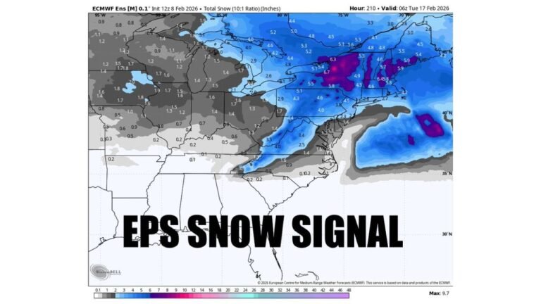
Forecast guidance shows a strong and persistent signal for significant freezing rain accumulation, a scenario that meteorologists describe as one of the most damaging winter weather outcomes. Unlike snowstorms, ice storms place extreme stress on power infrastructure, trees, and transportation networks, often leading to cascading impacts that can last for days or longer.
Model consensus now indicates that the atmosphere will be locked into a configuration that favors prolonged freezing rain, rather than a brief transition zone. This raises the risk of crippling ice accumulation, especially across parts of Texas, Louisiana, Mississippi, Alabama, Georgia, South Carolina, and North Carolina.
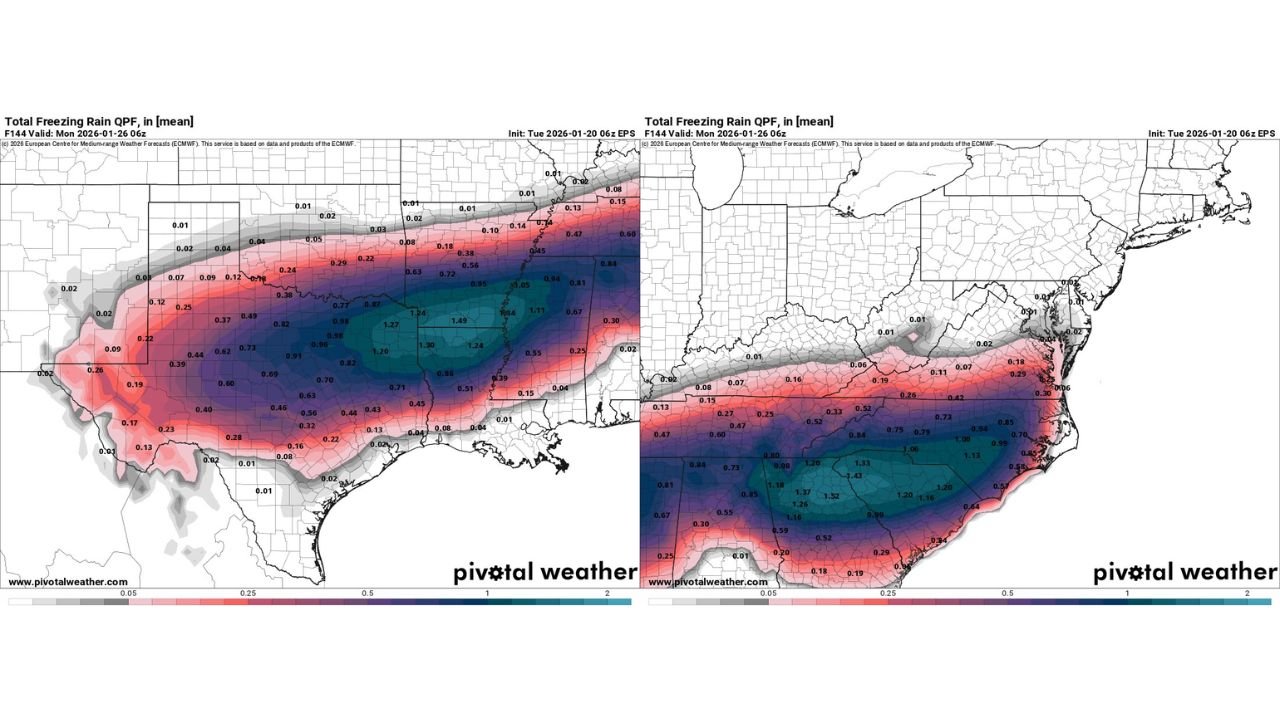
Freezing Rain Totals Capable of Causing Major Damage
Forecast maps indicate freezing rain amounts exceeding one inch in multiple areas, with some pockets potentially approaching or surpassing levels historically associated with widespread power grid failure. Ice accumulation of this magnitude can weigh down power lines and tree limbs, causing them to snap under the load.
Urban and suburban areas along the Dallas–Fort Worth metroplex, through central Alabama, into metro Atlanta, and eastward toward Charlotte are within the corridor of highest concern. Even slight shifts in storm placement would not eliminate the threat, but instead shift where the worst damage occurs.
Crippling Travel Conditions Likely
Freezing rain produces some of the most dangerous travel conditions seen during winter weather events. Roads may appear wet while being coated in a nearly invisible glaze of ice. Bridges, overpasses, and untreated secondary roads will become hazardous first, but major highways are also likely to deteriorate quickly.
Officials warn that travel during peak icing could become nearly impossible, with accidents, road closures, and emergency response delays expected if freezing rain persists for several hours. Air travel disruptions are also likely at major hubs across the South and Southeast.
Power Outages Could Last Days in Hardest-Hit Areas
One of the most concerning aspects of this event is the potential duration of power outages. Ice storms often cause damage that cannot be repaired quickly, especially when access roads are blocked by fallen trees and downed lines.
Forecast impacts suggest some communities could experience multi-day outages, and in isolated cases, outages lasting a week or more are not out of the question. This is particularly dangerous given that cold air will remain entrenched, increasing the risk of exposure for residents without heat.
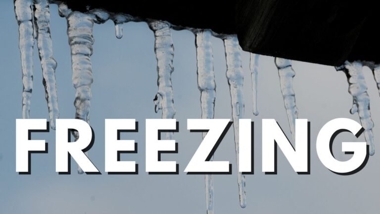
Why This Ice Storm Is Especially Dangerous
Meteorologists note that the cold air involved in this event is shallow but very dense, allowing freezing rain to persist even as warmer air flows above the surface. This setup is notorious for producing long-duration icing, rather than a brief period of mixed precipitation.
Additionally, the axis of heaviest ice is expected to align with major population centers, amplifying the potential human and economic impact. While the exact placement may still shift slightly, confidence is high that somewhere in the South will experience a destructive ice storm.
Prepare Now for a Worst-Case Scenario
Emergency managers stress that preparation should begin immediately. Residents in the potential impact zone are urged to secure food, water, medications, flashlights, batteries, and backup heat sources. Charging devices in advance and having a plan for extended power loss could prove critical.
People living in heavily wooded neighborhoods should be especially cautious, as tree damage often accounts for a large portion of ice storm-related destruction. Avoiding travel during the height of the storm could prevent injuries and allow emergency services to focus on the most critical needs.
A Storm With Regional Consequences
This ice storm is expected to impact a broad region, not a single state or city. From North Texas through the Deep South and into the Carolinas, millions of people could be affected by the same weather system. While some areas may escape with lighter icing or cold rain, others could face one of the most severe ice storms seen in years.
Forecasters emphasize that while the precise axis of heaviest ice may still evolve, the overall message is clear: this is a high-risk, high-impact winter storm with the potential to disrupt daily life across much of the South.
As the situation continues to evolve, staying informed and prepared will be essential. For continued coverage of this dangerous winter storm, power outage risks, and regional weather impacts, follow ongoing updates on ChicagoMusicGuide.com.