Crippling Ice Storm and Heavy Snow Threaten Texas, the Deep South, and Southeast With Days-Long Power Outages
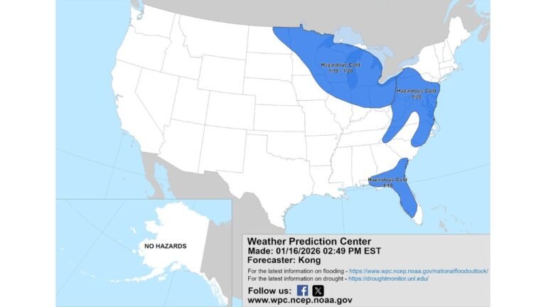
UNITED STATES — Meteorologists are warning that an exceptionally serious and potentially historic winter storm is likely to impact Texas, the Deep South, and the Southeast from Friday through Sunday, with the potential to become one of the most disruptive winter weather events in years. Forecast confidence is growing that this system will produce a dangerous combination of crippling ice accumulation and heavy snow, leading to impassable roads, widespread power outages, and severe tree damage across a large multi-state region.
Why This Winter Storm Is Being Called ‘Crippling’
Forecasters are rarely quick to use the term “crippling”, but this storm’s projected impacts justify the language. Current projections indicate a swath of 0.5 to 1.25 inches of ice accretion, with isolated areas potentially exceeding that range. Ice of this magnitude places extreme stress on power lines, utility poles, and trees, often resulting in cascading infrastructure failures.
Unlike brief icing events, this storm is expected to persist for many hours, allowing ice to accumulate steadily. That increases the likelihood of long-duration outages, especially in areas with dense tree cover and aging power infrastructure.
Widespread Power Outages and Dangerous Living Conditions
One of the most serious concerns is the duration of power outages that could follow the storm. Ice-laden tree limbs snapping onto power lines can delay restoration efforts for days. In some of the hardest-hit areas, outages could last a week or longer.
For residents without generators, this poses a major risk. As arctic air remains locked in behind the storm, indoor temperatures could drop rapidly, creating dangerous conditions — particularly for elderly residents, children, and those with medical needs. Emergency managers are urging families to prepare blankets, food, water, and alternative heat sources now, and to check on vulnerable neighbors before the storm arrives.
Tree Damage and Impassable Roads Likely
Ice accumulation of this scale is expected to cause widespread vegetation damage. Tree limbs will snap under the weight, and in some cases entire trees may fall, blocking roadways and damaging homes and vehicles. Roads coated in thick ice may remain impassable for multiple days, even after precipitation ends.
Emergency response times could be significantly delayed due to blocked streets and hazardous travel conditions, compounding the storm’s overall impact.
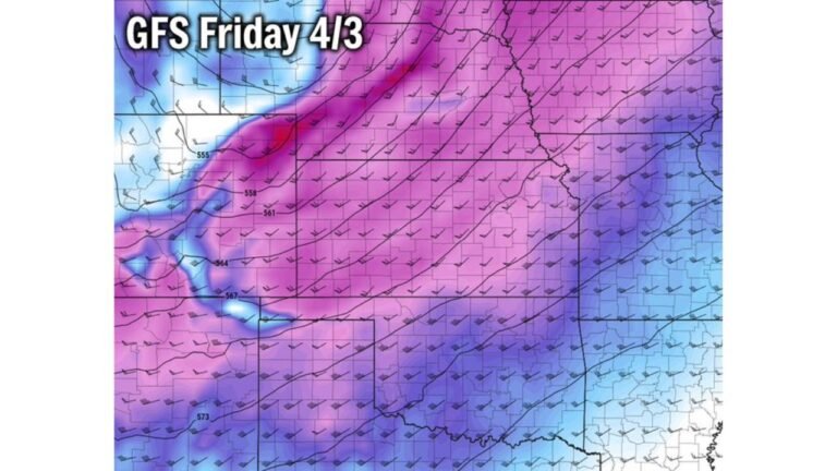
Heavy Snow Adds to the Disruption
In addition to ice, forecasters expect a separate zone of heavy snow to develop on the northern side of the storm. While exact placement remains uncertain, snowfall totals of 6 to 12 inches are increasingly likely somewhere within a long west-to-east corridor.
This snow band will likely produce plowable accumulations, further complicating travel and logistics. While snow generally causes fewer power outages than ice, its overlap with icing zones could intensify impacts where the two hazards meet.
Why Forecast Precision Is Still Limited
At this stage, forecasters cannot yet determine exactly who will receive snow versus ice, or where the sharp transition zones will set up. Small temperature differences — sometimes just one or two degrees — can mean the difference between a manageable snowstorm and a devastating ice storm.
What is clear, however, is that the Friday to Sunday time frame will be extremely rough across a broad region, and most residents in the affected areas should plan to stay off the roads entirely once conditions deteriorate.
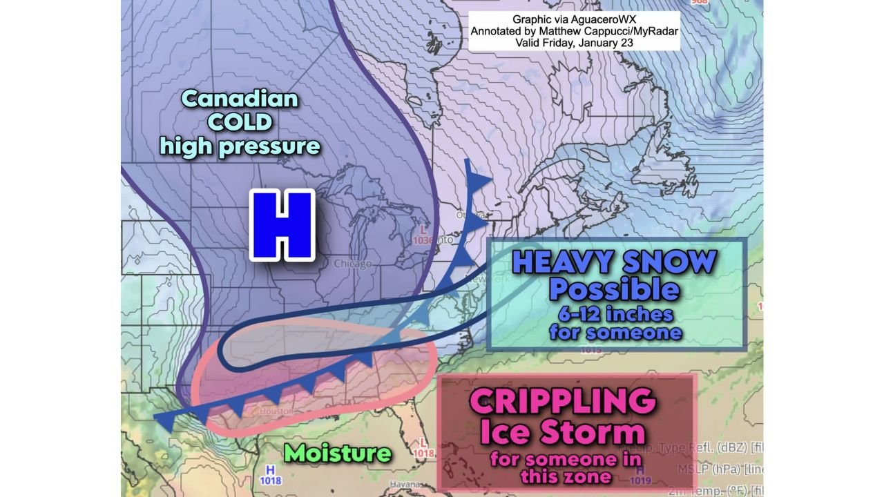
A Large-Scale Pattern Driving the Storm
This storm is being fueled by strong Canadian high pressure, forcing dense arctic air southward while moisture streams in from the Gulf. This classic setup traps cold air near the surface while warmer air rides overhead — the ideal environment for freezing rain.
The same pattern is also responsible for the heavy snow potential farther north, creating a sharp gradient of winter hazards across the central and eastern United States.
Preparation Is Critical Before the Storm Arrives
Officials stress that now is the time to prepare, not once precipitation begins. Stocking up on food, water, medications, batteries, and blankets could make a significant difference if power is lost for an extended period. Residents are also encouraged to contact elderly relatives, neighbors, and loved ones to ensure they have a plan in place.
Best-case scenarios involve lighter icing or cold rain. Worst-case outcomes include widespread outages, structural damage, and prolonged isolation for affected communities.
As this potentially historic winter storm approaches, staying informed and prepared could be lifesaving. For continued coverage of this developing system, regional impacts, and weather-related disruptions across the country, visit ChicagoMusicGuide.com for the latest updates.