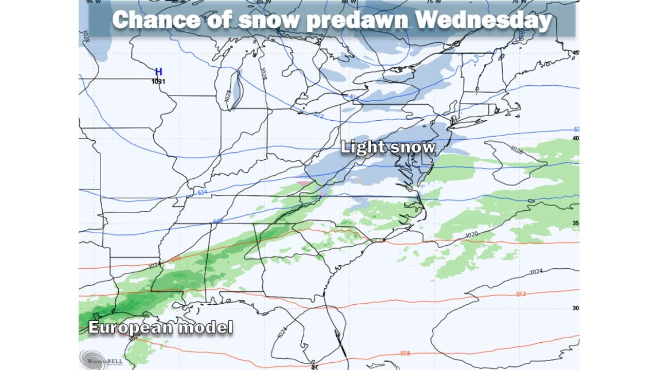
Maryland, Virginia, and Washington D.C. Face Light Snow Risk Tuesday Night Into Wednesday as Weak System Tracks South

UNITED STATES — Forecasters across the Mid-Atlantic are monitoring a weak weather disturbance expected to move through the region late Tuesday night into early Wednesday, bringing a low-confidence chance of light snow to the Washington, D.C. Beltway area. While the system lacks strong energy and moisture support, some models suggest it could still produce minor accumulations if conditions align.
The system is forecast to pass well south of the region, limiting its ability to pull in moisture from either the Gulf of Mexico or the Atlantic Ocean. As a result, snowfall potential remains capped, and any accumulation would depend heavily on the storm’s exact track as it moves through Virginia.
Why Snowfall Potential Remains Limited
Meteorologists describe the incoming system as a weak impulse, meaning it does not have the strength typically associated with more impactful winter storms. Several forecast models indicate the system could remain too far south to generate measurable precipitation across much of the Beltway.
Other guidance, however, shows a narrow window where the storm could follow a more favorable path, allowing snow to spread northward into the region during the pre-dawn hours Wednesday. Even in that scenario, snowfall would likely be brief and light, with totals highly sensitive to small shifts in track and timing.
Because of these uncertainties, confidence in snowfall amounts remains low to moderate at best.
What the Models Are Showing Right Now
Forecast guidance continues to vary, with snowfall projections ranging from no accumulation to a few inches in the most aggressive scenarios. Current model ranges for the Beltway area include:
- American model: 3 to 4 inches
- German model: 2 to 3 inches
- American AI model: Around 1 inch
- UKMet / European / European AI: Dusting
- Canadian model: No snow
Despite the spread, forecasters are leaning toward the lower end of the spectrum, with a dusting to one inch considered the most probable outcome. The chance of exceeding one inch is estimated at roughly one in three.
Temperatures Cold Enough for Accumulation if Snow Develops
Even though moisture may be limited, temperatures are expected to cooperate. Overnight lows and early-morning readings are forecast to remain in the 20s to low 30s, cold enough to support snow accumulation on untreated surfaces if precipitation materializes.
Should snow occur, impacts would likely be minor but could still affect early-morning travel, particularly on bridges, overpasses, and secondary roads during the Wednesday morning commute.
What Residents Should Watch For Next
Forecasters will continue to refine the forecast as the system approaches, with clarity expected within the next 24 hours. Small adjustments in the storm’s path could be the difference between no snow at all and a light coating across parts of the region.
Residents are encouraged to stay aware of updates, especially if traveling late Tuesday night or early Wednesday morning.
Have you seen light snow surprises from weak systems like this before? Do you think the Beltway sees a coating this time, or does the system stay south? Share your thoughts and follow ChicagoMusicGuide.com for the latest winter weather updates and forecast breakdowns.
