Arctic Blast to Slam Ohio Valley and Northeast States as Temperatures Plunge 30–40 Degrees Across Pennsylvania, Ohio, New York and New England
UNITED STATES — A major arctic blast is set to surge into the Eastern United States this weekend, delivering a dramatic temperature collapse of 30 to 40 degrees in parts of the Ohio Valley and Northeast. Forecast data shows the cold air arriving quickly, accompanied by a widespread but generally light snowfall event across Ohio, Pennsylvania, West Virginia, New York, and New England, marking one of the sharpest mid-winter cold reversals of the season.
Powerful Arctic Air Mass Drives Rapid Temperature Drop
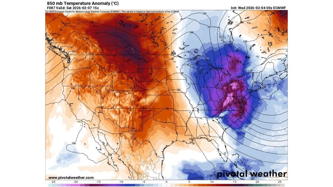
Upper-air temperature anomaly maps show an intense pocket of well-below-normal air plunging southward into the eastern half of the country by Saturday, February 7. In contrast to much warmer-than-average conditions lingering across the western U.S., the East will experience a sudden and forceful transition to deep arctic cold.
In some locations, especially across Pennsylvania, Ohio, West Virginia, and upstate New York, temperatures are expected to fall 30 to 40 degrees in a short period of time as the arctic air mass locks in. This type of drop significantly increases the risk of dangerous wind chills, frozen infrastructure, and travel disruptions.
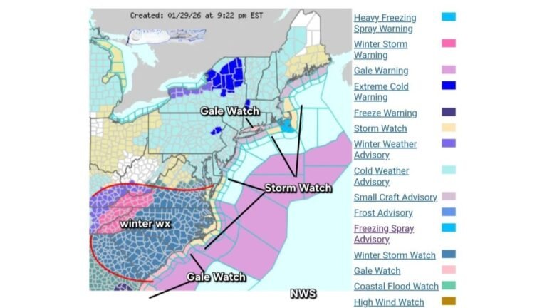
Light but Widespread Snow Develops Across the Ohio Valley and Northeast
As the cold air surges south and east, forecast guidance shows a broad area of light snowfall spreading across the Ohio Valley and Northeast. Snow is expected to be widespread but generally light, with many areas seeing coatings to light accumulations rather than a major snowstorm.
Even so, the timing of the snow combined with rapidly falling temperatures may lead to slick roads, especially during overnight and early morning hours. Portions of Ohio, western and central Pennsylvania, New York, and New England could see snow lingering into the early part of the weekend.
Cold Air Core Centers Over Pennsylvania and the Northeast
The coldest air appears focused over Pennsylvania, New York, and interior sections of New England, where upper-level temperature anomalies indicate some of the coldest departures from normal in the entire country. This aligns with earlier forecasts highlighting dangerously cold wind chills developing across the region.
As the arctic air deepens, daytime temperatures may struggle to recover, and nighttime lows could plunge well below normal, keeping cold stress elevated through the weekend.
Why This Arctic Blast Is Significant
This event stands out not only for its intensity but also for the speed of the temperature change. Rapid drops of this magnitude can catch people off guard, increasing the likelihood of cold-related health risks, frozen pipes, vehicle issues, and stress on heating systems.
The sharp contrast between warm conditions in the West and extreme cold in the East highlights a highly amplified weather pattern, one that often leads to prolonged cold spells rather than a quick rebound.
Impacts on Travel, Outdoor Plans, and Events
For those traveling or attending concerts, shows, or outdoor events across the Ohio Valley and Northeast, this arctic blast could significantly affect comfort and safety. Even light snowfall can become problematic when paired with rapidly dropping temperatures, allowing ice to form quickly on roadways and sidewalks.
Wind chills may make extended outdoor exposure dangerous, especially during nighttime and early morning hours. Eventgoers and travelers should plan for extra layers, allow additional travel time, and monitor local forecasts closely.
Cold Weather Precautions Recommended
Anyone spending time outdoors this weekend should dress in multiple layers, including a moisture-wicking base layer, insulating mid-layer, and a windproof outer shell. Exposed skin should be fully covered, as frostbite risk increases rapidly when temperatures plunge this sharply.
Checking on vulnerable individuals, protecting pets, and preparing homes for extreme cold will be important as this arctic air mass settles in.
As winter weather tightens its grip on the eastern U.S., staying informed will be key. For continued weather updates, regional impact breakdowns, and how changing conditions may affect travel and live events, visit ChicagoMusicGuide.com.