Arctic Blast Slams Pennsylvania, New York, Ohio, Michigan, and the Mid-Atlantic With Dangerous Wind Chills, Snow Squalls, and 40–50 MPH Gusts

UNITED STATES — A powerful Arctic blast is charging into the Eastern United States this weekend, bringing dangerously cold air, howling winds, and bands of snow across Pennsylvania, New York, Ohio, Michigan, and the Mid-Atlantic. Forecast guidance shows temperatures plunging 30 to 40 degrees behind a sharp cold front, with wind chills dropping below zero in many areas from Friday night through Sunday.
Arctic Front Timing and Temperature Crash
The leading edge of the Arctic cold front sweeps west-to-east late Friday afternoon through Friday night, with the coldest air locking in by early Saturday. Highs that hover near freezing on Thursday and the low to mid-30s on Friday will tumble quickly once the front passes. By Saturday, daytime readings struggle to reach the 20s, while Saturday night and Sunday morning lows fall into the teens and single digits, especially across Pennsylvania, Ohio, Michigan, and upstate New York.
Dangerous Wind Chills Across the Region
Behind the front, northwest winds of 25–35 mph will frequently gust higher, producing frigid wind chills. Forecast maps highlight wind chill values below zero across much of Pennsylvania, with –10°F to –30°F possible in north-central and western PA and parts of upstate New York. Even in the Mid-Atlantic, including Maryland, New Jersey, and the D.C. area, wind chills dip near or below zero late Friday night into Saturday morning, posing a real risk for frostbite and hypothermia on exposed skin.
Snow Showers, Squalls, and Narrow Heavier Bands
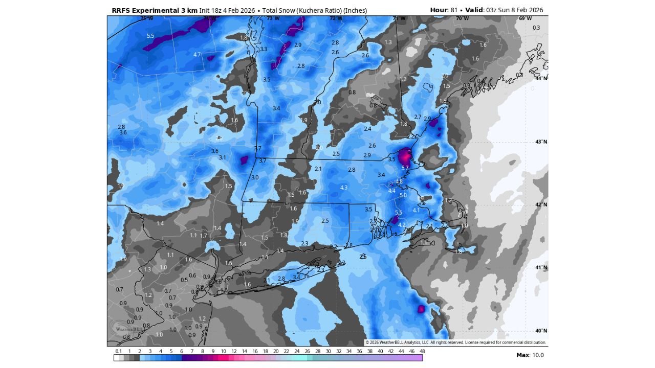
While snowfall amounts will vary, snow showers and brief snow squalls are expected along and just behind the front Friday evening into Saturday. Most locations see light accumulations, but guidance suggests a very narrow swath could pick up 3–6 inches where mesoscale bands set up—particularly across parts of upstate New York and interior New England. Blowing snow will reduce visibility at times, even where totals stay modest.
High Winds and Power Outage Risk
The wind will be the bigger story for many communities. Gusts of 40–50 mph are possible late Friday night through Saturday, especially across the Mid-Atlantic, Great Lakes, and Northeast. These winds, combined with falling temperatures, increase the chance of isolated to scattered power outages and make travel hazardous for high-profile vehicles.
What to Expect Through Sunday
Conditions remain brutally cold through Sunday, with little improvement in wind chills overnight. Daytime temperatures stay 20 or more degrees below average across much of the region. Even where skies clear, lingering winds will keep it feeling far colder than the thermometer suggests.
Safety Tips for the Cold and Wind
Anyone heading outdoors should dress in multiple loose-fitting layers, including a moisture-wicking base, an insulating middle layer, and a windproof outer shell. Cover hands, ears, nose, and face, and limit time outside when wind chills fall near or below zero. Check on vulnerable neighbors and ensure pets are brought indoors.
As this Arctic outbreak unfolds, stay alert for wind advisories, snow squall warnings, and updated forecasts as small shifts in the front’s timing can significantly change local impacts. For continuing coverage of severe winter weather, travel impacts, and regional updates, visit ChicagoMusicGuide.com for the latest reports and forecasts.
