Texas to Illinois and Michigan Targeted for Much-Needed Early March Soaking as 10-Day Rainfall Anomalies Turn Sharply Wetter
CHICAGO, ILLINOIS — After a drier-than-normal February across parts of the central United States, new ensemble guidance suggests the first 10 days of March will trend noticeably wetter from Texas through the Midwest and into the Great Lakes — a region that badly needs consistent moisture.
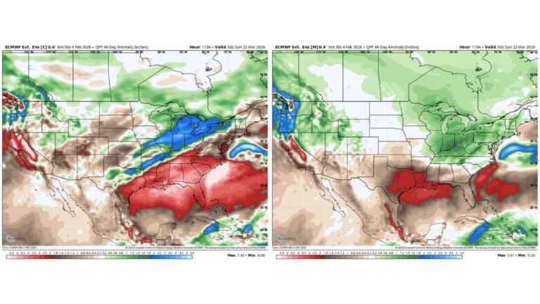
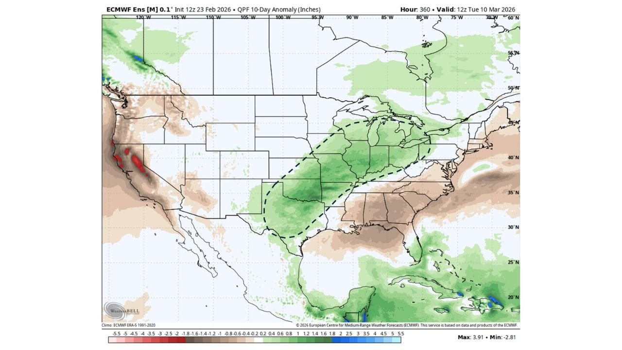
The latest ECMWF ensemble 10-day precipitation anomaly outlook (valid through March 10, 2026) paints a broad corridor of above-average rainfall stretching from the southern Plains into the Upper Midwest.
A Clear Wet Signal from Texas to Michigan
The forecast anomaly map highlights a defined swath of green shading — indicating above-normal precipitation — covering:
- Central and North Texas
- Oklahoma
- Arkansas
- Missouri
- Illinois
- Indiana
- Michigan
- Portions of Ohio
This zone represents the strongest positive precipitation anomaly signal over the central U.S.
In contrast, parts of the Deep South (including Alabama and Georgia) appear closer to normal or slightly below normal in some areas, while the Southwest and parts of California show mixed signals with localized dryness.
Illinois and the Midwest in the Bullseye
For Illinois, especially northern and central sections, this wetter pattern could mark a meaningful shift following February’s dryness.
The anomaly shading suggests rainfall totals during the first 10 days of March could run 1 to 3+ inches above average in some spots across the broader corridor.
That type of surplus, if realized, would:
- Improve topsoil moisture
- Help reduce lingering drought stress
- Recharge streams and rivers ahead of planting season
Michigan and portions of Indiana are also included within the wetter-than-normal zone, suggesting a regional pattern rather than a localized event.
Southern Plains Stand to Benefit
The wetter signal extends back southwest into:
- North and Central Texas
- Parts of Oklahoma
These areas have dealt with varying degrees of dryness and would benefit from repeated storm systems moving through.
If storm tracks verify as projected, this setup likely involves:
- Active southern jet stream energy
- Repeated frontal passages
- Gulf moisture transport feeding into the central U.S.
That combination typically produces widespread rainfall events rather than isolated storms.
Why This Matters After February’s Dry Trend
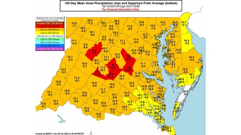
February precipitation anomalies showed below-normal totals across parts of the Plains and Midwest. While winter systems brought localized snowfall and rain, broad monthly deficits remained in some agricultural areas.
A shift toward above-normal rainfall in early March could:
- Stabilize soil moisture ahead of spring planting
- Reduce wildfire risk in transitional zones
- Ease short-term drought classifications
The fact that ensemble guidance shows a coherent, multi-state wet corridor adds confidence compared to a single deterministic model run.
Not Everyone Gets the Rain
The anomaly map also suggests that parts of:
- The Southeast
- Portions of the Mid-Atlantic
- Segments of the Southwest
may not see the same consistent above-normal precipitation.
This highlights a classic spring transition setup — where storm tracks favor the central U.S. corridor rather than hugging the Gulf Coast or East Coast.
Still Early — But a Promising Trend
While the signal is encouraging, it’s important to remember this is a 10-day ensemble outlook. Exact rainfall totals and placement will depend on:
- Individual storm track evolution
- Timing of frontal systems
- Moisture return from the Gulf
Still, the consistency in the ensemble guidance suggests the Texas-to-Great Lakes corridor — including Illinois — is positioned for a wetter-than-normal start to March.
After a dry February across parts of the region, that trend could not come at a better time.
For ongoing Midwest weather analysis and long-range pattern updates, stay with ChicagoMusicGuide.com.