Texas, Oklahoma and Deep South Face Escalating Severe Storm Threat After March 7 as New Forecast Analogs Signal Major Pattern Shift
DALLAS, TEXAS — Long-range forecast analogs are pointing toward a potentially significant escalation in severe weather beginning around March 7 and continuing into mid-March, with Texas, Oklahoma, and much of the Deep South emerging as the most at-risk regions. New ensemble guidance highlights a dynamic upper-level pattern that historically aligns with organized severe weather outbreaks across the Southern Plains and Southeast.
The evolving setup suggests increasing odds of strong thunderstorms, damaging winds, large hail, and possible tornado activity as atmospheric ingredients begin to align.
Upper-Level Pattern Favors Repeated Storm Development
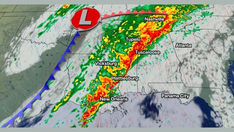
Forecast maps analyzing 500-millibar height anomalies show a pronounced trough digging into the western United States while a ridge strengthens across the Southeast. This configuration promotes strong southwesterly flow aloft, a key driver in transporting Gulf moisture northward into North and East Texas, central and eastern Oklahoma, Arkansas, Louisiana, Mississippi, Alabama, and Tennessee.
When a western trough combines with warm, moist air returning from the Gulf of Mexico, it creates a classic springtime severe weather setup. The jet stream positioning indicated in the analog data supports repeated storm system development along a corridor stretching from Dallas and Oklahoma City northeast toward Memphis and the Ohio Valley.
Historically, similar early-March patterns have produced widespread severe weather events across the Southern Plains and Deep South.
Widespread Above-Normal Temperatures Add Instability
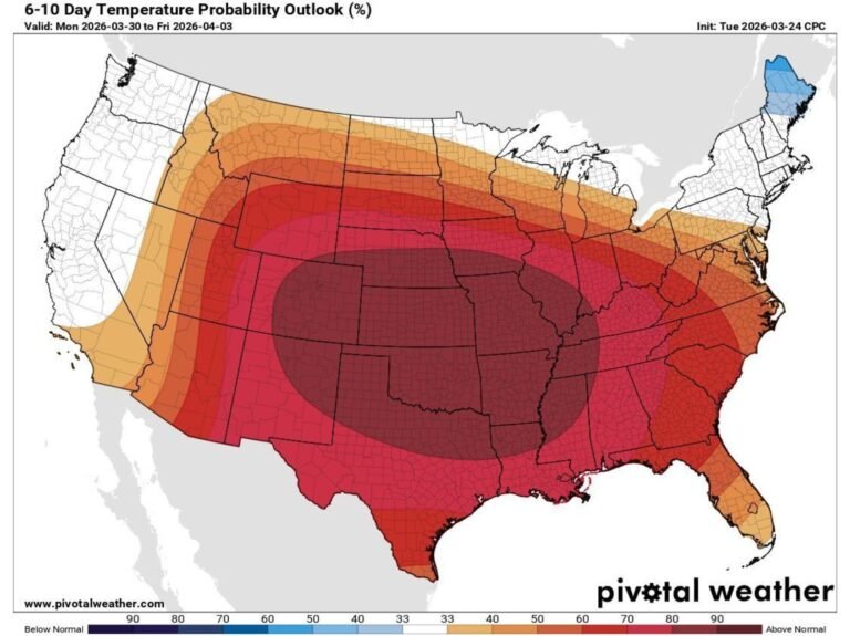
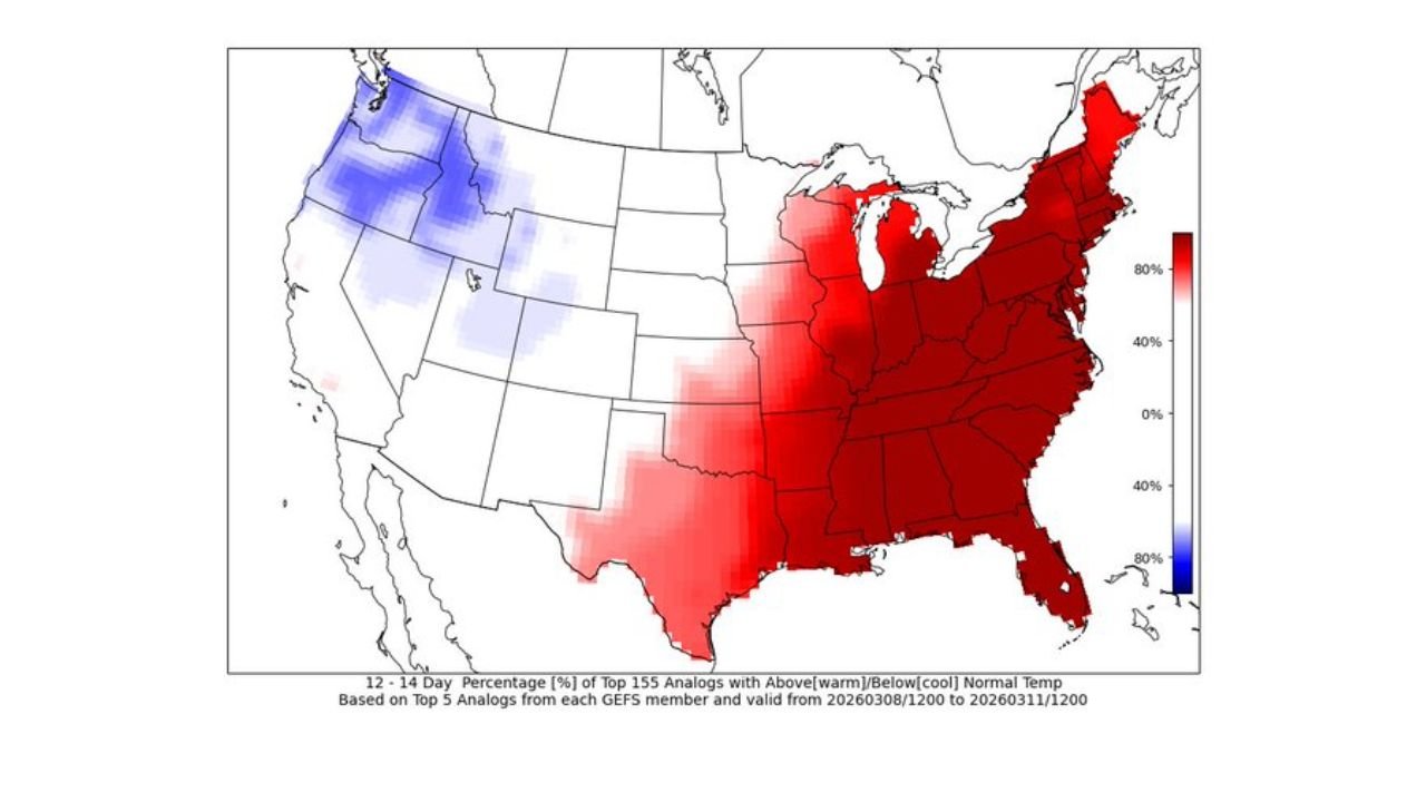
Another strong signal in the data shows a high probability of above-normal temperatures across the eastern half of the United States during the 12–14 day outlook window.
Much of Texas, the Lower Mississippi Valley, the Southeast, and the Ohio Valley are projected to run warmer than average. This warmth increases atmospheric instability, a crucial ingredient for severe storm development. When surface temperatures climb and moisture surges northward, the environment becomes more supportive of organized thunderstorms capable of producing significant impacts.
Meanwhile, cooler anomalies across parts of the western U.S. help maintain a sharp temperature gradient — a factor that can intensify storm systems as they move east.
For cities like Houston, Dallas, Oklahoma City, Little Rock, Memphis, Birmingham, and Nashville, the combination of warmth and dynamic upper-level energy raises concern for active weather periods after March 7.
Severe Weather Probability Concentrated Across Southern Plains and Deep South
The 12–14 day severe analog map highlights the highest percentages across:
- North and East Texas
- Central and Eastern Oklahoma
- Arkansas
- Louisiana
- Mississippi
- Alabama
- Western Tennessee
- Portions of Georgia
These elevated probabilities indicate that at least one measurable severe weather event is possible within this timeframe across these regions. March traditionally marks the beginning of the more active phase of the spring severe weather season, and the forecast pattern aligns with that seasonal transition.
While exact timing and storm intensity remain uncertain this far out, the consistent signals across multiple analog datasets point toward increasing vigilance being warranted.
Heavy Rainfall and Flooding Concerns Also Emerging
In addition to severe storms, precipitation anomaly projections show enhanced rainfall potential extending from Texas through the Mississippi Valley and into parts of the Southeast and Mid-Atlantic.
Repeated storm systems tracking along a similar path could lead to:
- Flash flooding
- Rapid river rises
- Saturated soil conditions
Urban areas such as Dallas, Houston, New Orleans, Jackson, Memphis, and Birmingham may need to monitor rainfall totals closely if the pattern verifies.
Why This Pattern Change Matters
The period around March 7 and beyond appears to mark a turning point toward a more amplified and energetic weather regime across the southern United States. As Gulf moisture deepens and upper-level energy strengthens, the ingredients for organized severe weather may align more frequently.
Residents across Texas, Oklahoma, Arkansas, Louisiana, Mississippi, Alabama, Tennessee, and Georgia should stay attentive to updated forecasts as confidence increases.
As early March approaches, preparation and awareness will be key — especially across the Southern Plains and Deep South where the strongest signals are centered. For continued updates on developing storm systems, regional weather risks, and how shifting patterns could impact travel and live events nationwide, visit ChicagoMusicGuide.com.